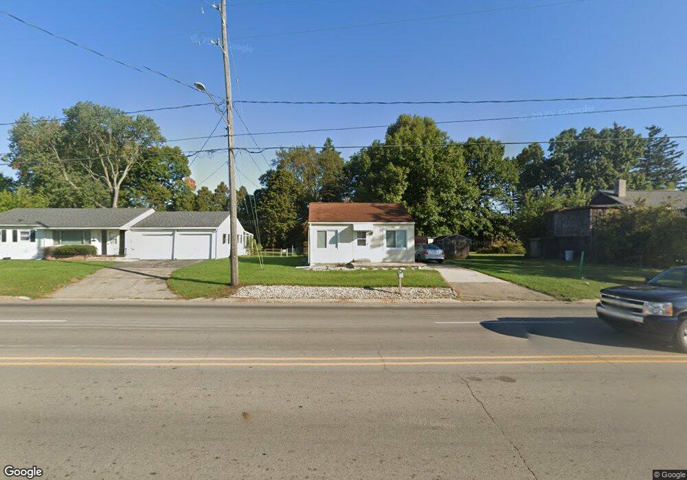
1308 W Parnall Rd Jackson, MI 49201
Estimated Value: $85,000 - $156,000
1
Bed
1
Bath
576
Sq Ft
$188/Sq Ft
Est. Value
About This Home
This home is located at 1308 W Parnall Rd, Jackson, MI 49201 and is currently estimated at $108,035, approximately $187 per square foot. 1308 W Parnall Rd is a home located in Jackson County with nearby schools including Northwest Early Elementary School, Northwest Elementary School, and Northwest Middle School.
Ownership History
Date
Name
Owned For
Owner Type
Purchase Details
Closed on
May 21, 2021
Sold by
Whitchead Neil R
Bought by
Edwards Brandon
Current Estimated Value
Home Financials for this Owner
Home Financials are based on the most recent Mortgage that was taken out on this home.
Original Mortgage
$46,000
Outstanding Balance
$41,556
Interest Rate
2.9%
Mortgage Type
New Conventional
Estimated Equity
$66,479
Purchase Details
Closed on
Aug 9, 2018
Sold by
Whitehead Rosemary
Bought by
Whitehead Neil R
Purchase Details
Closed on
Apr 1, 1994
Bought by
Whitehead
Create a Home Valuation Report for This Property
The Home Valuation Report is an in-depth analysis detailing your home's value as well as a comparison with similar homes in the area
Home Values in the Area
Average Home Value in this Area
Purchase History
| Date | Buyer | Sale Price | Title Company |
|---|---|---|---|
| Edwards Brandon | $58,000 | None Available | |
| Whitehead Neil R | -- | None Available | |
| Whitehead | $20,000 | -- |
Source: Public Records
Mortgage History
| Date | Status | Borrower | Loan Amount |
|---|---|---|---|
| Open | Edwards Brandon | $46,000 |
Source: Public Records
Tax History Compared to Growth
Tax History
| Year | Tax Paid | Tax Assessment Tax Assessment Total Assessment is a certain percentage of the fair market value that is determined by local assessors to be the total taxable value of land and additions on the property. | Land | Improvement |
|---|---|---|---|---|
| 2025 | $1,192 | $41,950 | $0 | $0 |
| 2024 | $555 | $41,100 | $0 | $0 |
| 2023 | $528 | $36,900 | $0 | $0 |
| 2022 | $1,071 | $30,100 | $0 | $0 |
| 2021 | $1,143 | $27,200 | $0 | $0 |
| 2020 | $1,130 | $25,900 | $0 | $0 |
| 2019 | $1,105 | $23,400 | $0 | $0 |
| 2018 | $1,036 | $23,400 | $0 | $0 |
| 2017 | $992 | $22,600 | $0 | $0 |
| 2016 | $764 | $20,542 | $20,542 | $0 |
| 2015 | $961 | $20,008 | $20,008 | $0 |
| 2014 | $961 | $18,928 | $0 | $0 |
| 2013 | -- | $18,928 | $18,928 | $0 |
Source: Public Records
Map
Nearby Homes
- 822 Woodworth Rd
- 3432 Loretta Dr
- 135 Peacock Walk
- 430 Mcconnell Dr
- 3335 Clinton Way
- 3375 Clinton Way
- VL 69 Clinton Way
- VL 29 Clinton Way
- VL 40 Clinton Way
- 0 Burt Ave
- VL Cooper St
- 2205 Cooper St
- VL Morrill Rd
- 5123 S Granite St
- 5127 S Granite St
- 1945 Cooper St
- 5243 S Boulder St
- 5038 Fieldstone St
- 0 Shirley Dr Unit 24064060
- 0 N Stone Rd Unit Lot 250 21037755
- 1304 W Parnall Rd
- 3410 Lansing Ave
- 1309 Michael Dr
- 3336 Lansing Ave
- 1313 W Parnall Rd
- 1313 Michael Dr
- 1321 W Parnall Rd
- 1330 W Parnall Rd
- 3334 Lansing Ave
- 1317 Michael Dr
- 1331 W Parnall Rd
- 1306 Michael Dr
- 1310 Michael Dr
- 1334 W Parnall Rd
- 1302 Michael Dr
- 1321 Michael Dr
- 1314 Michael Dr
- 3300 Lansing Ave
- 1318 Michael Dr
- 1325 Michael Dr