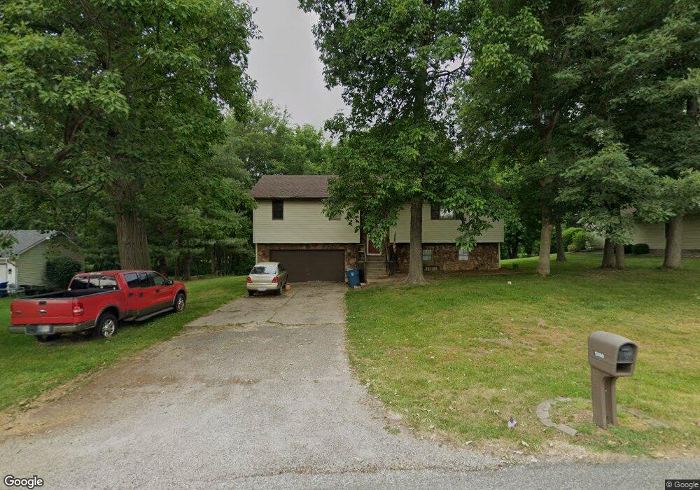
13080 Nutmeg Ridge Dr Plymouth, IN 46563
Estimated Value: $244,000 - $280,000
3
Beds
3
Baths
1,896
Sq Ft
$138/Sq Ft
Est. Value
About This Home
This home is located at 13080 Nutmeg Ridge Dr, Plymouth, IN 46563 and is currently estimated at $261,670, approximately $138 per square foot. 13080 Nutmeg Ridge Dr is a home located in Marshall County with nearby schools including Plymouth High School, St. Michael School, and St. Michael's Catholic School.
Ownership History
Date
Name
Owned For
Owner Type
Purchase Details
Closed on
Oct 17, 2007
Sold by
Stoneburner Jeffrey E and Stoneburner Brandy J
Bought by
Frick Stephen E and Frick Sally M
Current Estimated Value
Home Financials for this Owner
Home Financials are based on the most recent Mortgage that was taken out on this home.
Original Mortgage
$105,600
Outstanding Balance
$66,923
Interest Rate
6.5%
Mortgage Type
Adjustable Rate Mortgage/ARM
Estimated Equity
$194,747
Purchase Details
Closed on
Sep 2, 1999
Sold by
Douglas Dennis M and Douglas Vickie S
Bought by
Neilson Richard W
Create a Home Valuation Report for This Property
The Home Valuation Report is an in-depth analysis detailing your home's value as well as a comparison with similar homes in the area
Home Values in the Area
Average Home Value in this Area
Purchase History
| Date | Buyer | Sale Price | Title Company |
|---|---|---|---|
| Frick Stephen E | -- | Mckesson Title Corp | |
| Neilson Richard W | $100,000 | -- |
Source: Public Records
Mortgage History
| Date | Status | Borrower | Loan Amount |
|---|---|---|---|
| Open | Frick Stephen E | $105,600 |
Source: Public Records
Tax History Compared to Growth
Tax History
| Year | Tax Paid | Tax Assessment Tax Assessment Total Assessment is a certain percentage of the fair market value that is determined by local assessors to be the total taxable value of land and additions on the property. | Land | Improvement |
|---|---|---|---|---|
| 2024 | $1,125 | $169,300 | $48,600 | $120,700 |
| 2022 | $1,199 | $163,200 | $45,900 | $117,300 |
| 2021 | $957 | $134,500 | $37,500 | $97,000 |
| 2020 | $886 | $123,300 | $34,200 | $89,100 |
| 2019 | $810 | $118,400 | $32,800 | $85,600 |
| 2018 | $751 | $113,600 | $31,600 | $82,000 |
| 2017 | $672 | $113,400 | $31,600 | $81,800 |
| 2016 | $632 | $115,800 | $32,200 | $83,600 |
| 2014 | $597 | $111,700 | $30,700 | $81,000 |
Source: Public Records
Map
Nearby Homes
- 13060 Nutmeg Ridge Dr
- 13110 Nutmeg Ridge Dr
- 13101 Nutmeg Ridge Dr
- 13128 Nutmeg Trail
- 13073 Nutmeg Ridge Dr
- 13051 Nutmeg Ridge Dr
- 13154 Nutmeg Trail
- 10599 Muckshaw Rd
- 10649 Muckshaw Rd
- 13001 Nutmeg Ridge Dr
- 10557 Muckshaw Rd
- 13129 Nutmeg Ridge Dr
- 13122 Nutmeg Ridge Dr
- 13164 Nutmeg Trail
- 10600 Muckshaw Rd
- 10535 Muckshaw Rd
- 10640 Muckshaw Rd
- 13156 Nutmeg Ridge Dr
- 10630 Kings Ct
- 13145 Nutmeg Ridge Dr