Estimated Value: $107,000 - $221,000
2
Beds
1
Bath
768
Sq Ft
$214/Sq Ft
Est. Value
About This Home
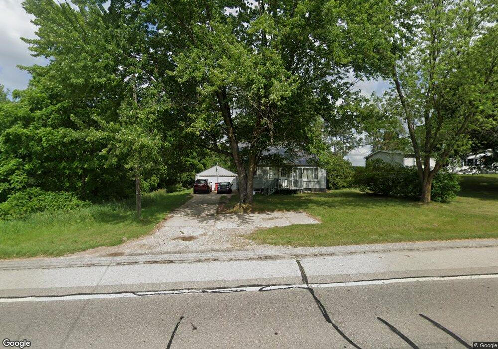
This home is located at 13082 S Mason Dr, Grant, MI 49327 and is currently estimated at $164,107, approximately $213 per square foot. 13082 S Mason Dr is a home located in Newaygo County with nearby schools including Grant Elementary School, Grant Primary Center, and Grant Middle School.
Ownership History
Date
Name
Owned For
Owner Type
Purchase Details
Closed on
Nov 12, 2012
Sold by
Fannie Mae
Bought by
Davis Josh and Davis Abigail
Current Estimated Value
Purchase Details
Closed on
Dec 15, 2011
Sold by
Wells Fargo Bank
Bought by
Fannie Mae
Purchase Details
Closed on
Dec 13, 2011
Sold by
Lewis Joshua Taylor and Myers Stacy
Bought by
Wells Fargo Bank
Purchase Details
Closed on
Apr 25, 2007
Sold by
Us Bank Natl Assoc
Bought by
Lewis Joshua and Myers Stacey
Purchase Details
Closed on
Sep 24, 2004
Sold by
Hart Michael R
Bought by
Falan Charles
Purchase Details
Closed on
Oct 25, 2002
Sold by
Peterson Gordon
Bought by
Hart Michael R
Purchase Details
Closed on
Jul 16, 2002
Sold by
Federal Home Loan Mtg Corp
Bought by
Peterson Gordon
Create a Home Valuation Report for This Property
The Home Valuation Report is an in-depth analysis detailing your home's value as well as a comparison with similar homes in the area
Purchase History
| Date | Buyer | Sale Price | Title Company |
|---|---|---|---|
| Davis Josh | $26,000 | -- | |
| Fannie Mae | -- | -- | |
| Wells Fargo Bank | $40,800 | -- | |
| Lewis Joshua | $54,900 | -- | |
| Falan Charles | $74,000 | -- | |
| Hart Michael R | $55,000 | -- | |
| Peterson Gordon | $41,000 | -- |
Source: Public Records
Tax History
| Year | Tax Paid | Tax Assessment Tax Assessment Total Assessment is a certain percentage of the fair market value that is determined by local assessors to be the total taxable value of land and additions on the property. | Land | Improvement |
|---|---|---|---|---|
| 2025 | $316 | $57,100 | $0 | $0 |
| 2024 | $3 | $48,000 | $0 | $0 |
| 2023 | $295 | $38,600 | $0 | $0 |
| 2022 | $1,184 | $35,100 | $0 | $0 |
| 2021 | $1,169 | $34,700 | $0 | $0 |
| 2020 | $1,138 | $33,100 | $0 | $0 |
| 2019 | $1,119 | $30,900 | $0 | $0 |
| 2018 | $1,124 | $25,900 | $0 | $0 |
| 2017 | $1,088 | $24,700 | $0 | $0 |
| 2016 | $1,073 | $24,200 | $0 | $0 |
| 2015 | -- | $24,000 | $0 | $0 |
| 2014 | -- | $22,800 | $0 | $0 |
Source: Public Records
Map
Nearby Homes
- 283 S Jones St
- 151 & 153 Clark St
- 140 E Commerce St
- 12712 S Elder Ave
- Lot 19 S Elder Ave
- 500 E 136th St
- 11298 S Gordon Ave
- 953 E 136th St
- 1773 N Newaygo Rd
- 2119 W 116th St
- 17090 Kenowa Ave
- 12449 S Catalpa Ave
- 2308 W 112th St
- 0 W 112th St Unit 26006032
- 1885 Shaw Rd
- 10041 S Mason Dr
- 10021 S Mason Dr
- 15255 Bailey Rd
- 2580 22 Mile Rd NW
- 12745 Austrian Dr
- 13082 S Mason Dr
- 13104 S Mason Dr
- 13103 S Mason Dr
- 13016 Mason Dr
- 13030 S Mason Dr
- 13120 S Mason Dr
- 316 W Mustang Moon Trail
- 13157 S Mason Dr
- 12998 Mason Dr
- 13157 S Mason Dr
- 13193 S Mason Dr
- 12978 S Mason Dr
- 13193 S Mason Dr
- 12902 S Mason Dr
- 12960 S Mason Dr
- 13187 Mason Dr
- 278 W Mustang Moon Trail
- 303 W Mustang Moon Trail
- 13207 S Mason Dr
- 275 W Mustang Moon Trail
Your Personal Tour Guide
Ask me questions while you tour the home.