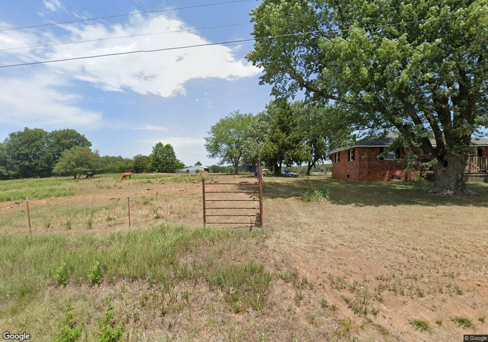
13085 E Highway N Stockton, MO 65785
Estimated Value: $158,399 - $206,000
--
Bed
--
Bath
1,120
Sq Ft
$163/Sq Ft
Est. Value
About This Home
This home is located at 13085 E Highway N, Stockton, MO 65785 and is currently estimated at $182,466, approximately $162 per square foot. 13085 E Highway N is a home with nearby schools including Stockton Elementary School, Stockton Middle School, and Stockton High School.
Ownership History
Date
Name
Owned For
Owner Type
Purchase Details
Closed on
Jun 2, 2021
Sold by
Walker Bo
Bought by
Cargil Travis Gene and Cargil Jamie Ann
Current Estimated Value
Purchase Details
Closed on
Nov 25, 2020
Sold by
Johnson Kelly and Johnson Chris
Bought by
Walker Bo
Home Financials for this Owner
Home Financials are based on the most recent Mortgage that was taken out on this home.
Original Mortgage
$137,878
Interest Rate
2.8%
Mortgage Type
New Conventional
Purchase Details
Closed on
Dec 22, 2015
Sold by
Anne Sloan Mary Jo
Bought by
Johnson Justin Cody and Johnson Kelly
Purchase Details
Closed on
Jul 17, 2015
Sold by
King Danelle Carter and Carter Darci D
Bought by
Johnson Justin Cody
Home Financials for this Owner
Home Financials are based on the most recent Mortgage that was taken out on this home.
Original Mortgage
$44,000
Interest Rate
3.9%
Mortgage Type
Future Advance Clause Open End Mortgage
Create a Home Valuation Report for This Property
The Home Valuation Report is an in-depth analysis detailing your home's value as well as a comparison with similar homes in the area
Home Values in the Area
Average Home Value in this Area
Purchase History
| Date | Buyer | Sale Price | Title Company |
|---|---|---|---|
| Cargil Travis Gene | -- | None Available | |
| Walker Bo | -- | None Available | |
| Johnson Justin Cody | -- | None Available | |
| Johnson Justin Cody | -- | None Available |
Source: Public Records
Mortgage History
| Date | Status | Borrower | Loan Amount |
|---|---|---|---|
| Previous Owner | Walker Bo | $137,878 | |
| Previous Owner | Johnson Justin Cody | $44,000 |
Source: Public Records
Tax History Compared to Growth
Tax History
| Year | Tax Paid | Tax Assessment Tax Assessment Total Assessment is a certain percentage of the fair market value that is determined by local assessors to be the total taxable value of land and additions on the property. | Land | Improvement |
|---|---|---|---|---|
| 2025 | $591 | $13,600 | $730 | $12,870 |
| 2024 | $591 | $11,940 | $640 | $11,300 |
| 2023 | $591 | $11,940 | $0 | $0 |
| 2022 | $590 | $11,940 | $0 | $0 |
| 2021 | $540 | $11,940 | $0 | $0 |
| 2020 | $540 | $10,860 | $0 | $0 |
| 2019 | $505 | $10,860 | $0 | $0 |
| 2018 | $503 | $10,860 | $0 | $0 |
| 2017 | -- | $10,860 | $0 | $0 |
| 2016 | -- | $10,860 | $0 | $0 |
| 2015 | -- | $10,860 | $0 | $0 |
| 2014 | -- | $10,860 | $0 | $0 |
| 2013 | -- | $10,860 | $0 | $0 |
Source: Public Records
Map
Nearby Homes
- 000 State Highway 39
- 14480 East Spur N
- 14480 E Spur N
- 12552 E 550 Rd
- 001 E 570th Rd
- 002 E 570th Rd
- 14925 E 500 Rd
- 10665 S 1275 Rd
- 11975 E 1100 Rd
- 11620 S 1215 Rd
- 000 E 1000 Rd
- Tbd East Hwy N
- 10210 S 1625 Rd
- 9661 E 1070 Rd
- 0000 S 2125 Rd
- 10321 S 1625 Rd
- 17410 E 900 Rd
- 8565 S 1301 Rd
- 13650 State Highway 39
- 11998 E Highway 32