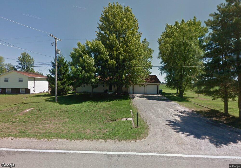
1309 Carter Rd Midland, MI 48642
Estimated Value: $187,000 - $210,261
3
Beds
1
Bath
1,200
Sq Ft
$167/Sq Ft
Est. Value
About This Home
This home is located at 1309 Carter Rd, Midland, MI 48642 and is currently estimated at $200,815, approximately $167 per square foot. 1309 Carter Rd is a home located in Bay County with nearby schools including Auburn Elementary School, Western Middle School, and Bay City Western High School.
Ownership History
Date
Name
Owned For
Owner Type
Purchase Details
Closed on
Aug 29, 2017
Sold by
Sitkewicz James M and Sitkewicz Annmarie T
Bought by
Sitkewicz James M and Sitkewicz Annmarie T
Current Estimated Value
Home Financials for this Owner
Home Financials are based on the most recent Mortgage that was taken out on this home.
Original Mortgage
$103,500
Outstanding Balance
$86,476
Interest Rate
3.92%
Mortgage Type
New Conventional
Estimated Equity
$114,339
Purchase Details
Closed on
Apr 30, 1993
Sold by
Eickholt Joseph A and Eickholt Frances I
Bought by
Sitkewicz James M and Sitkewicz Annmarie F
Create a Home Valuation Report for This Property
The Home Valuation Report is an in-depth analysis detailing your home's value as well as a comparison with similar homes in the area
Purchase History
| Date | Buyer | Sale Price | Title Company |
|---|---|---|---|
| Sitkewicz James M | -- | None Available | |
| Sitkewicz James M | $69,300 | -- |
Source: Public Records
Mortgage History
| Date | Status | Borrower | Loan Amount |
|---|---|---|---|
| Open | Sitkewicz James M | $103,500 |
Source: Public Records
Tax History
| Year | Tax Paid | Tax Assessment Tax Assessment Total Assessment is a certain percentage of the fair market value that is determined by local assessors to be the total taxable value of land and additions on the property. | Land | Improvement |
|---|---|---|---|---|
| 2025 | $1,326 | $93,300 | $0 | $0 |
| 2024 | $1,288 | $81,200 | $0 | $0 |
| 2023 | $1,226 | $77,500 | $0 | $0 |
| 2022 | $2,098 | $72,000 | $0 | $0 |
| 2021 | $1,969 | $67,400 | $67,400 | $0 |
| 2020 | $1,938 | $64,250 | $64,250 | $0 |
| 2019 | $1,776 | $58,800 | $0 | $0 |
| 2018 | $1,735 | $52,500 | $0 | $0 |
| 2017 | $1,704 | $52,350 | $0 | $0 |
| 2016 | $1,696 | $47,700 | $0 | $47,700 |
| 2015 | $1,688 | $54,750 | $0 | $54,750 |
| 2014 | $1,688 | $59,850 | $0 | $59,850 |
Source: Public Records
Map
Nearby Homes
- 2082 W Parish Rd
- 4949 S Garfield Rd
- 0 W Beaver Rd
- Lot B N Waldo
- Lot A N Waldo
- 2258 S Nine Mile Rd
- 4455 N Ehlers Rd
- 234 N Garfield Rd
- 1324 Townline 14 Rd
- 4967 N Mid Bay County Line Rd
- V/L E Hubbard
- 1404 Rumbaugh Ln
- 2581 N Arbutus Ct
- 3121 Apple Ridge Ct
- 2407 8 Mile Rd Unit 19
- 1285 Wheeler Rd
- 2444 Pajot Rd Unit 40
- 2458 E Birch Dr Unit 92
- 0 S Carter Unit 50201132
- 0 S Carter Unit 50201440
- 1307 S Carter Rd
- 1307 Carter Rd
- 1306 Carter Rd
- 1305 Carter Rd
- 1313 Carter Rd
- 1308 Carter Rd
- 1303 Carter Rd
- 1319 Carter Rd
- 1302 Carter Rd
- 1318 Carter Rd
- 1292 Carter Rd
- 1347 Carter Rd
- 1347 S Carter Rd
- 1282 Carter Rd
- 1213 Carter Rd
- 1196 S Carter Rd
- 1365 Carter Rd
- 1391 Carter Rd
- 1184 Carter Rd
- 1178 Carter Rd
Your Personal Tour Guide
Ask me questions while you tour the home.