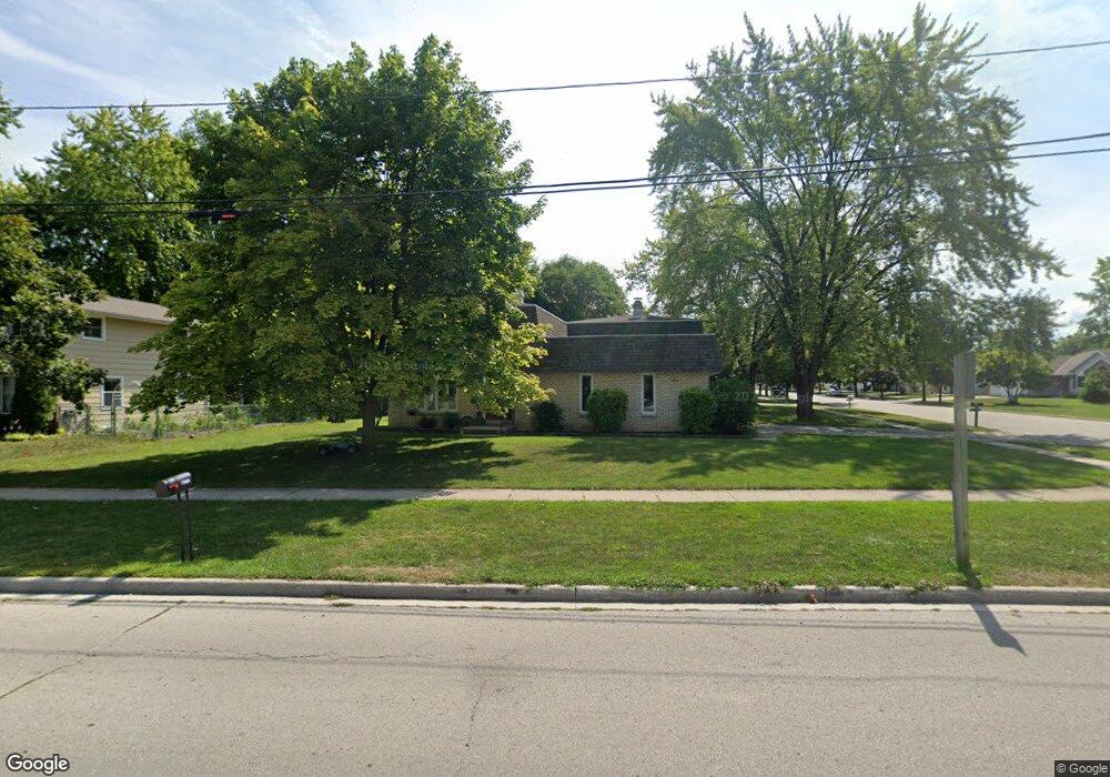
1309 Fox River Dr de Pere, WI 54115
Estimated Value: $347,000 - $370,051
8
Beds
8
Baths
3,090
Sq Ft
$114/Sq Ft
Est. Value
About This Home
This home is located at 1309 Fox River Dr, de Pere, WI 54115 and is currently estimated at $353,263, approximately $114 per square foot. 1309 Fox River Dr is a home located in Brown County with nearby schools including Susie C. Altmayer Elementary School, Foxview Intermediate School, and De Pere Middle School.
Ownership History
Date
Name
Owned For
Owner Type
Purchase Details
Closed on
Jun 21, 2016
Sold by
Leao Nicholas P and Leao Bethany A
Bought by
Joski Tony
Current Estimated Value
Home Financials for this Owner
Home Financials are based on the most recent Mortgage that was taken out on this home.
Original Mortgage
$152,950
Outstanding Balance
$120,354
Interest Rate
3.64%
Mortgage Type
New Conventional
Estimated Equity
$232,909
Purchase Details
Closed on
May 6, 2008
Sold by
Impac Funding Corp
Bought by
Leao Nicholas P and Leao Bethany A
Home Financials for this Owner
Home Financials are based on the most recent Mortgage that was taken out on this home.
Original Mortgage
$124,600
Interest Rate
6.01%
Mortgage Type
Purchase Money Mortgage
Purchase Details
Closed on
Jul 25, 2007
Sold by
Levickis John P
Bought by
Impac Funding Corp
Purchase Details
Closed on
Oct 26, 2005
Sold by
Levickis Cheryl D
Bought by
Levickis John P
Create a Home Valuation Report for This Property
The Home Valuation Report is an in-depth analysis detailing your home's value as well as a comparison with similar homes in the area
Home Values in the Area
Average Home Value in this Area
Purchase History
| Date | Buyer | Sale Price | Title Company |
|---|---|---|---|
| Joski Tony | $161,000 | Liberty Title | |
| Leao Nicholas P | $120,500 | Evans Title | |
| Impac Funding Corp | -- | None Available | |
| Levickis John P | -- | Title Trends Inc |
Source: Public Records
Mortgage History
| Date | Status | Borrower | Loan Amount |
|---|---|---|---|
| Open | Joski Tony | $152,950 | |
| Previous Owner | Leao Nicholas P | $124,600 |
Source: Public Records
Tax History
| Year | Tax Paid | Tax Assessment Tax Assessment Total Assessment is a certain percentage of the fair market value that is determined by local assessors to be the total taxable value of land and additions on the property. | Land | Improvement |
|---|---|---|---|---|
| 2025 | $4,987 | $339,400 | $35,100 | $304,300 |
| 2024 | $4,510 | $302,100 | $33,400 | $268,700 |
| 2023 | $3,781 | $262,600 | $33,400 | $229,200 |
| 2022 | $3,561 | $236,400 | $33,400 | $203,000 |
| 2021 | $3,378 | $211,900 | $27,800 | $184,100 |
| 2020 | $3,737 | $197,400 | $27,800 | $169,600 |
| 2019 | $3,475 | $183,000 | $27,800 | $155,200 |
| 2018 | $3,684 | $177,200 | $27,800 | $149,400 |
| 2017 | $3,411 | $161,000 | $27,800 | $133,200 |
| 2016 | $3,470 | $161,000 | $27,800 | $133,200 |
| 2015 | $3,583 | $148,800 | $29,700 | $119,100 |
| 2014 | $3,276 | $148,800 | $29,700 | $119,100 |
| 2013 | $3,276 | $148,800 | $29,700 | $119,100 |
Source: Public Records
Map
Nearby Homes
- 814 3rd St
- 1208 S Erie St
- 801 S Erie St
- 1109 S 6th St
- 911 S 7th St
- 308 S Superior St
- 555 Main Ave Unit 113
- 555 Main Ave Unit 111
- 555 Main Ave Unit 206
- 416 Lansdowne St
- 389 Willie Mays Cir
- 400 Battery Ave
- 318 S Webster Ave
- 1861 Chicago St
- 1129 Suburban Dr
- 735 Morning Glory Ln
- 115 S Washington St
- 253 Scout Way
- 0 S Broadway St
- 1258 Cornflower Ct
- 405 S Saint Bernard Dr
- 1305 Fox River Dr
- 407 S Saint Bernard Dr Unit 409
- 407 S St Bernard
- 1325 Fox River Dr Unit 1327
- 411 S Saint Bernard Dr
- 406 N St Bernard
- 406 N Saint Bernard Dr Unit 408
- 412 N Saint Bernard Dr Unit 414
- 414 N Saint Bernard Dr Unit 414 N. Saint Bernard
- 414 N Saint Bernard Dr
- 1306 Fox River Dr
- 410 S Saint Bernard Dr
- 416 N Saint Bernard Dr Unit 418
- 413 S Saint Bernard Dr
- 413 S St Bernard
- 413 St Bernard
- 1331 Fox River Dr
- 1329 Fox River Dr
- 1329 Fox River Dr Unit 1
Your Personal Tour Guide
Ask me questions while you tour the home.