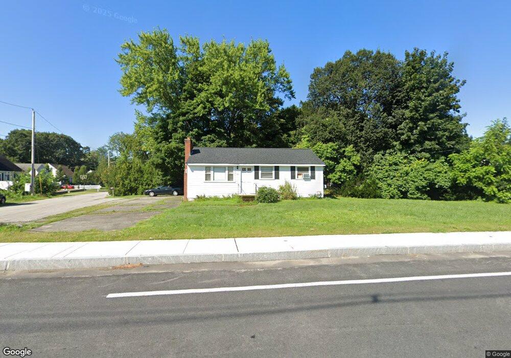
1309 Main St Tewksbury, MA 01876
Estimated Value: $483,000 - $640,000
3
Beds
1
Bath
896
Sq Ft
$618/Sq Ft
Est. Value
About This Home
This home is located at 1309 Main St, Tewksbury, MA 01876 and is currently estimated at $553,361, approximately $617 per square foot. 1309 Main St is a home located in Middlesex County.
Ownership History
Date
Name
Owned For
Owner Type
Purchase Details
Closed on
Mar 5, 1993
Sold by
Prudhomme Nancy F
Bought by
Drew Michael J and Drew Cheryl
Current Estimated Value
Home Financials for this Owner
Home Financials are based on the most recent Mortgage that was taken out on this home.
Original Mortgage
$107,532
Interest Rate
7.96%
Mortgage Type
Purchase Money Mortgage
Purchase Details
Closed on
Oct 30, 1990
Sold by
Thompson William F
Bought by
Prud'Homme Nancy F
Create a Home Valuation Report for This Property
The Home Valuation Report is an in-depth analysis detailing your home's value as well as a comparison with similar homes in the area
Home Values in the Area
Average Home Value in this Area
Purchase History
| Date | Buyer | Sale Price | Title Company |
|---|---|---|---|
| Drew Michael J | $109,900 | -- | |
| Prud'Homme Nancy F | $112,100 | -- |
Source: Public Records
Mortgage History
| Date | Status | Borrower | Loan Amount |
|---|---|---|---|
| Open | Prud'Homme Nancy F | $37,000 | |
| Closed | Prud'Homme Nancy F | $107,532 |
Source: Public Records
Tax History Compared to Growth
Tax History
| Year | Tax Paid | Tax Assessment Tax Assessment Total Assessment is a certain percentage of the fair market value that is determined by local assessors to be the total taxable value of land and additions on the property. | Land | Improvement |
|---|---|---|---|---|
| 2025 | $6,182 | $467,600 | $269,500 | $198,100 |
| 2024 | $5,969 | $445,800 | $256,700 | $189,100 |
| 2023 | $5,859 | $415,500 | $233,400 | $182,100 |
| 2022 | $5,594 | $368,000 | $203,000 | $165,000 |
| 2021 | $11,510 | $334,300 | $184,500 | $149,800 |
| 2020 | $5,062 | $317,000 | $175,700 | $141,300 |
| 2019 | $4,736 | $299,000 | $167,300 | $131,700 |
| 2018 | $10,570 | $265,300 | $167,300 | $98,000 |
| 2017 | $10,414 | $251,000 | $167,300 | $83,700 |
| 2016 | $3,984 | $243,700 | $167,300 | $76,400 |
| 2015 | $3,785 | $231,200 | $162,300 | $68,900 |
| 2014 | $3,549 | $220,300 | $162,300 | $58,000 |
Source: Public Records
Map
Nearby Homes
- 1325 Main
- 11 Orchard St
- 12 Hillcrest Rd
- 61 Patrick Rd
- 43 Patrick Rd
- 1418 Main St Unit 201
- 1455 Main St Unit 8
- 20 Sophie Ruth Way
- 172 Patrick Rd
- 13 Berkeley
- 9 Tomahawk Dr
- 14 Hinckley Rd
- 18 Newton Ave
- 15 Pinewood Rd
- 910 Livingston St
- 1117 Emerald Ct
- 1224 Emerald Ct
- 900 Livingston St
- 107 Eagle Dr Unit 107
- 93 Fairway Dr