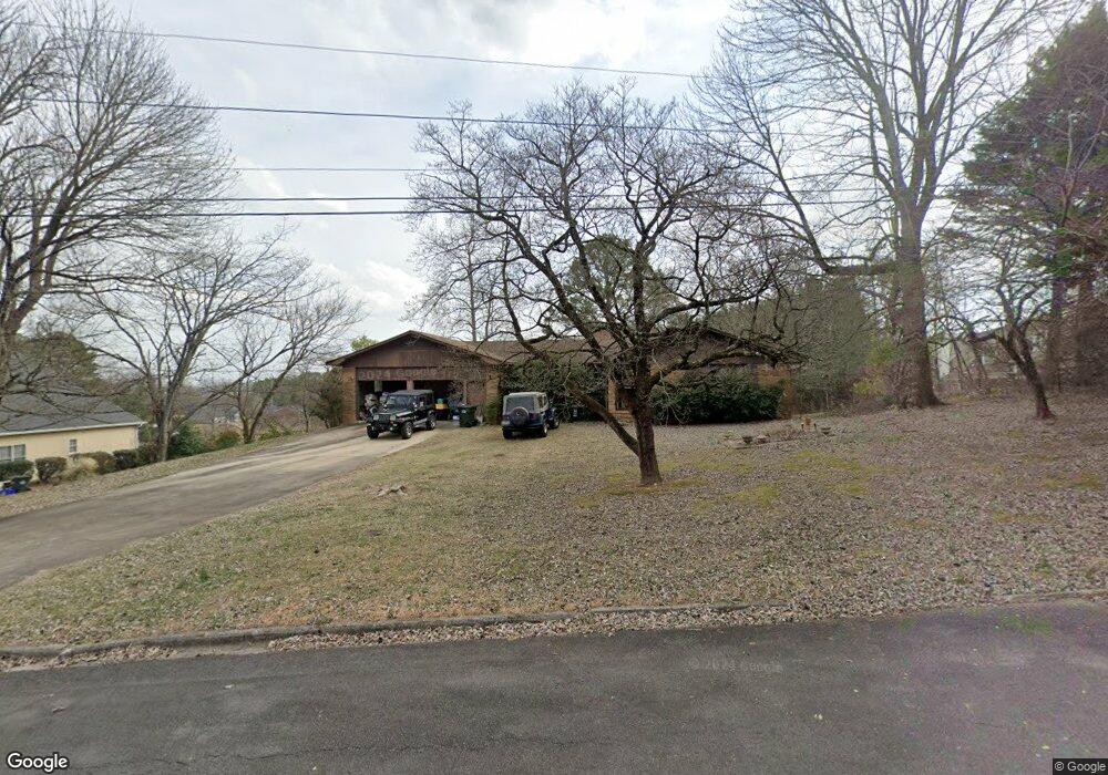
1309 Phillips Dr Dalton, GA 30720
Estimated Value: $345,652 - $430,000
--
Bed
2
Baths
2,653
Sq Ft
$148/Sq Ft
Est. Value
About This Home
This home is located at 1309 Phillips Dr, Dalton, GA 30720 and is currently estimated at $393,163, approximately $148 per square foot. 1309 Phillips Dr is a home located in Whitfield County with nearby schools including City Park Elementary School, Dalton Middle School, and Dalton High School.
Ownership History
Date
Name
Owned For
Owner Type
Purchase Details
Closed on
Dec 30, 2008
Sold by
Otts Yvonne
Bought by
Otts Jeffrey and Otts Rhianna
Current Estimated Value
Home Financials for this Owner
Home Financials are based on the most recent Mortgage that was taken out on this home.
Original Mortgage
$75,000
Outstanding Balance
$47,330
Interest Rate
5.15%
Mortgage Type
New Conventional
Estimated Equity
$345,833
Purchase Details
Closed on
May 23, 2008
Sold by
Otts Yvonne
Bought by
Otts Yvonne and Price Floyd A
Create a Home Valuation Report for This Property
The Home Valuation Report is an in-depth analysis detailing your home's value as well as a comparison with similar homes in the area
Home Values in the Area
Average Home Value in this Area
Purchase History
| Date | Buyer | Sale Price | Title Company |
|---|---|---|---|
| Otts Jeffrey | $75,000 | -- | |
| Otts Yvonne | -- | -- |
Source: Public Records
Mortgage History
| Date | Status | Borrower | Loan Amount |
|---|---|---|---|
| Open | Otts Jeffrey | $75,000 |
Source: Public Records
Tax History Compared to Growth
Tax History
| Year | Tax Paid | Tax Assessment Tax Assessment Total Assessment is a certain percentage of the fair market value that is determined by local assessors to be the total taxable value of land and additions on the property. | Land | Improvement |
|---|---|---|---|---|
| 2024 | $2,602 | $112,294 | $14,000 | $98,294 |
| 2023 | $2,602 | $76,520 | $14,000 | $62,520 |
| 2022 | $2,027 | $66,250 | $9,660 | $56,590 |
| 2021 | $2,142 | $69,483 | $9,660 | $59,823 |
| 2020 | $2,213 | $69,483 | $9,660 | $59,823 |
| 2019 | $2,278 | $69,483 | $9,660 | $59,823 |
| 2018 | $2,307 | $69,483 | $9,660 | $59,823 |
| 2017 | $2,214 | $69,483 | $9,660 | $59,823 |
| 2016 | $1,999 | $63,230 | $8,820 | $54,410 |
| 2014 | $1,759 | $60,219 | $8,400 | $51,819 |
| 2013 | -- | $60,218 | $8,400 | $51,818 |
Source: Public Records
Map
Nearby Homes
- 1510 Thornebrooke Cir Unit 3
- 1505 Anthony Ave
- Tract 2 Willowdale Rd Unit TRACT 2
- 1006 Willowdale Rd NW
- 1411 Belton Ave
- 115 Cliffs Dr NE
- 2205 Seminole Way
- Lot 5 Haig Mill Lake Rd
- 1202 Covie Dr
- Lot 12 Haig Mill Lake Rd
- Lot 13 Haig Mill Lake Rd
- 2203 Mathis Ln
- 1420 Cleo Way
- 204 Roslyn Ct
- 1416 Cleo Way
- 1521 Ashton Woods Way
- 2207 Mathis Ln
- 2115 Kings Rd
- 1403 Mack St
- 1402 Elite Dr
- 1522 Thornebrooke Cir
- 1307 Phillips Dr
- 1520 Thornebrooke Cir
- 1518 Thornebrooke Cir
- 1516 Thornebrooke Cir
- 1308 Phillips Dr
- 1529 Thornebrooke Cir
- 1531 Thornebrooke Cir
- 1527 Thornebrooke Cir
- 1525 Thornebrooke Cir
- 1305 Phillips Dr
- 1523 Thornebrooke Cir
- 1521 Thornebrooke Cir
- 1514 Thornebrooke Cir
- 1519 Thornebrooke Cir
- 1517 Thornebrooke Cir
- 1512 Thornebrooke Cir
- 1515 Thornebrooke Cir
- 1303 Phillips Dr
- 1513 Thornebrooke Cir