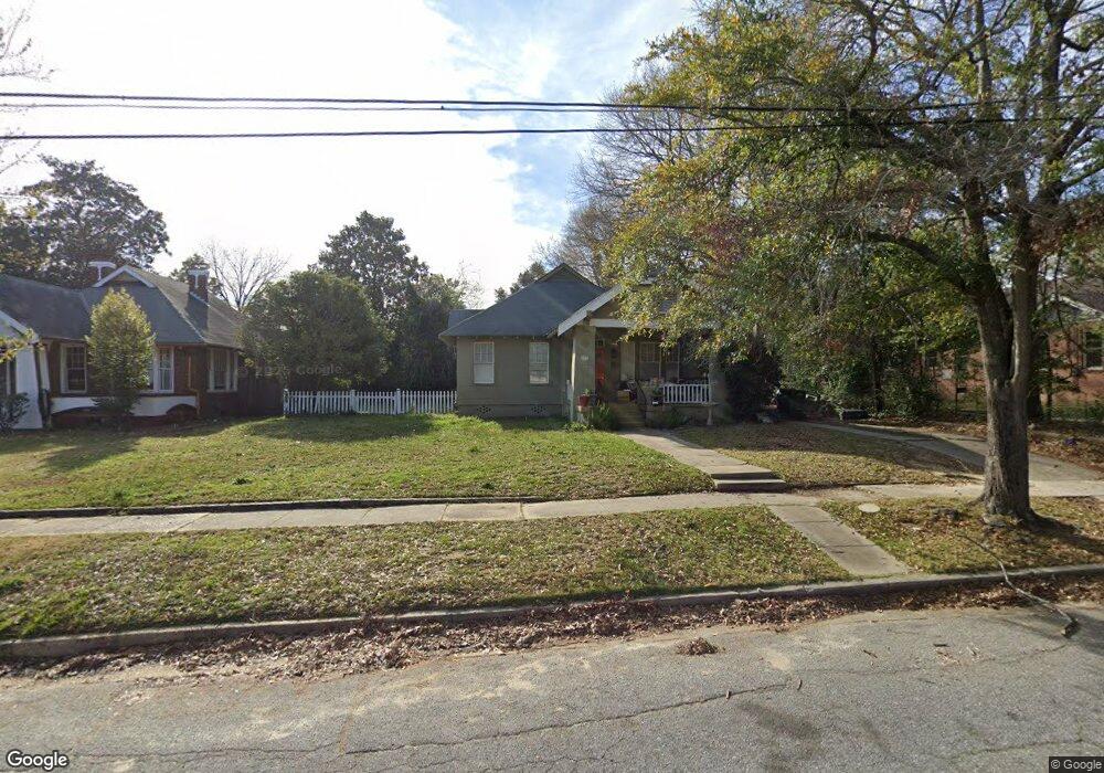
1309 Stark Ave Columbus, GA 31906
Wyntonn Grove NeighborhoodEstimated Value: $361,980 - $436,000
4
Beds
3
Baths
2,658
Sq Ft
$148/Sq Ft
Est. Value
About This Home
This home is located at 1309 Stark Ave, Columbus, GA 31906 and is currently estimated at $393,995, approximately $148 per square foot. 1309 Stark Ave is a home located in Muscogee County with nearby schools including Richards Middle School, Hardaway High School, and Wynnton Elementary School.
Ownership History
Date
Name
Owned For
Owner Type
Purchase Details
Closed on
Apr 29, 2014
Sold by
Marzuki Eric M
Bought by
Marzuki Terri L
Current Estimated Value
Purchase Details
Closed on
Sep 18, 2013
Sold by
Marzuki Eric M
Bought by
Marzuki Terri L
Home Financials for this Owner
Home Financials are based on the most recent Mortgage that was taken out on this home.
Original Mortgage
$8,000
Interest Rate
4.57%
Mortgage Type
New Conventional
Create a Home Valuation Report for This Property
The Home Valuation Report is an in-depth analysis detailing your home's value as well as a comparison with similar homes in the area
Home Values in the Area
Average Home Value in this Area
Purchase History
| Date | Buyer | Sale Price | Title Company |
|---|---|---|---|
| Marzuki Terri L | -- | -- | |
| Marzuki Terri L | $10,000 | -- |
Source: Public Records
Mortgage History
| Date | Status | Borrower | Loan Amount |
|---|---|---|---|
| Previous Owner | Marzuki Terri L | $8,000 |
Source: Public Records
Tax History Compared to Growth
Tax History
| Year | Tax Paid | Tax Assessment Tax Assessment Total Assessment is a certain percentage of the fair market value that is determined by local assessors to be the total taxable value of land and additions on the property. | Land | Improvement |
|---|---|---|---|---|
| 2025 | $4,528 | $115,668 | $17,976 | $97,692 |
| 2024 | $4,528 | $115,668 | $17,976 | $97,692 |
| 2023 | $4,556 | $115,668 | $17,976 | $97,692 |
| 2022 | $3,585 | $87,804 | $17,976 | $69,828 |
| 2021 | $3,650 | $89,392 | $17,976 | $71,416 |
| 2020 | $3,651 | $89,392 | $17,976 | $71,416 |
| 2019 | $3,662 | $89,392 | $17,976 | $71,416 |
| 2018 | $3,662 | $89,392 | $17,976 | $71,416 |
| 2017 | $3,674 | $89,392 | $17,976 | $71,416 |
| 2016 | $2,586 | $62,683 | $11,700 | $50,983 |
| 2015 | $2,589 | $62,683 | $11,700 | $50,983 |
| 2014 | $1,618 | $62,683 | $11,700 | $50,983 |
| 2013 | -- | $62,683 | $11,700 | $50,983 |
Source: Public Records
Map
Nearby Homes
- 1319 Hilton Ave
- 2227 15th St
- 2125 13th St Unit 12
- 2133 13th St
- 1227 Forest Ave Unit 4
- 1164 Tate Dr
- 2533 15th St
- 1310 S Dixon Dr
- 1513 Wells Dr
- 2312 Marion St
- 2726 Marion St
- 1700 Stark Ave
- 2016 Poplar Dr
- 1706 Stark Ave
- 1400 Eberhart Ave
- 1717 Stark Ave
- 1054 Lawyers Ln
- 1500 Preston Dr
- 2429 Bell St
- 1806 Stark Ave
- 1303 Stark Ave
- 1319 Stark Ave
- 1401 Stark Ave
- 1316 Wildwood Ave
- 1300 Stark Ave Unit A
- 1400 Wildwood Ave
- 1318 Stark Ave
- 1411 Stark Ave
- 1410 Stark Ave
- 1240 Wildwood Ave
- 1417 Stark Ave
- 2312 15th St Unit A
- 2312 15th St
- 2312 15th St Unit B
- 2243 14th St
- 1221 Stark Ave
- 1305 Hilton Ave
- 1315 Wildwood Ave
- 1234 Wildwood Ave
- 1309 Wildwood Ave