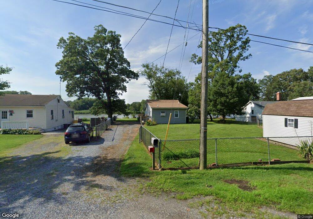
1309 Wrenn Cir Shady Side, MD 20764
Estimated Value: $396,220 - $992,000
--
Bed
1
Bath
480
Sq Ft
$1,239/Sq Ft
Est. Value
About This Home
This home is located at 1309 Wrenn Cir, Shady Side, MD 20764 and is currently estimated at $594,555, approximately $1,238 per square foot. 1309 Wrenn Cir is a home located in Anne Arundel County with nearby schools including Shady Side Elementary School, Southern Middle School, and Southern High School.
Ownership History
Date
Name
Owned For
Owner Type
Purchase Details
Closed on
Jan 28, 1994
Sold by
Vetter H J
Bought by
Bronzert Dennis
Current Estimated Value
Home Financials for this Owner
Home Financials are based on the most recent Mortgage that was taken out on this home.
Original Mortgage
$109,350
Interest Rate
7.11%
Create a Home Valuation Report for This Property
The Home Valuation Report is an in-depth analysis detailing your home's value as well as a comparison with similar homes in the area
Home Values in the Area
Average Home Value in this Area
Purchase History
| Date | Buyer | Sale Price | Title Company |
|---|---|---|---|
| Bronzert Dennis | $121,500 | -- |
Source: Public Records
Mortgage History
| Date | Status | Borrower | Loan Amount |
|---|---|---|---|
| Closed | Bronzert Dennis | $109,350 |
Source: Public Records
Tax History Compared to Growth
Tax History
| Year | Tax Paid | Tax Assessment Tax Assessment Total Assessment is a certain percentage of the fair market value that is determined by local assessors to be the total taxable value of land and additions on the property. | Land | Improvement |
|---|---|---|---|---|
| 2025 | $3,105 | $387,900 | -- | -- |
| 2024 | $3,105 | $380,000 | $0 | $0 |
| 2023 | $3,021 | $372,100 | $309,300 | $62,800 |
| 2022 | $2,843 | $370,133 | $0 | $0 |
| 2021 | $198 | $368,167 | $0 | $0 |
| 2020 | $2,705 | $366,200 | $309,300 | $56,900 |
| 2019 | $2,641 | $338,833 | $0 | $0 |
| 2018 | $198 | $311,467 | $0 | $0 |
| 2017 | $2,431 | $284,100 | $0 | $0 |
| 2016 | $198 | $267,233 | $0 | $0 |
| 2015 | $198 | $250,367 | $0 | $0 |
| 2014 | -- | $233,500 | $0 | $0 |
Source: Public Records
Map
Nearby Homes
- 1302 Spruce St
- 4913 Chestnut St
- 4992 Lerch Dr
- 1419 Shady Rest Rd
- 4912 Beech St
- 6152 Shady Side Rd
- 4908 Aspen St
- 6118 Shady Side Rd
- 0 Shady Side Rd Unit MDAA2113156
- 0 Shady Side Rd Unit MDAA2113166
- 6070 Shady Side Rd
- 1428 Haile Pkwy
- 1408 & 1410 Haile Pkwy
- 4938 Rullman Rd
- 4900 Thomas Dr
- 1436 Haile Pkwy
- 4846 Woods Wharf Rd
- 1445 & 1447 Haile Pkwy
- 0 Haile Pkwy Unit MDAA2127474
- 4907 Quince St
- 1307 Wrenn Cir
- 1313 Jordan Dr
- 1316 Jordan Dr
- 4959 Bonniewood Dr
- 1301 Wrenn Cir
- 1318 Jordan Dr
- 4964 Bonniewood Dr
- 4962 Bonniewood Dr
- 1325 Jordan Dr
- 1320 Jordan Dr
- 4960 Bonniewood Dr
- 4953 Bonniewood Dr
- 1322 Jordan Dr
- 4956 Bonniewood Dr
- 1327 Jordan Dr
- 4954 Bonniewood Dr
- 4951 Bonniewood Dr
- 1324 Jordan Dr
- 4950 Bonniewood Dr
- 1330 Jordan Dr