Estimated Value: $97,258 - $165,000
3
Beds
--
Bath
1,902
Sq Ft
$72/Sq Ft
Est. Value
About This Home
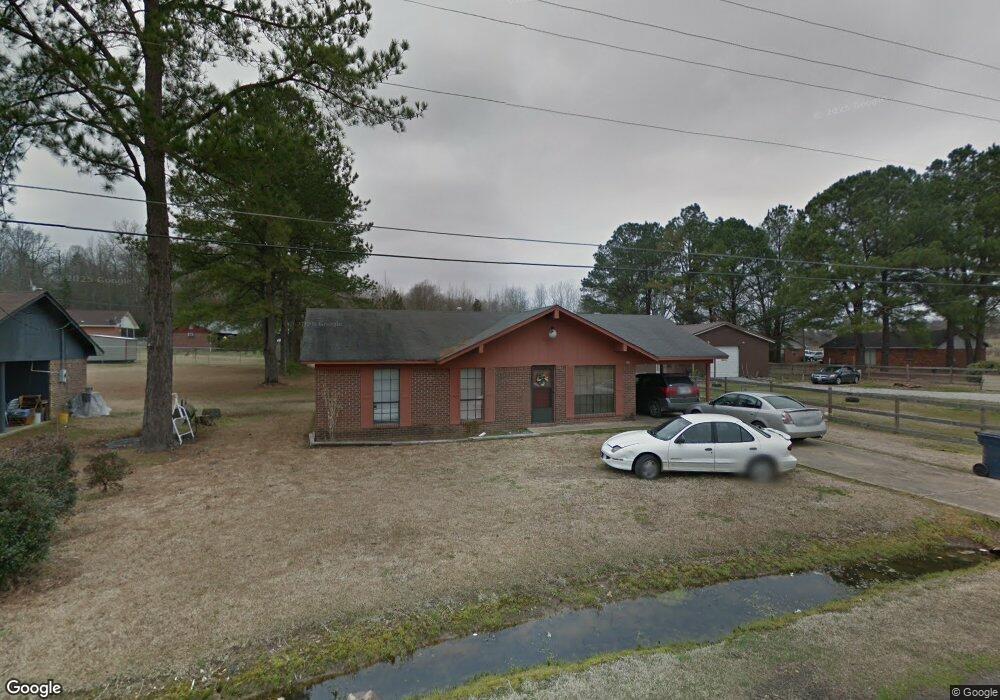
This home is located at 131 Annette St, Bruce, MS 38915 and is currently estimated at $137,315, approximately $72 per square foot. 131 Annette St is a home with nearby schools including Bruce Elementary School, Bruce Upper Elementary School, and Bruce High School.
Ownership History
Date
Name
Owned For
Owner Type
Purchase Details
Closed on
Apr 30, 2020
Sold by
Knox Leno
Bought by
Robinson Allegra Harris
Current Estimated Value
Purchase Details
Closed on
Jul 1, 2019
Sold by
Knox Lenora
Bought by
Robinson Allegra Harris and Knox Leno
Purchase Details
Closed on
Feb 4, 2019
Sold by
Prewett Michael W and Prewett Rebecca A
Bought by
Knox Leno
Create a Home Valuation Report for This Property
The Home Valuation Report is an in-depth analysis detailing your home's value as well as a comparison with similar homes in the area
Purchase History
| Date | Buyer | Sale Price | Title Company |
|---|---|---|---|
| Robinson Allegra Harris | -- | None Available | |
| Robinson Allegra Harris | -- | None Available | |
| Knox Leno | -- | None Available |
Source: Public Records
Tax History
| Year | Tax Paid | Tax Assessment Tax Assessment Total Assessment is a certain percentage of the fair market value that is determined by local assessors to be the total taxable value of land and additions on the property. | Land | Improvement |
|---|---|---|---|---|
| 2025 | $617 | $6,912 | $450 | $6,462 |
| 2024 | $596 | $6,912 | $450 | $6,462 |
| 2023 | $541 | $6,912 | $450 | $6,462 |
| 2022 | $317 | $3,927 | $450 | $3,477 |
| 2021 | $297 | $3,927 | $450 | $3,477 |
| 2020 | $370 | $3,927 | $450 | $3,477 |
| 2019 | $671 | $5,890 | $675 | $5,215 |
| 2018 | $654 | $5,795 | $675 | $5,120 |
| 2017 | $654 | $5,795 | $675 | $5,120 |
| 2016 | $655 | $5,795 | $675 | $5,120 |
| 2015 | $697 | $6,221 | $675 | $5,546 |
| 2014 | -- | $3,677 | $675 | $3,002 |
| 2013 | -- | $3,677 | $675 | $3,002 |
Source: Public Records
Map
Nearby Homes
- 319 Rodgers Ave
- 113 Woodson St
- 109 E Spratlin St
- 114 S Williams
- 115 W Johnson St
- 232 E Calhoun St
- 119 S McSweyn Place
- 213 N Pontotoc Rd
- 209 N Pontotoc Rd
- 0 Mississippi 9
- 00 Mississippi 9
- 105 Cr 257
- 26 Cr 272
- 410 W Calhoun St
- 10 Cr 259
- 01 Hwy 9
- 13 County Road 259c
- 501 Highway 9 N
- 181 Cr 221
- 137 Highway 9 N
- 127 Annette St
- 130 Annette St
- 123 Annette St
- 126 Annette St
- 137 Annette St
- 306 Pilgreen Rd
- 530 N Murphree St
- 121 Annette St
- 526 N Murphree St
- 105 Annette St
- 532 N Murphree St
- 120 Annette St
- 522 N Murphree St
- 0 Annette St
- 201 Pilgreen Rd
- 117 Annette St
- 518 N Murphree St
- 300 Pilgreen Rd
- 116 Annette St
- 637 N McSweyn Place
Your Personal Tour Guide
Ask me questions while you tour the home.