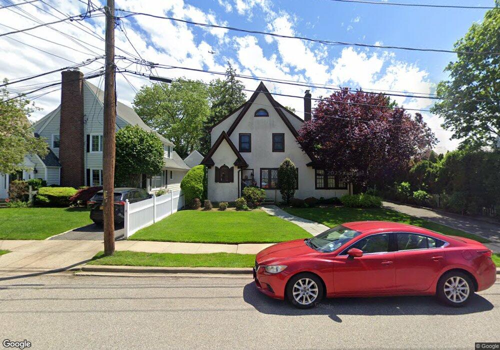
131 Avon Place West Hempstead, NY 11552
Estimated Value: $822,000 - $827,999
3
Beds
2
Baths
1,573
Sq Ft
$524/Sq Ft
Est. Value
About This Home
This home is located at 131 Avon Place, West Hempstead, NY 11552 and is currently estimated at $825,000, approximately $524 per square foot. 131 Avon Place is a home located in Nassau County with nearby schools including Chestnut Street School, West Hempstead Secondary School, and The Waldorf School of Garden City.
Ownership History
Date
Name
Owned For
Owner Type
Purchase Details
Closed on
Jun 10, 2015
Sold by
Farrell Jr John V O and Farrell Mary E O
Bought by
Connor John O and Tosi Lisa
Current Estimated Value
Home Financials for this Owner
Home Financials are based on the most recent Mortgage that was taken out on this home.
Original Mortgage
$380,000
Outstanding Balance
$295,262
Interest Rate
3.84%
Mortgage Type
New Conventional
Estimated Equity
$529,738
Create a Home Valuation Report for This Property
The Home Valuation Report is an in-depth analysis detailing your home's value as well as a comparison with similar homes in the area
Home Values in the Area
Average Home Value in this Area
Purchase History
| Date | Buyer | Sale Price | Title Company |
|---|---|---|---|
| Connor John O | $455,000 | Commonwealth |
Source: Public Records
Mortgage History
| Date | Status | Borrower | Loan Amount |
|---|---|---|---|
| Open | Connor John O | $380,000 |
Source: Public Records
Tax History Compared to Growth
Tax History
| Year | Tax Paid | Tax Assessment Tax Assessment Total Assessment is a certain percentage of the fair market value that is determined by local assessors to be the total taxable value of land and additions on the property. | Land | Improvement |
|---|---|---|---|---|
| 2025 | $15,943 | $567 | $270 | $297 |
| 2024 | $4,981 | $567 | $270 | $297 |
| 2023 | $15,024 | $567 | $270 | $297 |
| 2022 | $15,024 | $567 | $270 | $297 |
| 2021 | $20,452 | $542 | $258 | $284 |
| 2020 | $15,124 | $820 | $569 | $251 |
| 2019 | $14,928 | $820 | $569 | $251 |
| 2018 | $14,070 | $820 | $0 | $0 |
| 2017 | $8,637 | $820 | $503 | $317 |
| 2016 | $12,614 | $868 | $533 | $335 |
| 2015 | $4,193 | $927 | $569 | $358 |
| 2014 | $4,193 | $927 | $569 | $358 |
| 2013 | $3,921 | $927 | $569 | $358 |
Source: Public Records
Map
Nearby Homes
- 252 Lexington Ave
- 47 Stratford Rd
- 301 Concord Ave
- 253 William St
- 67 3rd St
- 2 Sunset Ln
- 39 Hilbert St
- 170 Ivy St
- 200 Hilton Ave Unit 55
- 197 Ivy St
- 144 Hilton Ave
- 35 Mulford Place
- 306 Cambridge Ave
- 181 Oak St
- 30 Cathedral Ave Unit 4A
- 22 Mulford Place Unit 2D
- 22 Mulford Place Unit 6C
- 20 Wendell St Unit A16
- 20 Wendell St Unit E2
- 20 Wendell St Unit 39C
- 127 Avon Place
- 130 Saint Pauls Place
- 2 Avon Place
- 117 Avon Place
- 204 Westminster Rd
- 126 Saint Pauls Place
- 134 Saint Pauls Place
- 128 Avon Place
- 126 Avon Place
- 134 Avon Place
- 122 Saint Pauls Place
- 220 Westminster Rd
- 121 Saint Pauls Place
- 6 Stevens Ave
- 9 Stevens Ave
- 11 Stevens Ave
- 7 Stevens Ave
- 139 Saint Pauls Place
- 3 Stevens Ave
- 185 Buckingham Rd