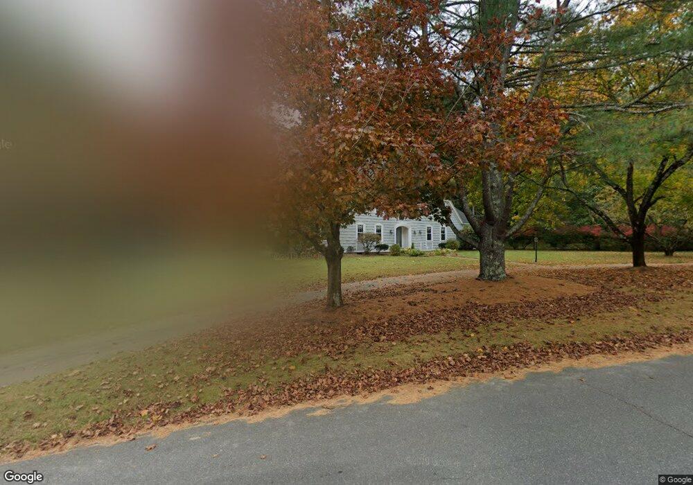
131 Bent Rd Sudbury, MA 01776
Estimated Value: $1,111,000 - $1,216,000
4
Beds
3
Baths
2,909
Sq Ft
$404/Sq Ft
Est. Value
About This Home
This home is located at 131 Bent Rd, Sudbury, MA 01776 and is currently estimated at $1,175,276, approximately $404 per square foot. 131 Bent Rd is a home located in Middlesex County with nearby schools including Israel Loring Elementary School, Ephraim Curtis Middle School, and Lincoln-Sudbury Regional High School.
Ownership History
Date
Name
Owned For
Owner Type
Purchase Details
Closed on
Oct 30, 2015
Sold by
Smith Brian D and Smith Jeanne R
Bought by
Smith Jeanne R
Current Estimated Value
Home Financials for this Owner
Home Financials are based on the most recent Mortgage that was taken out on this home.
Original Mortgage
$368,900
Outstanding Balance
$291,433
Interest Rate
3.92%
Mortgage Type
New Conventional
Estimated Equity
$883,843
Purchase Details
Closed on
Jul 14, 2006
Sold by
Stevens Nt and Stevens Lissa E
Bought by
Smith Brian D and Smith Jeanne R
Purchase Details
Closed on
Feb 13, 1998
Sold by
Bennett Gladys M
Bought by
Stevens Robert E and Stevens Lisa E
Home Financials for this Owner
Home Financials are based on the most recent Mortgage that was taken out on this home.
Original Mortgage
$377,600
Interest Rate
6.95%
Mortgage Type
Purchase Money Mortgage
Create a Home Valuation Report for This Property
The Home Valuation Report is an in-depth analysis detailing your home's value as well as a comparison with similar homes in the area
Home Values in the Area
Average Home Value in this Area
Purchase History
| Date | Buyer | Sale Price | Title Company |
|---|---|---|---|
| Smith Jeanne R | -- | -- | |
| Smith Brian D | $791,000 | -- | |
| Stevens Robert E | $419,000 | -- |
Source: Public Records
Mortgage History
| Date | Status | Borrower | Loan Amount |
|---|---|---|---|
| Open | Smith Jeanne R | $368,900 | |
| Previous Owner | Stevens Robert E | $415,000 | |
| Previous Owner | Stevens Robert E | $100,000 | |
| Previous Owner | Stevens Robert E | $377,600 |
Source: Public Records
Tax History Compared to Growth
Tax History
| Year | Tax Paid | Tax Assessment Tax Assessment Total Assessment is a certain percentage of the fair market value that is determined by local assessors to be the total taxable value of land and additions on the property. | Land | Improvement |
|---|---|---|---|---|
| 2025 | $15,368 | $1,049,700 | $510,100 | $539,600 |
| 2024 | $14,794 | $1,012,600 | $495,700 | $516,900 |
| 2023 | $13,813 | $875,900 | $443,700 | $432,200 |
| 2022 | $13,725 | $760,400 | $407,700 | $352,700 |
| 2021 | $13,230 | $702,600 | $407,700 | $294,900 |
| 2020 | $12,963 | $702,600 | $407,700 | $294,900 |
| 2019 | $12,582 | $702,500 | $407,700 | $294,800 |
| 2018 | $12,585 | $701,900 | $433,300 | $268,600 |
| 2017 | $12,340 | $695,600 | $429,700 | $265,900 |
| 2016 | $11,956 | $671,700 | $413,700 | $258,000 |
| 2015 | $11,526 | $654,900 | $402,100 | $252,800 |
| 2014 | $11,503 | $638,000 | $390,500 | $247,500 |
Source: Public Records
Map
Nearby Homes
- 143 Peakham Rd
- 54 Stone Rd
- 30 Rolling Ln
- 12 Hickory Rd
- 0 Boston Post Rd
- 0 Robbins Rd
- 7 Saddle Ridge Rd
- 25 Bridle Path
- 123 Dutton Rd
- 21 Summer St
- 89 Bridle Path
- 7 Adams Rd
- 24 Woodland Rd
- 128 Nobscot Rd
- 1011 Boston Post Rd
- 30 Nobscot Rd Unit 14
- 270 Old Lancaster Rd
- 100 Nobscot Dr
- 6 Mountain View Dr
- 32 Eaton Rd W