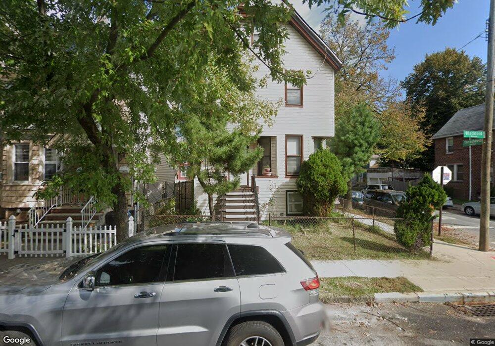
131 Blackford Ave Staten Island, NY 10302
Port Richmond NeighborhoodEstimated Value: $507,234 - $604,000
3
Beds
1
Bath
1,508
Sq Ft
$375/Sq Ft
Est. Value
About This Home
This home is located at 131 Blackford Ave, Staten Island, NY 10302 and is currently estimated at $565,059, approximately $374 per square foot. 131 Blackford Ave is a home located in Richmond County with nearby schools including PS 21 Margaret Emery-Elm Park, I.S. 51 Edwin Markham, and Port Richmond High School.
Ownership History
Date
Name
Owned For
Owner Type
Purchase Details
Closed on
Sep 22, 1999
Sold by
Citibank Na
Bought by
Rogers Josephine
Current Estimated Value
Home Financials for this Owner
Home Financials are based on the most recent Mortgage that was taken out on this home.
Original Mortgage
$115,000
Interest Rate
7.84%
Create a Home Valuation Report for This Property
The Home Valuation Report is an in-depth analysis detailing your home's value as well as a comparison with similar homes in the area
Home Values in the Area
Average Home Value in this Area
Purchase History
| Date | Buyer | Sale Price | Title Company |
|---|---|---|---|
| Rogers Josephine | $130,000 | Commonwealth Land Title Ins |
Source: Public Records
Mortgage History
| Date | Status | Borrower | Loan Amount |
|---|---|---|---|
| Previous Owner | Rogers Josephine | $115,000 |
Source: Public Records
Tax History Compared to Growth
Tax History
| Year | Tax Paid | Tax Assessment Tax Assessment Total Assessment is a certain percentage of the fair market value that is determined by local assessors to be the total taxable value of land and additions on the property. | Land | Improvement |
|---|---|---|---|---|
| 2025 | $3,655 | $33,840 | $3,131 | $30,709 |
| 2024 | $3,667 | $30,720 | $3,254 | $27,466 |
| 2023 | $3,433 | $18,490 | $2,598 | $15,892 |
| 2022 | $3,215 | $29,520 | $5,100 | $24,420 |
| 2021 | $3,558 | $28,020 | $5,100 | $22,920 |
| 2020 | $4,239 | $27,540 | $5,100 | $22,440 |
| 2019 | $3,124 | $23,940 | $5,100 | $18,840 |
| 2018 | $2,843 | $15,408 | $4,470 | $10,938 |
| 2017 | $2,841 | $15,408 | $4,294 | $11,114 |
| 2016 | $2,747 | $15,291 | $4,036 | $11,255 |
| 2015 | $2,307 | $14,426 | $3,569 | $10,857 |
| 2014 | $2,307 | $13,610 | $4,043 | $9,567 |
Source: Public Records
Map
Nearby Homes
- 145 Clinton Place
- 152 Port Richmond Ave
- 11 Laforge Ave
- 38 Laforge Ave
- 469 Port Richmond Ave
- 98 Saint Josephs Ave
- 209 Nicholas Ave
- 231 Charles Ave
- 28 Hooker Place
- 28 Clinton Place
- 47 Montell St
- 1594 Castleton Ave
- 471 Heberton Ave
- 162 John St
- 121 Harrison Ave
- 83 Palmer Ave
- 145 Morningside Ave Unit 2C
- 54 Riverside Dr Unit 1AA
- 30 Decker Ave
- 125 Decker Ave
- 133 Blackford Ave
- 135 Blackford Ave
- 139 Blackford Ave
- 117 Blackford Ave
- 130 Clinton Place
- 115 Blackford Ave
- 141 Blackford Ave
- 134 Clinton Place
- 138 Clinton Place
- 143 Blackford Ave
- 118 Clinton Place
- 142 Clinton Place
- 128 Blackford Ave Unit 1ST
- 128 Blackford Ave
- 111 Blackford Ave
- 145 Blackford Ave
- 114 Clinton Place
- 132 Blackford Ave
- 144 Clinton Place
- 136 Blackford Ave