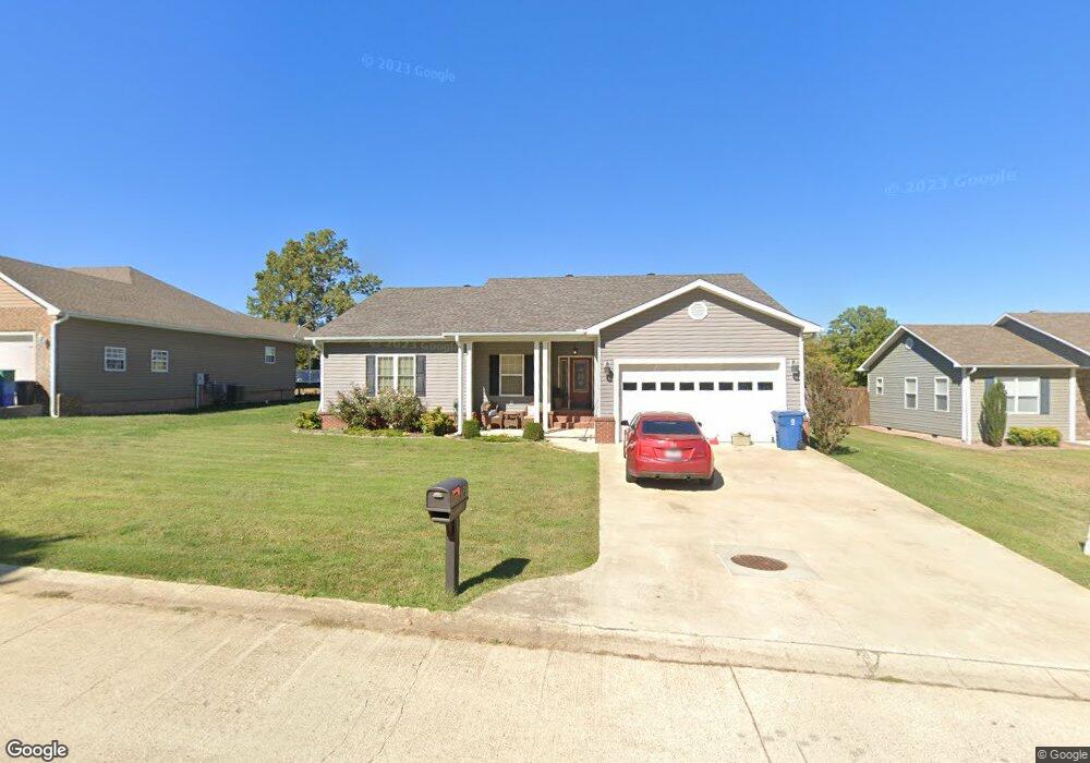
131 Boulder Trail Dr Poplar Bluff, MO 63901
Estimated Value: $240,000 - $310,000
--
Bed
--
Bath
2,151
Sq Ft
$124/Sq Ft
Est. Value
About This Home
This home is located at 131 Boulder Trail Dr, Poplar Bluff, MO 63901 and is currently estimated at $266,287, approximately $123 per square foot. 131 Boulder Trail Dr is a home with nearby schools including Oak Grove Elementary School, Poplar Bluff Fifth & Sixth Grade Center, and Poplar Bluff Junior High School.
Ownership History
Date
Name
Owned For
Owner Type
Purchase Details
Closed on
Mar 5, 2012
Sold by
Mccauley Investments Llc
Bought by
Mcbride Richard P and Mcbride Kimberly L
Current Estimated Value
Home Financials for this Owner
Home Financials are based on the most recent Mortgage that was taken out on this home.
Original Mortgage
$182,000
Outstanding Balance
$125,259
Interest Rate
3.91%
Mortgage Type
New Conventional
Estimated Equity
$141,028
Create a Home Valuation Report for This Property
The Home Valuation Report is an in-depth analysis detailing your home's value as well as a comparison with similar homes in the area
Home Values in the Area
Average Home Value in this Area
Purchase History
| Date | Buyer | Sale Price | Title Company |
|---|---|---|---|
| Mcbride Richard P | -- | None Available |
Source: Public Records
Mortgage History
| Date | Status | Borrower | Loan Amount |
|---|---|---|---|
| Open | Mcbride Richard P | $182,000 |
Source: Public Records
Tax History Compared to Growth
Tax History
| Year | Tax Paid | Tax Assessment Tax Assessment Total Assessment is a certain percentage of the fair market value that is determined by local assessors to be the total taxable value of land and additions on the property. | Land | Improvement |
|---|---|---|---|---|
| 2024 | $16 | $35,540 | $0 | $0 |
| 2023 | $1,583 | $35,540 | $0 | $0 |
| 2022 | $1,530 | $34,420 | $0 | $0 |
| 2021 | $1,531 | $34,420 | $0 | $0 |
| 2020 | $1,554 | $34,420 | $0 | $0 |
| 2019 | $1,553 | $34,420 | $0 | $0 |
| 2018 | $1,553 | $34,420 | $0 | $0 |
| 2017 | -- | $34,420 | $0 | $0 |
| 2016 | -- | $34,420 | $0 | $0 |
| 2015 | -- | $34,420 | $0 | $0 |
| 2014 | -- | $32,180 | $0 | $0 |
| 2012 | $11 | $20,220 | $0 | $0 |
Source: Public Records
Map
Nearby Homes
- 319 Pintail Ln
- 16 Boulder Trail
- 0 Boulder Trail
- 0 Mallard Trail Unit MIS25057052
- 0 Lots 8-13 Mallard Pointe Sub
- 6708 Brown Ln
- 134 Alisha Ave
- 147 Alisha Ave
- 148 Lanee Ln
- 125 Terrell Ave
- 3011 Wolf Run
- 226 Forest Meadow Dr
- 205 Batson Lake Ln
- 267 Misty Lake Rd
- 5100 Crabapple Ln
- 725 County Road 526
- 112 Mayson Ln
- 1460 Victoria Rd
- 0 Brownwood Trails #18 Unit MIS25061746
- 3451 Normandy Rd
- 141 Boulder Trail Dr
- 121 Boulder Trail Dr
- 272 Boulder Trail Dr
- 151 Boulder Trail Dr
- 111 Boulder Trail
- 128 Boulder Trail Dr
- 138 Boulder Trail Dr
- 148 Boulder Trail Dr
- 158 Boulder Trail Dr
- 158 Boulder Trail Dr
- 120 Boulder Trail
- 109 Boulder Trail Dr
- 108 Boulder Trail Dr
- 17 Boulder Trail
- 171 W Boulder Trail Dr
- 168 Boulder Trail Dr
- 0 Lot 7 Boulder Ridge Sub Unit 9939146
- 0 Lot 7 Boulder Ridge Sub Unit 9936825
- 0 Lot 3 Boulder Ridge Unit 9925198
- 0 Lot 1 Boulder Ridge Unit 9925196