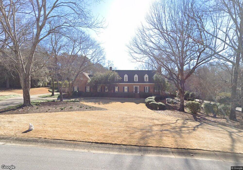
131 Branford Place Unit n/a Athens, GA 30606
Tanglewood NeighborhoodEstimated Value: $979,000 - $1,232,000
5
Beds
5
Baths
5,070
Sq Ft
$211/Sq Ft
Est. Value
About This Home
This home is located at 131 Branford Place Unit n/a, Athens, GA 30606 and is currently estimated at $1,068,953, approximately $210 per square foot. 131 Branford Place Unit n/a is a home located in Clarke County with nearby schools including Timothy Elementary School, Clarke Middle School, and Clarke Central High School.
Ownership History
Date
Name
Owned For
Owner Type
Purchase Details
Closed on
Oct 15, 2012
Sold by
Sligh Matthew J
Bought by
Oneill M Shane and Oneill Amy R
Current Estimated Value
Home Financials for this Owner
Home Financials are based on the most recent Mortgage that was taken out on this home.
Original Mortgage
$548,041
Interest Rate
3.6%
Mortgage Type
New Conventional
Purchase Details
Closed on
May 24, 2010
Sold by
Phillips Kathleen Ann B
Bought by
Sligh Matthew J
Home Financials for this Owner
Home Financials are based on the most recent Mortgage that was taken out on this home.
Original Mortgage
$450,000
Interest Rate
5.03%
Mortgage Type
Unknown
Purchase Details
Closed on
Jan 3, 1991
Sold by
Phillips Timothy W
Bought by
Phillips Kathleen B
Create a Home Valuation Report for This Property
The Home Valuation Report is an in-depth analysis detailing your home's value as well as a comparison with similar homes in the area
Home Values in the Area
Average Home Value in this Area
Purchase History
| Date | Buyer | Sale Price | Title Company |
|---|---|---|---|
| Oneill M Shane | $526,500 | -- | |
| Sligh Matthew J | $550,000 | -- | |
| Phillips Kathleen B | -- | -- |
Source: Public Records
Mortgage History
| Date | Status | Borrower | Loan Amount |
|---|---|---|---|
| Closed | Oneill M Shane | $548,041 | |
| Previous Owner | Sligh Matthew J | $450,000 |
Source: Public Records
Tax History Compared to Growth
Tax History
| Year | Tax Paid | Tax Assessment Tax Assessment Total Assessment is a certain percentage of the fair market value that is determined by local assessors to be the total taxable value of land and additions on the property. | Land | Improvement |
|---|---|---|---|---|
| 2025 | $10,145 | $350,057 | $32,000 | $318,057 |
| 2024 | $10,145 | $331,318 | $32,000 | $299,318 |
| 2023 | $9,854 | $305,582 | $32,000 | $273,582 |
| 2022 | $8,277 | $269,478 | $32,000 | $237,478 |
| 2021 | $7,717 | $238,979 | $32,000 | $206,979 |
| 2020 | $7,631 | $236,441 | $32,000 | $204,441 |
| 2019 | $7,544 | $232,211 | $30,000 | $202,211 |
| 2018 | $7,442 | $229,202 | $30,000 | $199,202 |
| 2017 | $7,184 | $221,592 | $30,000 | $191,592 |
| 2016 | $7,109 | $219,385 | $30,000 | $189,385 |
| 2015 | $7,157 | $220,502 | $30,000 | $190,502 |
| 2014 | $7,205 | $221,592 | $30,000 | $191,592 |
Source: Public Records
Map
Nearby Homes
- 132 Branford Place
- 205 Heritage Stroll
- 835 Timothy Rd
- 190 Bowles Dr Unit 1
- 190 Bowles Dr
- 200 Cheatham Dr
- 497 Somerset Dr
- 145 Holly Falls Dr
- 105 Greystone Terrace
- 299 Kennington Dr
- 1720 Timothy Rd
- 155 Harold Dr
- 164 Plum Nelly Rd
- 255 Pine Valley Dr
- 589 W Lake Dr
- 262 Rhodes Dr
- 175 Tillman Ln
- 104 W Lake Ct
- 213 Highpointe Ln
- 131 Branford Place
- 0 Branford Place Unit 8657398
- 0 Branford Place Unit 8624634
- 0 Branford Place Unit 8531930
- 0 Branford Place Unit 8088156
- 0 Branford Place Unit 7454593
- 0 Branford Place Unit 3055226
- 111 Branford Place
- 111 Middleton Place
- 151 Branford Place
- 122 Branford Place
- 115 Middleton Place
- 112 Branford Place
- 745 Timothy Rd
- 689 Timothy Rd
- 120 Middleton Place
- 125 Middleton Place
- 112 Towns Walk Dr
- 116 Towns Walk Dr Unit 6A
- 116 Towns Walk Dr