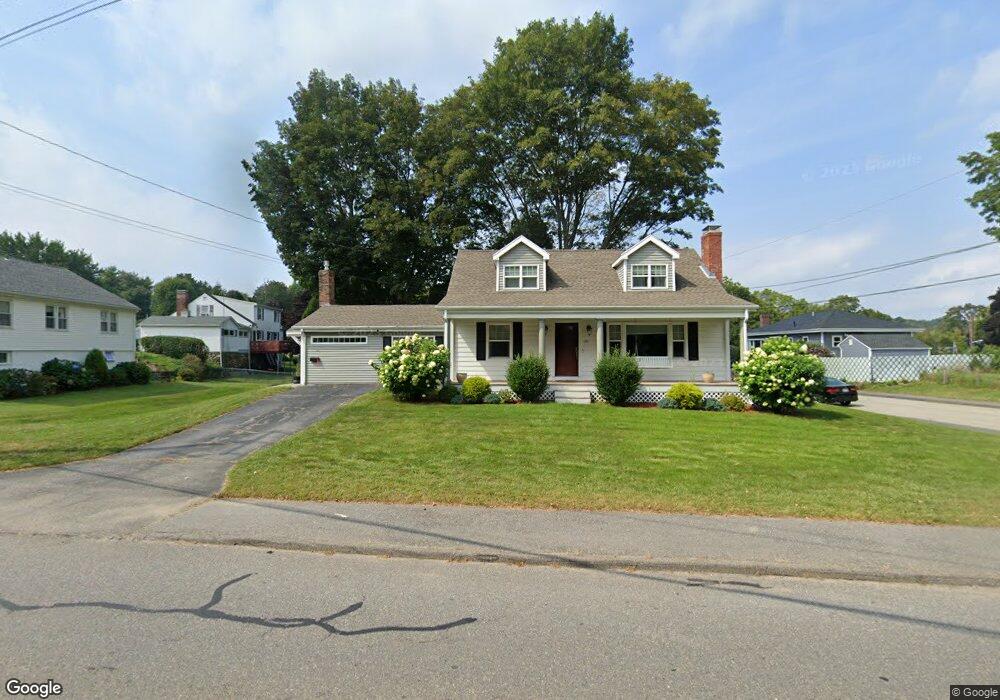
131 Cook Ln Marlborough, MA 01752
Estimated Value: $691,851 - $732,000
3
Beds
3
Baths
2,194
Sq Ft
$327/Sq Ft
Est. Value
About This Home
This home is located at 131 Cook Ln, Marlborough, MA 01752 and is currently estimated at $716,713, approximately $326 per square foot. 131 Cook Ln is a home located in Middlesex County with nearby schools including Marlborough High School, New Covenant Christian School, and Glenhaven Academy - JRI School.
Ownership History
Date
Name
Owned For
Owner Type
Purchase Details
Closed on
Apr 24, 2023
Sold by
Finn William H
Bought by
William H Finn Iii Ft and Finn
Current Estimated Value
Purchase Details
Closed on
Dec 5, 2014
Sold by
Patricia A Finn Ft and Gorski
Bought by
Gorski Kathleen F and Finn William H
Purchase Details
Closed on
Feb 19, 2009
Sold by
Finn Patricia A
Bought by
Gorski Tr Kathleen F and Carney Kerri A
Create a Home Valuation Report for This Property
The Home Valuation Report is an in-depth analysis detailing your home's value as well as a comparison with similar homes in the area
Home Values in the Area
Average Home Value in this Area
Purchase History
| Date | Buyer | Sale Price | Title Company |
|---|---|---|---|
| William H Finn Iii Ft | -- | None Available | |
| Gorski Kathleen F | -- | -- | |
| Gorski Tr Kathleen F | -- | -- |
Source: Public Records
Tax History Compared to Growth
Tax History
| Year | Tax Paid | Tax Assessment Tax Assessment Total Assessment is a certain percentage of the fair market value that is determined by local assessors to be the total taxable value of land and additions on the property. | Land | Improvement |
|---|---|---|---|---|
| 2025 | $6,453 | $654,500 | $219,000 | $435,500 |
| 2024 | $6,223 | $607,700 | $199,100 | $408,600 |
| 2023 | $6,296 | $545,600 | $167,600 | $378,000 |
| 2022 | $5,917 | $451,000 | $159,600 | $291,400 |
| 2021 | $6,337 | $429,700 | $133,000 | $296,700 |
| 2020 | $5,817 | $410,200 | $126,700 | $283,500 |
| 2019 | $5,674 | $403,300 | $124,200 | $279,100 |
| 2018 | $5,400 | $369,100 | $98,700 | $270,400 |
| 2017 | $5,757 | $375,800 | $98,000 | $277,800 |
| 2016 | $3,703 | $241,400 | $98,000 | $143,400 |
| 2015 | $4,060 | $257,600 | $100,300 | $157,300 |
Source: Public Records
Map
Nearby Homes
- 41 Kane Dr
- 97 Cook Ln
- 96 Cook Ln
- 57 Marlton Dr
- 53 Hillcrest Rd
- Lot 1 Quinn Rd
- 53 Phelps St
- 110 Boston Post Rd E Unit 104
- 37 Hosmer St Unit 10
- 37 Hosmer St Unit 20
- 70 Phelps St
- 8 Roundtop Rd
- 25 Walnut St
- 100 Phelps St Unit 7
- 181 Boston Post Rd E Unit 26
- 75 Warren Ave
- 16 Clinton St
- 24 Clinton St
- 35 Roundtop Rd
- 38 Sawin St