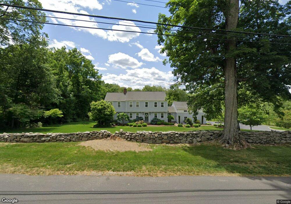
131 Dunham Rd Fairfield, CT 06824
Greenfield Hill NeighborhoodEstimated Value: $1,323,775 - $1,542,000
5
Beds
4
Baths
2,434
Sq Ft
$582/Sq Ft
Est. Value
About This Home
This home is located at 131 Dunham Rd, Fairfield, CT 06824 and is currently estimated at $1,416,194, approximately $581 per square foot. 131 Dunham Rd is a home located in Fairfield County with nearby schools including Dwight Elementary School, Roger Ludlowe Middle School, and Fairfield Ludlowe High School.
Ownership History
Date
Name
Owned For
Owner Type
Purchase Details
Closed on
Jun 30, 2004
Sold by
Gibbons Joseph P and Gibbons Ann S
Bought by
Coolidge Calin P and Coolidge Annie D
Current Estimated Value
Home Financials for this Owner
Home Financials are based on the most recent Mortgage that was taken out on this home.
Original Mortgage
$450,000
Interest Rate
6.3%
Create a Home Valuation Report for This Property
The Home Valuation Report is an in-depth analysis detailing your home's value as well as a comparison with similar homes in the area
Home Values in the Area
Average Home Value in this Area
Purchase History
| Date | Buyer | Sale Price | Title Company |
|---|---|---|---|
| Coolidge Calin P | $865,000 | -- | |
| Coolidge Calin P | $865,000 | -- |
Source: Public Records
Mortgage History
| Date | Status | Borrower | Loan Amount |
|---|---|---|---|
| Open | Coolidge Calin P | $308,400 | |
| Closed | Coolidge Calin P | $100,000 | |
| Closed | Coolidge Calin P | $417,000 | |
| Closed | Coolidge Calin P | $450,000 |
Source: Public Records
Tax History
| Year | Tax Paid | Tax Assessment Tax Assessment Total Assessment is a certain percentage of the fair market value that is determined by local assessors to be the total taxable value of land and additions on the property. | Land | Improvement |
|---|---|---|---|---|
| 2025 | $15,791 | $556,220 | $326,340 | $229,880 |
| 2024 | $15,519 | $556,220 | $326,340 | $229,880 |
| 2023 | $15,302 | $556,220 | $326,340 | $229,880 |
| 2022 | $15,151 | $556,220 | $326,340 | $229,880 |
| 2021 | $15,007 | $556,220 | $326,340 | $229,880 |
| 2020 | $17,099 | $638,260 | $369,810 | $268,450 |
| 2019 | $17,099 | $638,260 | $369,810 | $268,450 |
| 2018 | $16,825 | $638,260 | $369,810 | $268,450 |
| 2017 | $16,480 | $638,260 | $369,810 | $268,450 |
| 2016 | $16,244 | $638,260 | $369,810 | $268,450 |
| 2015 | $19,215 | $775,110 | $553,910 | $221,200 |
| 2014 | $18,913 | $775,110 | $553,910 | $221,200 |
Source: Public Records
Map
Nearby Homes
- 1380 Old Academy Rd
- 3674 Congress St
- 2683 Bronson Rd
- 2177 Cross Hwy
- 1115 Galloping Hill Rd
- 360 Duck Farm Rd
- 148 Millspaugh Dr
- 22 Brett Rd
- 88 Merry Meet Cir
- 4800 Congress St
- 281 Wood House Rd
- 10 Mary Jane Ln
- 6 Buckboard Ln
- 212 Fence Row Dr
- 218 Lower Farm Rd
- 475 Fence Row Dr
- 180 Catamount Rd
- 21 Sturges Commons
- 1 Sturges Hwy Unit 2
- 677 Eleven O Clock Rd
- 105 Dunham Rd
- 41 Gay Bowers Rd
- 26 Gay Bowers Rd
- 1200 Old Academy Rd
- 1130 Old Academy Rd
- 78 Gay Bowers Rd
- 115 Gay Bowers Rd
- 1296 Old Academy Rd
- 311 Dunham Rd
- 114 Gay Bowers Rd
- 1122 Old Academy Rd
- 1245 Old Academy Rd
- 1050 Old Academy Rd
- 216 Dunham Rd
- 1139 Old Academy Rd
- 1313 Old Academy Rd
- 150 Gay Bowers Rd
- 39 Meeting House Ln
- 1291 Old Academy Rd
- 1244 Redding Rd
Your Personal Tour Guide
Ask me questions while you tour the home.