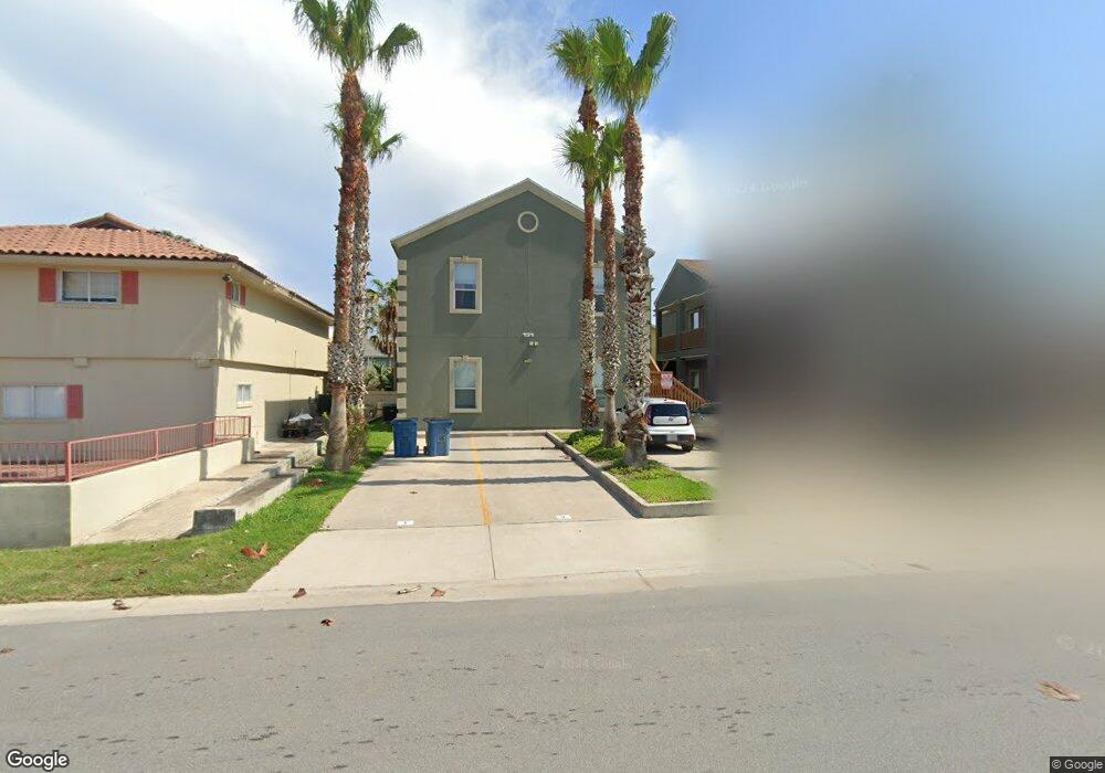
131 E Atol St Unit A4 South Padre Island, TX 78597
Estimated Value: $298,571 - $482,000
2
Beds
2
Baths
992
Sq Ft
$361/Sq Ft
Est. Value
About This Home
This home is located at 131 E Atol St Unit A4, South Padre Island, TX 78597 and is currently estimated at $357,893, approximately $360 per square foot. 131 E Atol St Unit A4 is a home located in Cameron County with nearby schools including Garriga Elementary School, Derry Elementary School, and Port Isabel Junior High School.
Ownership History
Date
Name
Owned For
Owner Type
Purchase Details
Closed on
Feb 23, 2016
Sold by
Coates Jim B and Blegen David E
Bought by
Lauffer Ii Robert A and Lauffer Kimberly Kyle
Current Estimated Value
Home Financials for this Owner
Home Financials are based on the most recent Mortgage that was taken out on this home.
Original Mortgage
$151,200
Outstanding Balance
$119,983
Interest Rate
3.81%
Mortgage Type
New Conventional
Estimated Equity
$237,910
Purchase Details
Closed on
Jun 25, 2006
Sold by
Allan & Allen Properties Llc
Bought by
Coates Jim B and Blegen David E
Home Financials for this Owner
Home Financials are based on the most recent Mortgage that was taken out on this home.
Original Mortgage
$171,900
Interest Rate
6.19%
Mortgage Type
Purchase Money Mortgage
Create a Home Valuation Report for This Property
The Home Valuation Report is an in-depth analysis detailing your home's value as well as a comparison with similar homes in the area
Home Values in the Area
Average Home Value in this Area
Purchase History
| Date | Buyer | Sale Price | Title Company |
|---|---|---|---|
| Lauffer Ii Robert A | -- | Stewart Title Company | |
| Coates Jim B | -- | Dba Cameron County Title Co |
Source: Public Records
Mortgage History
| Date | Status | Borrower | Loan Amount |
|---|---|---|---|
| Open | Lauffer Ii Robert A | $151,200 | |
| Previous Owner | Coates Jim B | $171,900 |
Source: Public Records
Tax History Compared to Growth
Tax History
| Year | Tax Paid | Tax Assessment Tax Assessment Total Assessment is a certain percentage of the fair market value that is determined by local assessors to be the total taxable value of land and additions on the property. | Land | Improvement |
|---|---|---|---|---|
| 2025 | $5,360 | $309,000 | $56,250 | $252,750 |
| 2024 | $5,360 | $328,255 | $56,250 | $272,005 |
| 2023 | $5,681 | $331,360 | $56,250 | $275,110 |
| 2022 | $4,095 | $216,102 | $43,750 | $172,352 |
| 2021 | $3,167 | $157,448 | $32,813 | $124,635 |
| 2020 | $3,216 | $158,824 | $32,813 | $126,011 |
| 2019 | $3,276 | $158,638 | $31,250 | $127,388 |
| 2018 | $3,302 | $160,013 | $31,250 | $128,763 |
| 2017 | $3,304 | $161,389 | $31,250 | $130,139 |
| 2016 | $3,333 | $162,764 | $31,250 | $131,514 |
| 2015 | $3,304 | $164,140 | $31,250 | $132,890 |
Source: Public Records
Map
Nearby Homes
- 126 E Atol St Unit 5
- 135 E Bahama St
- 3400 Gulf Blvd Unit 402
- 3608 Gulf Blvd Unit A2
- 3608 Gulf Blvd Unit 202-A
- 115 E Atol St Unit 3
- 114 E Bahama St Unit 6
- 114 E Atol St Unit 4
- 110 E Bahama St
- 109 E Retama St Unit 2
- 106 E Atol St Unit 1
- 107 E Bahama St Unit 7
- 107 E Bahama St
- 107 E Bahama St Unit 4
- 117 E Campeche St Unit 1
- 117 E Mesquite St
- TBD Other
- 110 E Retama St Unit 4
- 110 E Retama St Unit 3
- 110 E Retama St Unit 1
- 131 E Atol St
- 131 E Atol St Unit 7
- 131 E Atol St Unit 3
- 131 E Atol St Unit 2
- 131 E Atol St Unit 5
- 131 E Atol St Unit B7
- 131 E Atol St Unit B3
- 131 E Atol St Unit A2
- 131 E Atol St Unit 8
- 131 E Atol St Unit 2A
- 131 E Atol St Unit A3
- 131 E Atol St Unit 1
- 131 E Atol St Unit 6
- 3419 Gulf Blvd
- 135 E Atol St
- 129 E Atol St Unit A
- 130 E Bahama St
- 129A E Atol St Unit A
- 3415 Gulf Blvd
- LOT 17-19 E Atol St