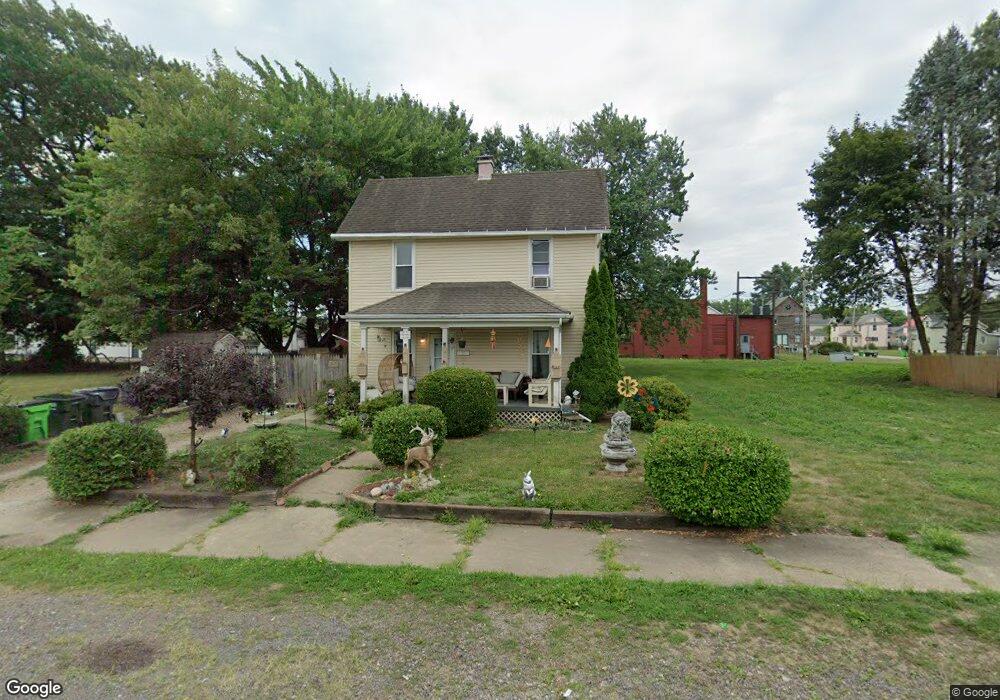
131 E Harrison St Alliance, OH 44601
Estimated Value: $70,000 - $111,000
3
Beds
1
Bath
1,237
Sq Ft
$75/Sq Ft
Est. Value
About This Home
This home is located at 131 E Harrison St, Alliance, OH 44601 and is currently estimated at $92,157, approximately $74 per square foot. 131 E Harrison St is a home located in Stark County with nearby schools including Alliance Early Learning School, Alliance Intermediate School at Northside, and Alliance Middle School.
Ownership History
Date
Name
Owned For
Owner Type
Purchase Details
Closed on
Dec 7, 1999
Sold by
Sommers Elmer B and Sommers Delilah
Bought by
Sloat Joseph and Sloat Tammy
Current Estimated Value
Home Financials for this Owner
Home Financials are based on the most recent Mortgage that was taken out on this home.
Original Mortgage
$42,400
Outstanding Balance
$13,433
Interest Rate
8.02%
Mortgage Type
Stand Alone First
Estimated Equity
$78,724
Purchase Details
Closed on
Nov 10, 1997
Sold by
Estrada Cheryl A
Bought by
Sommers Elmer B and Sommers Delilah
Create a Home Valuation Report for This Property
The Home Valuation Report is an in-depth analysis detailing your home's value as well as a comparison with similar homes in the area
Home Values in the Area
Average Home Value in this Area
Purchase History
| Date | Buyer | Sale Price | Title Company |
|---|---|---|---|
| Sloat Joseph | $50,000 | Trident Title Agency | |
| Sommers Elmer B | $12,000 | -- |
Source: Public Records
Mortgage History
| Date | Status | Borrower | Loan Amount |
|---|---|---|---|
| Open | Sloat Joseph | $42,400 |
Source: Public Records
Tax History
| Year | Tax Paid | Tax Assessment Tax Assessment Total Assessment is a certain percentage of the fair market value that is determined by local assessors to be the total taxable value of land and additions on the property. | Land | Improvement |
|---|---|---|---|---|
| 2025 | -- | $26,010 | $6,900 | $19,110 |
| 2024 | -- | $26,010 | $6,900 | $19,110 |
| 2023 | $335 | $8,340 | $3,470 | $4,870 |
| 2022 | $337 | $8,340 | $3,470 | $4,870 |
| 2021 | $338 | $8,340 | $3,470 | $4,870 |
| 2020 | $249 | $5,740 | $2,520 | $3,220 |
| 2019 | $245 | $5,750 | $2,520 | $3,230 |
Source: Public Records
Map
Nearby Homes
- 710 N Freedom Ave
- 505 N Union Ave
- 62 E Market St
- 361 E Main St
- 171 1/2 W Main St
- 849 Walnut Ave
- 163 W Market St
- 717 Garfield Ave
- 264 W Market St
- 33 S Lincoln Ave
- 427 S Union Ave
- 847 E Patterson St
- V/L S Freedom Ave
- 118 S Mckinley Ave
- 343 W Columbia St
- 1015 Reed St
- 1025 Reed St
- 228 W Oxford St
- 442 S Liberty Ave
- 11344 Walnut Ave NE
Your Personal Tour Guide
Ask me questions while you tour the home.