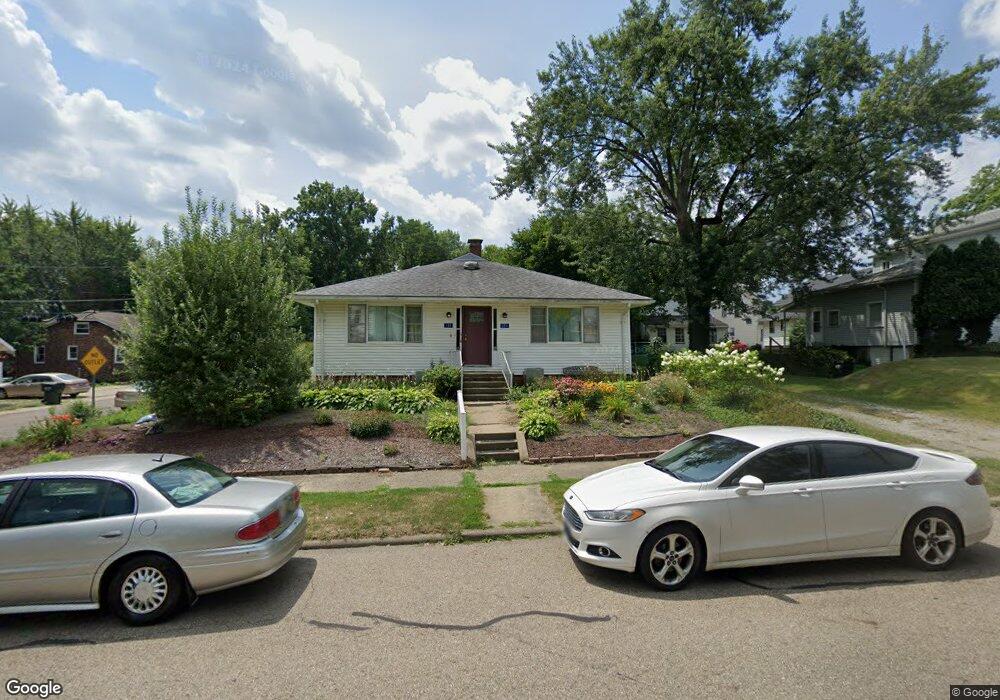
131 E Mill St Alliance, OH 44601
Estimated Value: $141,000 - $178,557
3
Beds
3
Baths
1,584
Sq Ft
$102/Sq Ft
Est. Value
About This Home
This home is located at 131 E Mill St, Alliance, OH 44601 and is currently estimated at $160,889, approximately $101 per square foot. 131 E Mill St is a home located in Stark County with nearby schools including Alliance Elementary School at Rockhill, Alliance Intermediate School at Northside, and Alliance Middle School.
Ownership History
Date
Name
Owned For
Owner Type
Purchase Details
Closed on
Sep 12, 2014
Sold by
Donohoe Samuel E and Donohoe Janis S
Bought by
Fontaine Pamela P
Current Estimated Value
Home Financials for this Owner
Home Financials are based on the most recent Mortgage that was taken out on this home.
Original Mortgage
$85,914
Outstanding Balance
$65,700
Interest Rate
4.11%
Mortgage Type
FHA
Estimated Equity
$95,189
Purchase Details
Closed on
Sep 28, 1999
Sold by
Knoll Eursel and Knoll Eursel G
Bought by
Donohoe Samuel E and Donohoe Janis S
Home Financials for this Owner
Home Financials are based on the most recent Mortgage that was taken out on this home.
Original Mortgage
$63,750
Interest Rate
7.93%
Mortgage Type
Purchase Money Mortgage
Create a Home Valuation Report for This Property
The Home Valuation Report is an in-depth analysis detailing your home's value as well as a comparison with similar homes in the area
Home Values in the Area
Average Home Value in this Area
Purchase History
| Date | Buyer | Sale Price | Title Company |
|---|---|---|---|
| Fontaine Pamela P | $87,500 | Heritage Union Title Co Ltd | |
| Donohoe Samuel E | $85,000 | Union Title Company |
Source: Public Records
Mortgage History
| Date | Status | Borrower | Loan Amount |
|---|---|---|---|
| Open | Fontaine Pamela P | $85,914 | |
| Previous Owner | Donohoe Samuel E | $63,750 |
Source: Public Records
Tax History
| Year | Tax Paid | Tax Assessment Tax Assessment Total Assessment is a certain percentage of the fair market value that is determined by local assessors to be the total taxable value of land and additions on the property. | Land | Improvement |
|---|---|---|---|---|
| 2025 | -- | $49,850 | $10,750 | $39,100 |
| 2024 | -- | $49,850 | $10,750 | $39,100 |
| 2023 | $1,791 | $44,000 | $8,400 | $35,600 |
| 2022 | $1,803 | $44,000 | $8,400 | $35,600 |
| 2021 | $1,807 | $44,000 | $8,400 | $35,600 |
| 2020 | $1,645 | $37,420 | $7,320 | $30,100 |
| 2019 | $1,622 | $37,420 | $7,320 | $30,100 |
Source: Public Records
Map
Nearby Homes
- 2041 Watson Ave
- 2372 S Union Ave
- 2405 Cherry Ave
- 2406 S Union Ave
- 2117 Miller Ave
- 2408 S Linden Ave
- 2351 S Freedom Ave
- 1805 S Linden Ave
- 390 E College St
- 2364 Shunk Ave
- 555 E Milton St
- 233 Shadyside Ct
- 224 Shadyside Ct
- 2705 Shunk Ave
- 853 Fairway Dr
- 1608 S Liberty Ave
- 834 Devine St
- 551 South St
- 549 Linwood Dr
- 167 11th St