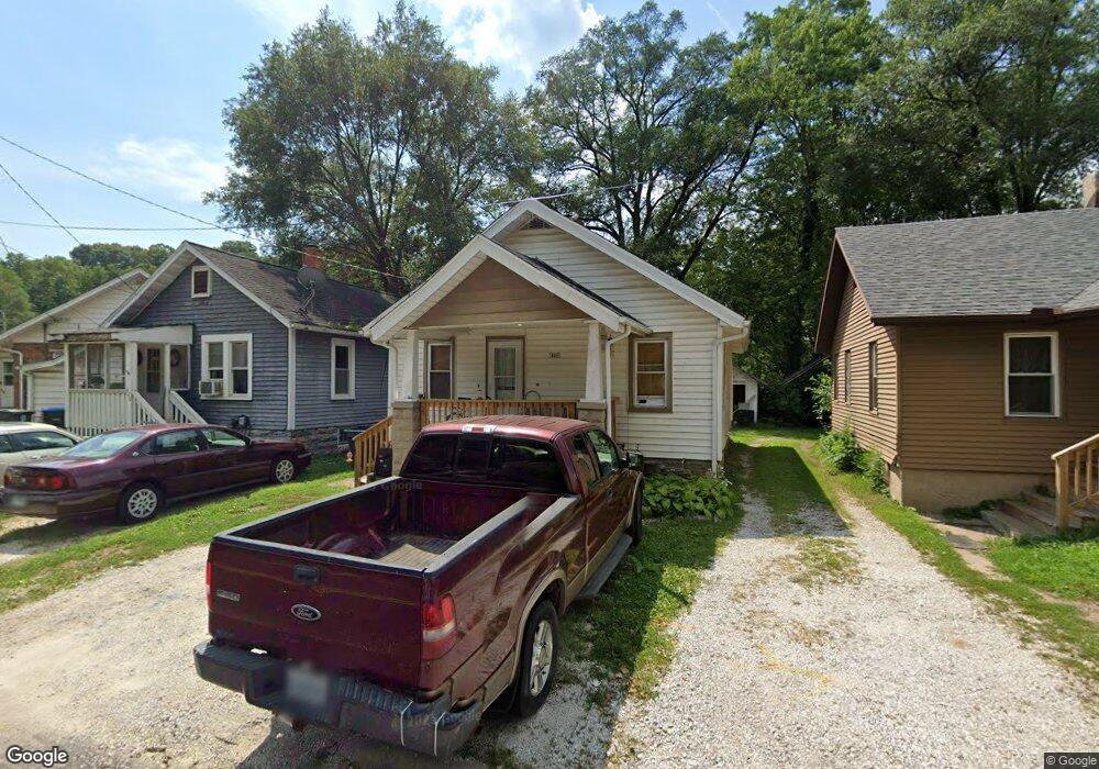
131 Elmwood St East Peoria, IL 61611
Estimated Value: $63,000 - $89,000
2
Beds
1
Bath
720
Sq Ft
$102/Sq Ft
Est. Value
About This Home
This home is located at 131 Elmwood St, East Peoria, IL 61611 and is currently estimated at $73,691, approximately $102 per square foot. 131 Elmwood St is a home located in Tazewell County with nearby schools including Woodrow Wilson Elementary School, Glendale Elementary School, and Central Junior High School.
Ownership History
Date
Name
Owned For
Owner Type
Purchase Details
Closed on
Mar 30, 2006
Sold by
Mitchell David R and Mitchell Sharon C
Bought by
Lowe Tammy
Current Estimated Value
Home Financials for this Owner
Home Financials are based on the most recent Mortgage that was taken out on this home.
Original Mortgage
$42,528
Outstanding Balance
$24,468
Interest Rate
6.38%
Mortgage Type
FHA
Estimated Equity
$49,223
Purchase Details
Closed on
Jul 5, 2005
Sold by
Tazewell County Clerk
Bought by
Mitchell David R and Mitchell Sharon C
Create a Home Valuation Report for This Property
The Home Valuation Report is an in-depth analysis detailing your home's value as well as a comparison with similar homes in the area
Home Values in the Area
Average Home Value in this Area
Purchase History
| Date | Buyer | Sale Price | Title Company |
|---|---|---|---|
| Lowe Tammy | $43,500 | None Available | |
| Mitchell David R | $33,500 | -- |
Source: Public Records
Mortgage History
| Date | Status | Borrower | Loan Amount |
|---|---|---|---|
| Open | Lowe Tammy | $42,528 |
Source: Public Records
Tax History Compared to Growth
Tax History
| Year | Tax Paid | Tax Assessment Tax Assessment Total Assessment is a certain percentage of the fair market value that is determined by local assessors to be the total taxable value of land and additions on the property. | Land | Improvement |
|---|---|---|---|---|
| 2024 | $1,076 | $18,590 | $1,860 | $16,730 |
| 2023 | $1,076 | $17,110 | $1,710 | $15,400 |
| 2022 | $986 | $15,900 | $1,590 | $14,310 |
| 2021 | $923 | $15,290 | $1,530 | $13,760 |
| 2020 | $860 | $14,850 | $1,490 | $13,360 |
| 2019 | $854 | $14,850 | $1,490 | $13,360 |
| 2018 | $831 | $14,850 | $1,490 | $13,360 |
| 2017 | $823 | $14,710 | $1,480 | $13,230 |
| 2016 | $800 | $14,710 | $1,480 | $13,230 |
| 2015 | $784 | $0 | $0 | $0 |
| 2013 | $789 | $14,710 | $1,480 | $13,230 |
Source: Public Records
Map
Nearby Homes
- 223 Kerfoot St
- 123 Terrace Ln
- 210 Stewart St
- 615 Meadow Ave
- 700 N Main St
- 1004 Springfield Rd
- 950 N Main St
- Lot 7 Sundance Ln
- 1513 Bloomington Rd
- 315 Pekin Ave
- 208 Montrose Ave
- 1406 Springfield Rd
- 0000 Highway 24
- 228 Crescent Ave
- 106 Field Grove Rd
- 1604 Springfield Rd
- 628 Lorentz St
- 404 Rainbow Dr
- 117 Greenlawn Ct
- 617 N Stewart St
- 127 Elmwood St
- 135 Elmwood St
- 137 Elmwood St
- 121 Elmwood St
- 103 Elmwood St
- 427 Bloomington Rd
- 100 Shadoway Dr
- 130 Elmwood St
- 423 Bloomington Rd
- 106 Shadoway Dr
- 415 Bloomington Rd
- 513 Bloomington Rd
- 126 Elmwood St
- 407 Veterans Dr
- 215 Elmwood St
- 106 Elmwood St
- 108 Shadoway Dr
- 519 Bloomington Rd
- 101 Shadoway Dr
- 114 Shadoway Dr