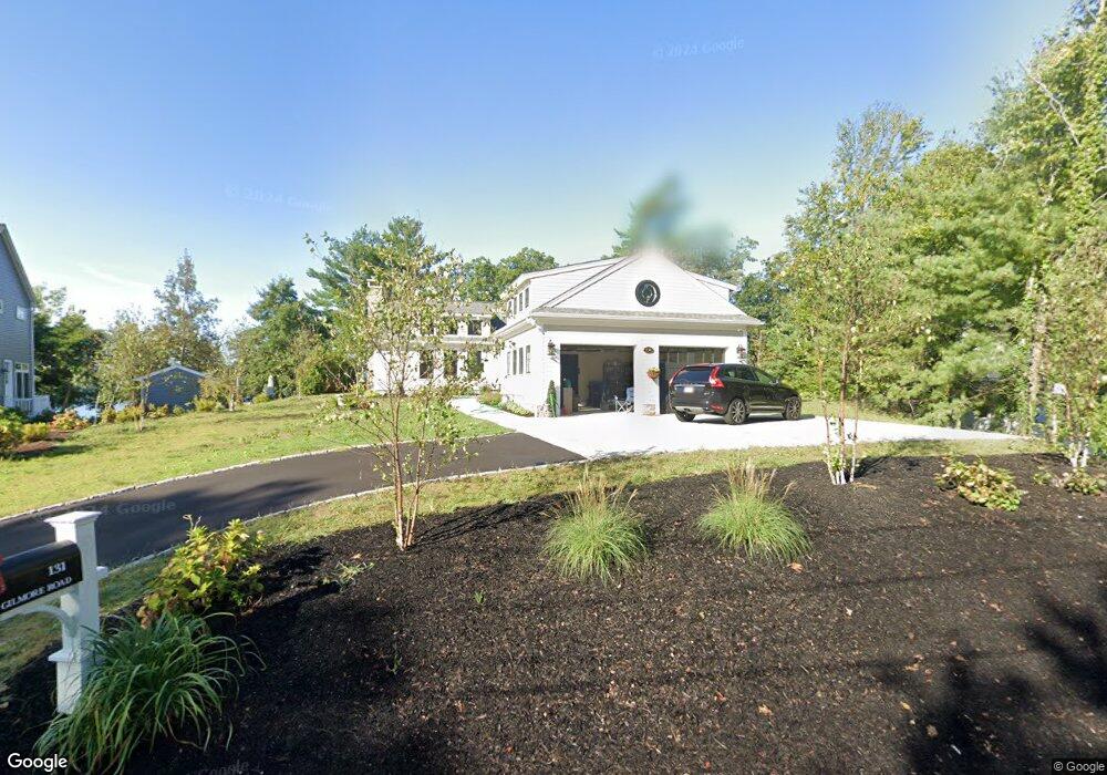
131 Gilmore Rd Wrentham, MA 02093
Estimated Value: $943,041 - $1,218,000
3
Beds
3
Baths
2,915
Sq Ft
$372/Sq Ft
Est. Value
About This Home
This home is located at 131 Gilmore Rd, Wrentham, MA 02093 and is currently estimated at $1,084,010, approximately $371 per square foot. 131 Gilmore Rd is a home located in Norfolk County with nearby schools including Delaney Elementary School and Charles E Roderick.
Ownership History
Date
Name
Owned For
Owner Type
Purchase Details
Closed on
Jul 31, 2014
Sold by
Wegert Karen J
Bought by
Frye David and Frye Janet H
Current Estimated Value
Home Financials for this Owner
Home Financials are based on the most recent Mortgage that was taken out on this home.
Original Mortgage
$417,000
Outstanding Balance
$318,791
Interest Rate
4.18%
Mortgage Type
New Conventional
Estimated Equity
$765,219
Purchase Details
Closed on
Aug 23, 2012
Sold by
Johnson Inga L Est
Bought by
Wegert Karen J
Create a Home Valuation Report for This Property
The Home Valuation Report is an in-depth analysis detailing your home's value as well as a comparison with similar homes in the area
Home Values in the Area
Average Home Value in this Area
Purchase History
| Date | Buyer | Sale Price | Title Company |
|---|---|---|---|
| Frye David | $535,000 | -- | |
| Wegert Karen J | $510,000 | -- |
Source: Public Records
Mortgage History
| Date | Status | Borrower | Loan Amount |
|---|---|---|---|
| Open | Frye David | $417,000 |
Source: Public Records
Tax History Compared to Growth
Tax History
| Year | Tax Paid | Tax Assessment Tax Assessment Total Assessment is a certain percentage of the fair market value that is determined by local assessors to be the total taxable value of land and additions on the property. | Land | Improvement |
|---|---|---|---|---|
| 2025 | $11,089 | $956,800 | $496,700 | $460,100 |
| 2024 | $10,894 | $907,800 | $496,700 | $411,100 |
| 2023 | $10,913 | $864,700 | $445,200 | $419,500 |
| 2022 | $9,736 | $712,200 | $366,200 | $346,000 |
| 2021 | $10,423 | $740,800 | $404,800 | $336,000 |
| 2020 | $10,541 | $739,700 | $411,900 | $327,800 |
| 2019 | $8,351 | $591,400 | $426,600 | $164,800 |
| 2018 | $7,695 | $540,400 | $426,900 | $113,500 |
| 2017 | $7,414 | $520,300 | $418,700 | $101,600 |
| 2016 | $7,230 | $506,300 | $406,600 | $99,700 |
| 2015 | $7,168 | $478,500 | $390,800 | $87,700 |
| 2014 | $7,049 | $460,400 | $375,900 | $84,500 |
Source: Public Records
Map
Nearby Homes
- 570 Franklin St
- 131 Creek St Unit 7
- Lot 3 - 14 Earle Stewart Ln
- 11 Earle Stewart Ln
- Lot 1 - Blueberry 2 Car Plan at King Philip Estates
- Lot 8 - Blueberry 2 Car Plan at King Philip Estates
- Lot 5 - Hughes 2 car Plan at King Philip Estates
- Lot 6 - Blueberry 3 Car Plan at King Philip Estates
- Lot 2 - Camden 2 Car Plan at King Philip Estates
- Lot 7 - Cedar Plan at King Philip Estates
- Lot 4 - Hemingway 2 Car Plan at King Philip Estates
- Lot 3 - Blueberry 2 Car Plan at King Philip Estates
- 50 Reed Fulton Ave Unit Lot 61
- 10 Nature View Dr
- 15 Nature View Dr
- 45 Joshua Rd
- 319 Taunton St
- 791 South St Unit 5
- 270 Dedham St
- 1 Lorraine Metcalf Dr
- 137 Gilmore Rd
- 127 Gilmore Rd
- 139 Gilmore Rd
- 139 Gilmore Rd Unit 1
- 140 Gilmore Rd
- 121 Gilmore Rd
- 130 Gilmore Rd
- 155 Gilmore Rd
- 113 Gilmore Rd
- 110 Gilmore Rd
- 105 Gilmore Rd
- 95 Metacomet St
- 103 Gilmore Rd
- 85 Metacomet St
- 95 Gilmore Rd
- 75 Metacomet St
- 161 Gilmore Rd
- 100 Gilmore Rd
- 89 Gilmore Rd
- 65 Metacomet St