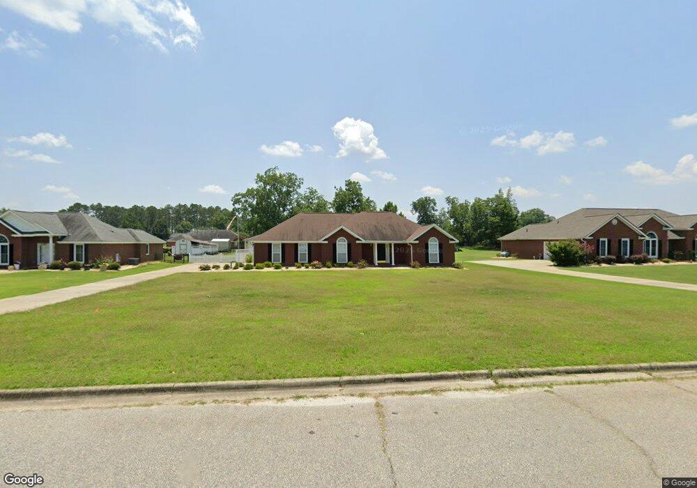
131 Hawkstead Dr Leesburg, GA 31763
Estimated Value: $276,000 - $286,218
3
Beds
2
Baths
1,841
Sq Ft
$154/Sq Ft
Est. Value
About This Home
This home is located at 131 Hawkstead Dr, Leesburg, GA 31763 and is currently estimated at $282,805, approximately $153 per square foot. 131 Hawkstead Dr is a home located in Lee County with nearby schools including Lee County Primary School, Lee County Elementary School, and Lee County Middle School - West Campus.
Ownership History
Date
Name
Owned For
Owner Type
Purchase Details
Closed on
Jan 24, 2025
Sold by
Brenner Dona
Bought by
Georgia State
Current Estimated Value
Purchase Details
Closed on
Jan 7, 2019
Sold by
East Adina Victoria
Bought by
Hardee Robert D
Purchase Details
Closed on
Jun 1, 2003
Sold by
Hardee Robert D
Bought by
Hardee Robert D
Purchase Details
Closed on
May 1, 2003
Sold by
Ray Lloyd Realty
Bought by
Hardee Robert D
Purchase Details
Closed on
Apr 1, 2002
Sold by
Holly Plantation Par
Bought by
Ray Lloyd Realty
Create a Home Valuation Report for This Property
The Home Valuation Report is an in-depth analysis detailing your home's value as well as a comparison with similar homes in the area
Home Values in the Area
Average Home Value in this Area
Purchase History
| Date | Buyer | Sale Price | Title Company |
|---|---|---|---|
| Georgia State | -- | -- | |
| Hardee Robert D | -- | -- | |
| Hardee Robert D | -- | -- | |
| Hardee Robert D | -- | -- | |
| Hardee Robert D | $150,000 | -- | |
| Ray Lloyd Realty | -- | -- |
Source: Public Records
Tax History Compared to Growth
Tax History
| Year | Tax Paid | Tax Assessment Tax Assessment Total Assessment is a certain percentage of the fair market value that is determined by local assessors to be the total taxable value of land and additions on the property. | Land | Improvement |
|---|---|---|---|---|
| 2024 | $2,522 | $83,480 | $8,000 | $75,480 |
| 2023 | $2,297 | $83,480 | $8,000 | $75,480 |
| 2022 | $2,297 | $83,480 | $8,000 | $75,480 |
| 2021 | $2,357 | $83,480 | $8,000 | $75,480 |
| 2020 | $1,932 | $60,320 | $8,480 | $51,840 |
| 2019 | $1,967 | $60,320 | $8,480 | $51,840 |
| 2018 | $1,968 | $60,320 | $8,480 | $51,840 |
| 2017 | $1,862 | $60,320 | $8,480 | $51,840 |
| 2016 | $1,862 | $60,320 | $8,480 | $51,840 |
| 2015 | $1,872 | $60,320 | $8,480 | $51,840 |
| 2014 | $2,223 | $71,000 | $10,000 | $61,000 |
| 2013 | -- | $71,000 | $10,000 | $61,000 |
Source: Public Records
Map
Nearby Homes
- 112 Beowulf Ln
- 107 Beowulf Ln
- 307 Ambleside Dr
- 695 Winifred Rd
- 260 Hawkstead Dr
- 324 Ambleside Dr
- 4922 van Cise Ln
- 252 Wiregrass Way
- 123 Larkspur Dr
- 122 Bay Ct
- 227 Longleaf Dr
- 4817 Coachlight Ct
- 2624 Crofton Dr
- 122 Live Oak Dr
- 2813 W Doublegate Dr
- 158 Live Oak Dr
- 3811 Burton Ct
- 2511 Fox Ridge Dr
- 3806 Burton Ct
- 3805 Burton Ct
- 135 Hawkstead Dr
- 127 Hawkstead Dr
- 163 Ambleside Dr
- 139 Hawkstead Dr
- 121 Hawkstead Dr
- 159 Ambleside Dr
- 167 Ambleside Dr
- 130 Hawkstead Dr
- 134 Hawkstead Dr
- 171 Ambleside Dr
- 155 Ambleside Dr
- 124 Hawkstead Dr
- 143 Hawkstead Dr
- 140 Hawkstead Dr
- 120 Hawkstead Dr
- 175 Ambleside Dr
- 115 Hawkstead Dr
- 178 Dadford Dr
- 147 Hawkstead Dr
- 147 Ambleside Dr