Estimated Value: $748,000 - $802,000
3
Beds
3
Baths
1,504
Sq Ft
$512/Sq Ft
Est. Value
About This Home
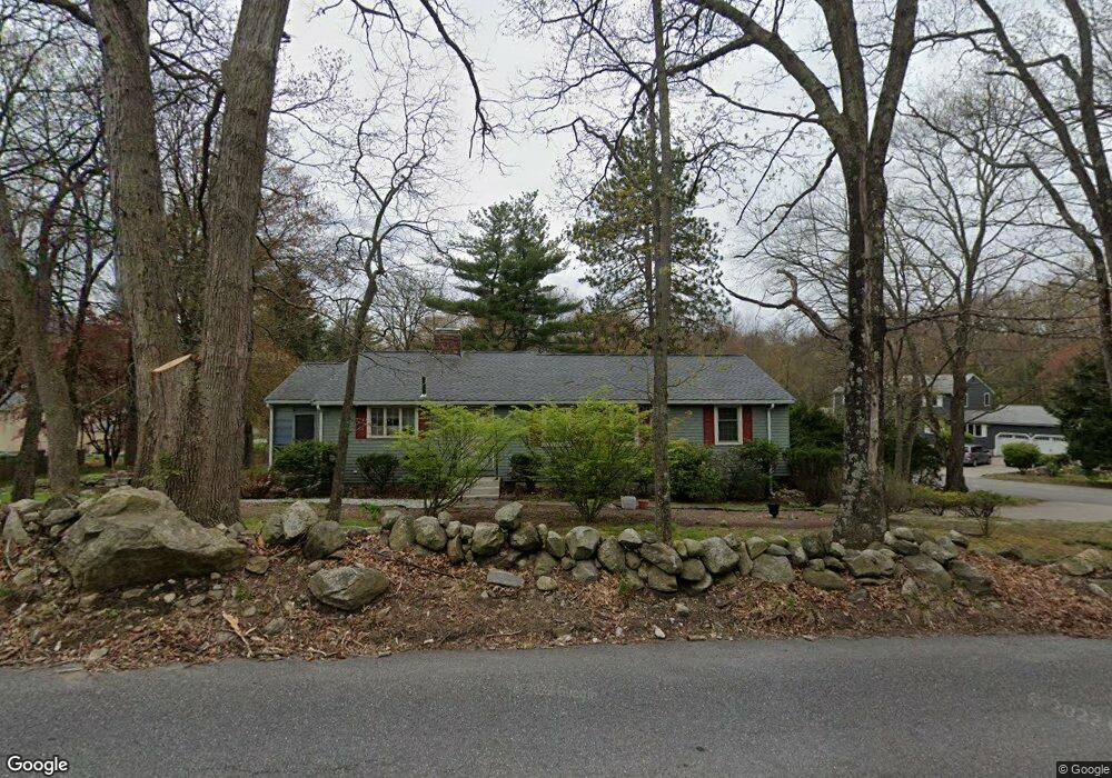
This home is located at 131 High St, Acton, MA 01720 and is currently estimated at $769,876, approximately $511 per square foot. 131 High St is a home located in Middlesex County with nearby schools including Acton-Boxborough Regional High School, Maynard Knowledge Beginnings, and The Imago School.
Ownership History
Date
Name
Owned For
Owner Type
Purchase Details
Closed on
May 14, 2020
Sold by
Sexton Suzanne M
Bought by
Sexton Ft
Current Estimated Value
Create a Home Valuation Report for This Property
The Home Valuation Report is an in-depth analysis detailing your home's value as well as a comparison with similar homes in the area
Home Values in the Area
Average Home Value in this Area
Purchase History
| Date | Buyer | Sale Price | Title Company |
|---|---|---|---|
| Sexton Ft | -- | None Available |
Source: Public Records
Tax History
| Year | Tax Paid | Tax Assessment Tax Assessment Total Assessment is a certain percentage of the fair market value that is determined by local assessors to be the total taxable value of land and additions on the property. | Land | Improvement |
|---|---|---|---|---|
| 2025 | $11,050 | $644,300 | $335,100 | $309,200 |
| 2024 | $10,487 | $629,100 | $335,100 | $294,000 |
| 2023 | $10,280 | $585,400 | $305,100 | $280,300 |
| 2022 | $9,964 | $512,300 | $265,500 | $246,800 |
| 2021 | $9,377 | $463,500 | $245,600 | $217,900 |
| 2020 | $9,050 | $470,400 | $245,600 | $224,800 |
| 2019 | $8,577 | $442,800 | $245,600 | $197,200 |
| 2018 | $8,165 | $421,300 | $245,600 | $175,700 |
| 2017 | $7,883 | $413,600 | $245,600 | $168,000 |
| 2016 | $7,688 | $399,800 | $245,600 | $154,200 |
| 2015 | $7,405 | $388,700 | $245,600 | $143,100 |
| 2014 | $7,272 | $373,900 | $245,600 | $128,300 |
Source: Public Records
Map
Nearby Homes
- 30 Brewster Ln
- 63 Conant St
- 40 High St
- 128 Parker St Unit 3B
- 132 Parker St Unit G5
- 3 Drummer Rd Unit B3
- 70 River St
- 31 Drummer Rd Unit 31
- 2 Marble Farm Rd
- 129 Main St Unit 129
- 131 Main St
- 19 Railroad St Unit D2
- 19 Railroad St Unit C2
- 25 Nylander Way
- 12 Brown St
- 70 Powder Mill Rd
- 68 Powder Mill Rd
- 2 & 6 Powder Mill Rd
- 66 Powder Mill Rd
- 17 Prospect St
Your Personal Tour Guide
Ask me questions while you tour the home.