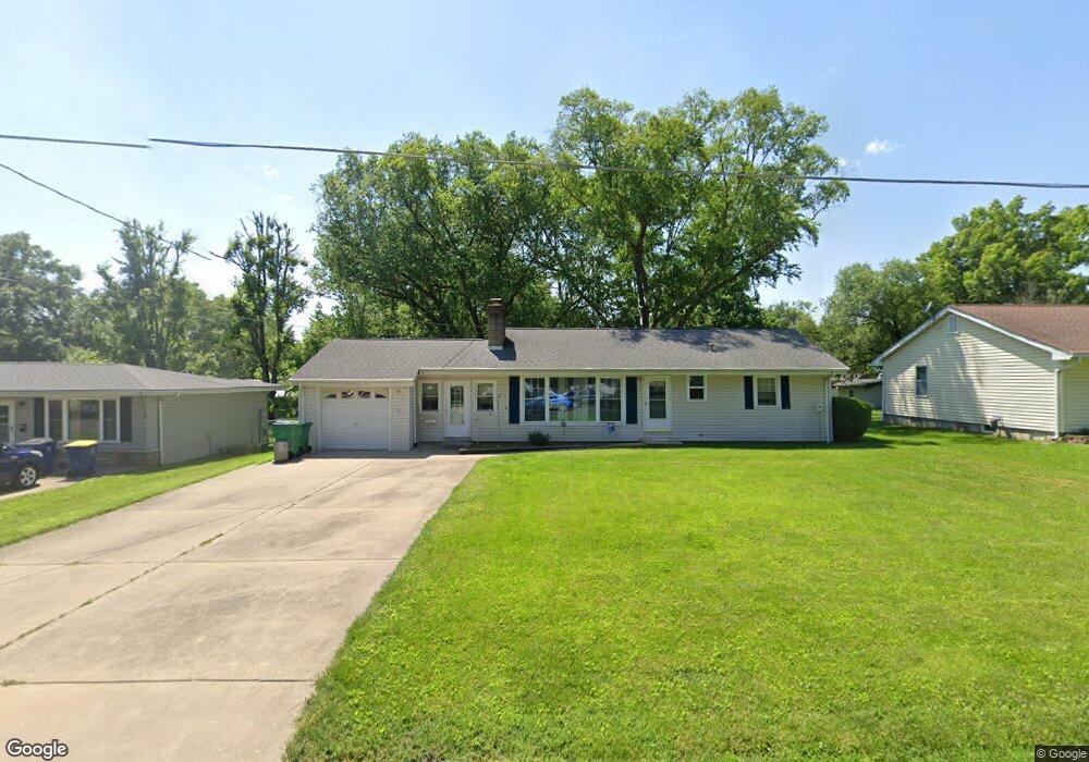
131 Hogan Ave Pacific, MO 63069
Estimated Value: $185,990 - $196,000
2
Beds
1
Bath
1,096
Sq Ft
$173/Sq Ft
Est. Value
About This Home
This home is located at 131 Hogan Ave, Pacific, MO 63069 and is currently estimated at $189,663, approximately $173 per square foot. 131 Hogan Ave is a home located in Franklin County with nearby schools including Pacific High School and St Bridget Elementary School.
Ownership History
Date
Name
Owned For
Owner Type
Purchase Details
Closed on
Apr 6, 2015
Sold by
Hildebrand Jean C
Bought by
Hildebrand Trust
Current Estimated Value
Purchase Details
Closed on
Nov 16, 2007
Sold by
Hildebrand Jean C and Hildebrand Marty L
Bought by
Hildebrand Jean C
Home Financials for this Owner
Home Financials are based on the most recent Mortgage that was taken out on this home.
Original Mortgage
$89,000
Interest Rate
6.42%
Mortgage Type
New Conventional
Create a Home Valuation Report for This Property
The Home Valuation Report is an in-depth analysis detailing your home's value as well as a comparison with similar homes in the area
Home Values in the Area
Average Home Value in this Area
Purchase History
| Date | Buyer | Sale Price | Title Company |
|---|---|---|---|
| Hildebrand Trust | -- | -- | |
| Hildebrand Jean C | -- | None Available |
Source: Public Records
Mortgage History
| Date | Status | Borrower | Loan Amount |
|---|---|---|---|
| Previous Owner | Hildebrand Jean C | $89,000 |
Source: Public Records
Tax History
| Year | Tax Paid | Tax Assessment Tax Assessment Total Assessment is a certain percentage of the fair market value that is determined by local assessors to be the total taxable value of land and additions on the property. | Land | Improvement |
|---|---|---|---|---|
| 2025 | $1,993 | $27,398 | $0 | $0 |
| 2024 | $1,993 | $25,853 | $0 | $0 |
| 2023 | $1,952 | $25,853 | $0 | $0 |
| 2022 | $1,564 | $22,543 | $0 | $0 |
| 2021 | $1,557 | $22,543 | $0 | $0 |
| 2020 | $1,413 | $20,438 | $0 | $0 |
| 2019 | $1,411 | $20,438 | $0 | $0 |
| 2018 | $1,404 | $19,925 | $0 | $0 |
| 2017 | $1,394 | $19,925 | $0 | $0 |
| 2016 | $1,383 | $19,568 | $0 | $0 |
| 2015 | $1,345 | $19,568 | $0 | $0 |
| 2014 | $1,336 | $19,775 | $0 | $0 |
Source: Public Records
Map
Nearby Homes
- 127 Phelan St
- 1709 W Hawthorne Dr
- 121 Western Ave
- 806 W Congress St
- 801 W Union St
- 0 Highland St
- 508 Pacific Estates Dr
- 1505 Cypress Dr
- 1501 Cypress Dr
- 621 W Osage St
- 505 N Monroe St Unit 8
- 707 S Hawthorne Dr
- 0 N 6th St Unit MAR24075265
- 1837 Oak St
- 1796 Meade Ct
- 222 W Saint Louis St
- 502 S 3rd St
- 1808 Westlake Ct
- 42 Cedar Ledge
- 0 E Park St Unit MIS25062036
Your Personal Tour Guide
Ask me questions while you tour the home.