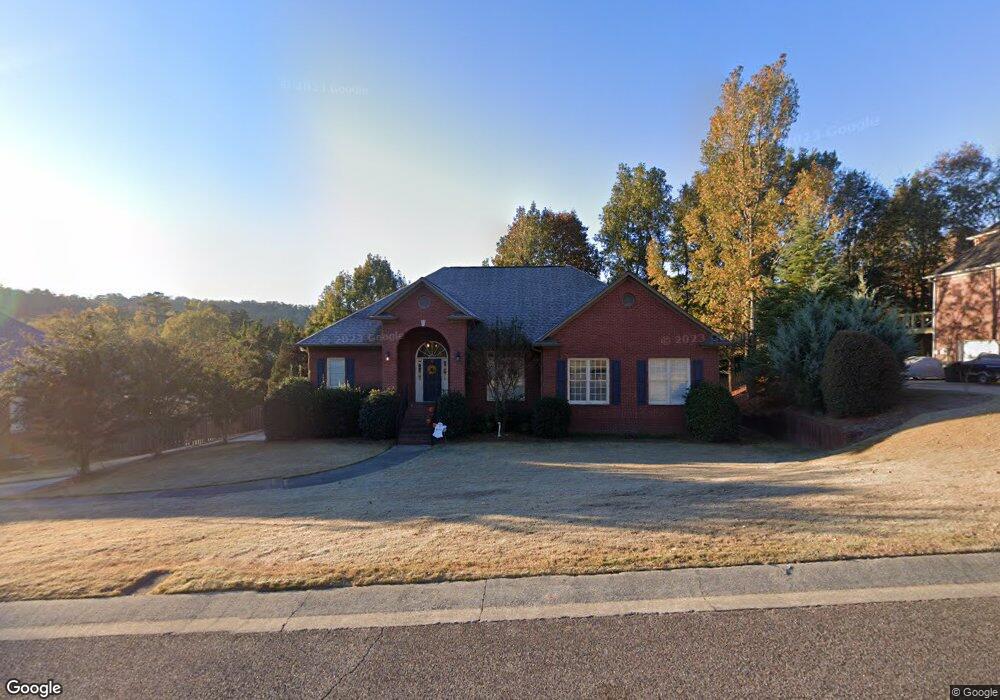
131 Katy Cir Birmingham, AL 35242
Estimated Value: $480,000 - $567,764
--
Bed
2
Baths
3,087
Sq Ft
$172/Sq Ft
Est. Value
About This Home
This home is located at 131 Katy Cir, Birmingham, AL 35242 and is currently estimated at $532,191, approximately $172 per square foot. 131 Katy Cir is a home located in Shelby County with nearby schools including Oak Mountain Elementary School, Oak Mountain Intermediate School, and Oak Mt. Middle School.
Ownership History
Date
Name
Owned For
Owner Type
Purchase Details
Closed on
Nov 8, 2019
Sold by
Collins Michael H and Collins Kristin
Bought by
Hall Christopher Matthew and Gilbert Hall Amy Lauren
Current Estimated Value
Home Financials for this Owner
Home Financials are based on the most recent Mortgage that was taken out on this home.
Original Mortgage
$296,000
Outstanding Balance
$260,404
Interest Rate
3.6%
Mortgage Type
New Conventional
Estimated Equity
$271,787
Purchase Details
Closed on
Sep 27, 2007
Sold by
Hemphill Sherwin J and Hemphill Dianne L
Bought by
Collins Michael H
Home Financials for this Owner
Home Financials are based on the most recent Mortgage that was taken out on this home.
Original Mortgage
$276,720
Interest Rate
6.57%
Mortgage Type
Purchase Money Mortgage
Purchase Details
Closed on
Jun 30, 2005
Sold by
Tobias Kenneth I and Tobias Angela F
Bought by
Hemphill Sherwin J and Hemphill Dianne L
Home Financials for this Owner
Home Financials are based on the most recent Mortgage that was taken out on this home.
Original Mortgage
$294,000
Interest Rate
4.75%
Mortgage Type
Fannie Mae Freddie Mac
Purchase Details
Closed on
Mar 8, 2002
Sold by
Harbar Construction Company Inc
Bought by
Tobias Kenneth I and Tobias Angela F
Home Financials for this Owner
Home Financials are based on the most recent Mortgage that was taken out on this home.
Original Mortgage
$236,968
Interest Rate
6.98%
Create a Home Valuation Report for This Property
The Home Valuation Report is an in-depth analysis detailing your home's value as well as a comparison with similar homes in the area
Home Values in the Area
Average Home Value in this Area
Purchase History
| Date | Buyer | Sale Price | Title Company |
|---|---|---|---|
| Hall Christopher Matthew | $370,000 | None Available | |
| Collins Michael H | $345,900 | None Available | |
| Hemphill Sherwin J | $327,500 | -- | |
| Tobias Kenneth I | $296,210 | -- |
Source: Public Records
Mortgage History
| Date | Status | Borrower | Loan Amount |
|---|---|---|---|
| Open | Hall Christopher Matthew | $296,000 | |
| Previous Owner | Collins Michael H | $276,720 | |
| Previous Owner | Hemphill Sherwin J | $294,000 | |
| Previous Owner | Tobias Kenneth I | $236,968 | |
| Closed | Tobias Kenneth I | $44,431 |
Source: Public Records
Tax History Compared to Growth
Tax History
| Year | Tax Paid | Tax Assessment Tax Assessment Total Assessment is a certain percentage of the fair market value that is determined by local assessors to be the total taxable value of land and additions on the property. | Land | Improvement |
|---|---|---|---|---|
| 2024 | $2,105 | $47,840 | $0 | $0 |
| 2023 | $1,970 | $45,700 | $0 | $0 |
| 2022 | $1,790 | $41,620 | $0 | $0 |
| 2021 | $1,748 | $40,660 | $0 | $0 |
| 2020 | $1,515 | $35,360 | $0 | $0 |
| 2019 | $1,544 | $36,020 | $0 | $0 |
| 2017 | $1,482 | $34,620 | $0 | $0 |
| 2015 | $1,414 | $33,060 | $0 | $0 |
| 2014 | $1,379 | $32,280 | $0 | $0 |
Source: Public Records
Map
Nearby Homes
- 100 Emily Cir
- 2309 Woodland Cir
- 2336 Woodland Cir
- 5081 Pinehurst Terrace
- 5082 Shelby Dr
- 5032 Stone Bridge Ln
- 8032 Eagle Crest Ln
- 8028 Eagle Crest Ln Unit 7
- 8000 Eagle Crest Ln
- 5035 Stratford Rd
- 5349 Harvest Ridge Ln
- 5010 Mark Trail
- 1 Buckhorn Valley Dr
- 2000 Eagle Crest Ct
- 826 Griffin Park Cir
- 3371 N Broken Bow Dr
- 164 Bridge Dr
- 5195 Redfern Way
- 708 Meadow Ridge Ct
- 4908 Sussex Rd
