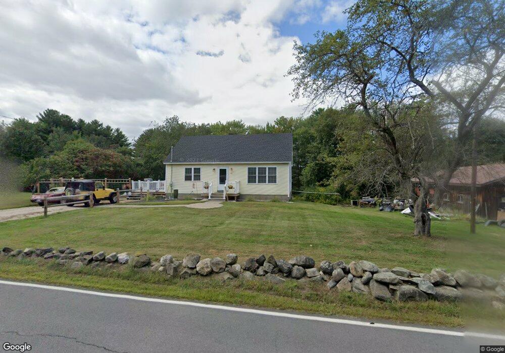
131 Moses Gerrish Farmer Rd Eliot, ME 03903
South Eliot NeighborhoodEstimated Value: $489,080 - $589,000
4
Beds
2
Baths
1,296
Sq Ft
$407/Sq Ft
Est. Value
About This Home
This home is located at 131 Moses Gerrish Farmer Rd, Eliot, ME 03903 and is currently estimated at $527,520, approximately $407 per square foot. 131 Moses Gerrish Farmer Rd is a home located in York County with nearby schools including Marshwood High School and Seacoast Waldorf School.
Ownership History
Date
Name
Owned For
Owner Type
Purchase Details
Closed on
Dec 14, 2017
Sold by
Obrey Richard S
Bought by
Adair Marcia M and Adair Gano L
Current Estimated Value
Home Financials for this Owner
Home Financials are based on the most recent Mortgage that was taken out on this home.
Original Mortgage
$183,658
Outstanding Balance
$156,085
Interest Rate
3.94%
Mortgage Type
FHA
Estimated Equity
$371,435
Purchase Details
Closed on
Apr 22, 2014
Sold by
Obrey Mildred B Est and Obrey Richard S
Bought by
Gilman David S and Gilman Corrine P
Create a Home Valuation Report for This Property
The Home Valuation Report is an in-depth analysis detailing your home's value as well as a comparison with similar homes in the area
Home Values in the Area
Average Home Value in this Area
Purchase History
| Date | Buyer | Sale Price | Title Company |
|---|---|---|---|
| Adair Marcia M | -- | -- | |
| Gilman David S | -- | -- |
Source: Public Records
Mortgage History
| Date | Status | Borrower | Loan Amount |
|---|---|---|---|
| Open | Adair Marcia M | $183,658 |
Source: Public Records
Tax History
| Year | Tax Paid | Tax Assessment Tax Assessment Total Assessment is a certain percentage of the fair market value that is determined by local assessors to be the total taxable value of land and additions on the property. | Land | Improvement |
|---|---|---|---|---|
| 2024 | $3,708 | $312,900 | $135,400 | $177,500 |
| 2023 | $3,387 | $276,500 | $129,200 | $147,300 |
| 2022 | $3,269 | $270,200 | $129,200 | $141,000 |
| 2021 | $3,426 | $253,800 | $118,900 | $134,900 |
| 2020 | $3,524 | $239,700 | $113,700 | $126,000 |
| 2019 | $3,524 | $239,700 | $113,700 | $126,000 |
| 2018 | $3,524 | $239,700 | $113,700 | $126,000 |
| 2017 | $3,428 | $239,700 | $113,700 | $126,000 |
| 2016 | $3,368 | $239,700 | $113,700 | $126,000 |
| 2015 | $3,311 | $236,500 | $113,700 | $122,800 |
| 2014 | $3,264 | $236,500 | $113,700 | $122,800 |
| 2013 | $3,003 | $228,000 | $113,700 | $114,300 |
Source: Public Records
Map
Nearby Homes
- 0 Franks Fort Island Unit 1650383
- 1128 State Rd
- 18 Shipping Ln
- 8 Caslyn Dr
- 62 Village Dr Unit 62
- 22 Summer Ln
- 10 Shipwright Way
- 18 Governor Hill Rd
- 71 Shipwright Way
- 1708 State Rd
- 18 Little Bay Dr
- 5 Spinney Way Unit 9
- 19 Aspen Cir
- 0 Cote Dr Unit 55B
- 96 Spinnaker Way
- 45 Shearwater Dr
- 348 Dover Point Rd
- 354 Dover Point Rd
- 37 Shearwater Dr Unit 1906
- 1360 Woodbury Ave
- 127 Moses Gerrish Farmer Rd
- 138 Moses Gerrish Farmer Rd
- 7 Farmer Rd
- 140 Moses Gerrish Farmer Rd
- 27 Farmer Rd
- 26 Farmer Rd
- 144 Moses Gerrish Farmer Rd
- 24 Farmer Rd
- 117 Moses Gerrish Farmer Rd
- 147 Moses Gerrish Farmer Rd
- 113 Moses Gerrish Farmer Rd
- 111 Moses Gerrish Farmer Rd
- 149 Moses Gerrish Farmer Rd
- 153 Moses Gerrish Farmer Rd
- 8 Mast Cove Rd
- 156 Moses Gerrish Farmer Rd
- 103 Moses Gerrish Farmer Rd
- 161 Moses Gerrish Farmer Rd
- 0 Mast Cove
- 12 Mast Cove Rd
Your Personal Tour Guide
Ask me questions while you tour the home.