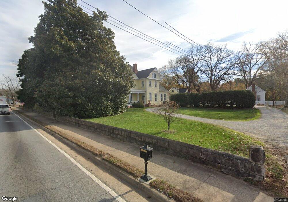
131 N Broad St Winder, GA 30680
Estimated Value: $486,000 - $730,000
4
Beds
4
Baths
4,576
Sq Ft
$134/Sq Ft
Est. Value
About This Home
This home is located at 131 N Broad St, Winder, GA 30680 and is currently estimated at $611,972, approximately $133 per square foot. 131 N Broad St is a home located in Barrow County with nearby schools including County Line Elementary School, Russell Middle School, and Winder-Barrow High School.
Ownership History
Date
Name
Owned For
Owner Type
Purchase Details
Closed on
Dec 23, 2015
Sold by
Russell Dee Baxter
Bought by
Alvarez Rolando and Alvarez Erin
Current Estimated Value
Home Financials for this Owner
Home Financials are based on the most recent Mortgage that was taken out on this home.
Original Mortgage
$213,009
Outstanding Balance
$135,181
Interest Rate
3.97%
Mortgage Type
New Conventional
Estimated Equity
$476,791
Purchase Details
Closed on
Nov 15, 2012
Sold by
Russell Richard B
Bought by
Russell Dee Baxter
Create a Home Valuation Report for This Property
The Home Valuation Report is an in-depth analysis detailing your home's value as well as a comparison with similar homes in the area
Home Values in the Area
Average Home Value in this Area
Purchase History
| Date | Buyer | Sale Price | Title Company |
|---|---|---|---|
| Alvarez Rolando | $224,220 | -- | |
| Russell Dee Baxter | -- | -- |
Source: Public Records
Mortgage History
| Date | Status | Borrower | Loan Amount |
|---|---|---|---|
| Open | Alvarez Rolando | $213,009 |
Source: Public Records
Tax History Compared to Growth
Tax History
| Year | Tax Paid | Tax Assessment Tax Assessment Total Assessment is a certain percentage of the fair market value that is determined by local assessors to be the total taxable value of land and additions on the property. | Land | Improvement |
|---|---|---|---|---|
| 2024 | $5,930 | $214,710 | $43,680 | $171,030 |
| 2023 | $4,554 | $214,710 | $43,680 | $171,030 |
| 2022 | $5,321 | $162,685 | $43,680 | $119,005 |
| 2021 | $5,343 | $155,594 | $43,680 | $111,914 |
| 2020 | $4,445 | $127,884 | $43,680 | $84,204 |
| 2019 | $4,071 | $114,793 | $43,680 | $71,113 |
| 2018 | $4,058 | $114,793 | $43,680 | $71,113 |
| 2017 | $3,099 | $103,862 | $43,680 | $60,182 |
| 2016 | $2,861 | $101,076 | $43,680 | $57,396 |
| 2015 | $3,241 | $101,076 | $43,680 | $57,396 |
| 2014 | $2,492 | $78,915 | $21,403 | $57,512 |
| 2013 | -- | $74,457 | $21,403 | $53,054 |
Source: Public Records
Map
Nearby Homes
- 116 N Broad St
- 15 E New St
- 18 E New St
- 0 Jerome St Unit 7439149
- 0 Jerome St Unit 10359679
- 19 Holland Cove
- 25 Holland Cove
- 17 W Wright St
- 92 Woodlawn Ave
- 209 Georgia Ave
- 102 N Center St
- 122 Capitol Ave
- 0 Georgia Highway 211 Unit 7483562
- 253 3rd Ave
- 0 W Athens St Unit 10544465
- 311 2nd Ave
- 0 W Williams St Unit 10464682
- 165 Shields St
- 120 N Williamson St
- 131 Pinehurst Dr
- 133 N Broad St
- 5 W Kimball St
- 137 N Broad St
- 3 W Kimball St
- 136 N Broad St
- 1 W Kimball St
- 168 Park Ave
- 9 W Kimball St
- 9 W Kimball St
- W W Kimball St
- 11 W Kimball St
- 11 E New St
- 150 Park Ave
- 141 Walker St
- 141 Walker St
- 141 Walker St Unit B
- 141 Walker St Unit A
- 118 N Broad St
- 121 N Broad St
- 145 Walker St