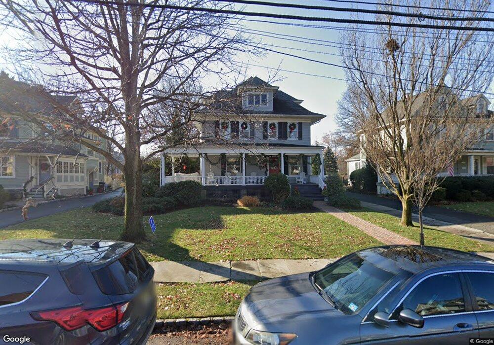
131 N Euclid Ave Westfield, NJ 07090
Estimated Value: $1,497,000 - $1,680,000
--
Bed
--
Bath
3,376
Sq Ft
$468/Sq Ft
Est. Value
About This Home
This home is located at 131 N Euclid Ave, Westfield, NJ 07090 and is currently estimated at $1,580,214, approximately $468 per square foot. 131 N Euclid Ave is a home located in Union County with nearby schools including Wilson Elementary School, Roosevelt Intermediate School, and Westfield Senior High School.
Ownership History
Date
Name
Owned For
Owner Type
Purchase Details
Closed on
Feb 11, 2025
Sold by
Mccarthy-Gelinne Deirdre
Bought by
Gelinne Family Trust and Gelinne
Current Estimated Value
Purchase Details
Closed on
Aug 9, 2005
Sold by
Gelinne Deirdre Mc Carthy
Bought by
Gelinne Deirdre Mc Carthy
Create a Home Valuation Report for This Property
The Home Valuation Report is an in-depth analysis detailing your home's value as well as a comparison with similar homes in the area
Home Values in the Area
Average Home Value in this Area
Purchase History
| Date | Buyer | Sale Price | Title Company |
|---|---|---|---|
| Gelinne Family Trust | -- | None Listed On Document | |
| Gelinne Family Trust | -- | None Listed On Document | |
| Gelinne Deirdre Mc Carthy | -- | -- |
Source: Public Records
Tax History Compared to Growth
Tax History
| Year | Tax Paid | Tax Assessment Tax Assessment Total Assessment is a certain percentage of the fair market value that is determined by local assessors to be the total taxable value of land and additions on the property. | Land | Improvement |
|---|---|---|---|---|
| 2025 | $22,288 | $989,700 | $596,400 | $393,300 |
| 2024 | $21,833 | $989,700 | $596,400 | $393,300 |
| 2023 | $21,833 | $989,700 | $596,400 | $393,300 |
| 2022 | $21,368 | $989,700 | $596,400 | $393,300 |
| 2021 | $21,061 | $973,700 | $596,400 | $377,300 |
| 2020 | $21,012 | $973,700 | $596,400 | $377,300 |
| 2019 | $20,935 | $973,700 | $596,400 | $377,300 |
| 2018 | $22,192 | $238,700 | $84,900 | $153,800 |
| 2017 | $22,070 | $238,700 | $84,900 | $153,800 |
| 2016 | $21,552 | $238,700 | $84,900 | $153,800 |
| 2015 | $21,123 | $238,700 | $84,900 | $153,800 |
| 2014 | $20,426 | $238,700 | $84,900 | $153,800 |
Source: Public Records
Map
Nearby Homes
- 415 Highland Ave
- 304 E Dudley Ave
- 645 Kimball Ave
- 260 Prospect St Unit C15
- 629 Tremont Ave
- 112 Linden Ave
- 303 Prospect St
- 508 N Chestnut St
- 203 Ross Place
- 559 Lawrence Ave
- 215 Ross Place Unit J
- 766 Oak Ave
- 522 Boulevard
- 131 Wells St
- 538 Westfield Ave
- 820 E Broad St
- 603 Carleton Rd
- 529 Benson Place
- 517 Clark St
- 740 Lawrence Ave
- 135 N Euclid Ave
- 127 N Euclid Ave
- 139 N Euclid Ave
- 121 N Euclid Ave
- 145 N Euclid Ave
- 132 N Euclid Ave
- 126 N Euclid Ave
- 117 N Euclid Ave
- 136 N Euclid Ave
- 118 N Euclid Ave
- 140 N Euclid Ave
- 151 N Euclid Ave
- 144 N Euclid Ave
- 155 N Euclid Ave
- 435 E Broad St
- 435 E Broad St Unit 1
- 150 N Euclid Ave
- 445 E Broad St
- 123 Harrison Ave
- 127 Harrison Ave