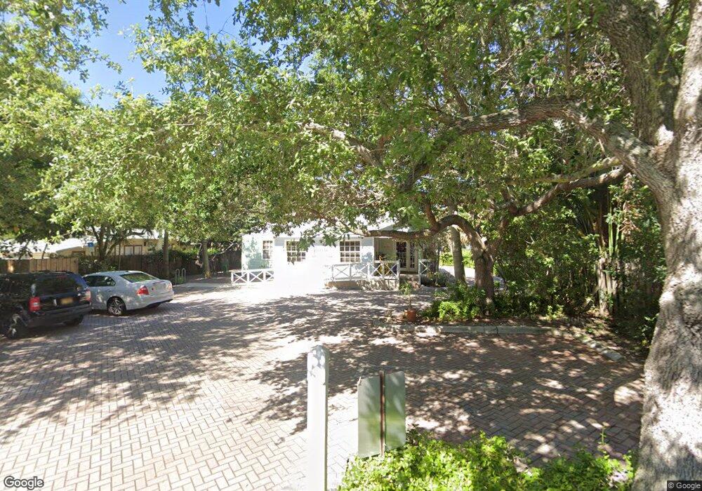
131 N Swinton Ave Delray Beach, FL 33444
Downtown Delray Beach NeighborhoodEstimated Value: $1,028,492
--
Bed
1
Bath
1,464
Sq Ft
$703/Sq Ft
Est. Value
About This Home
This home is located at 131 N Swinton Ave, Delray Beach, FL 33444 and is currently estimated at $1,028,492, approximately $702 per square foot. 131 N Swinton Ave is a home located in Palm Beach County with nearby schools including Plumosa School of the Arts, Carver Community Middle School, and Atlantic High School.
Ownership History
Date
Name
Owned For
Owner Type
Purchase Details
Closed on
Jun 20, 2025
Sold by
Long Lots Llc
Bought by
Bapeck Kb Llc
Current Estimated Value
Purchase Details
Closed on
Jul 30, 2014
Sold by
Kemish James W and Kemish Steven W
Bought by
Long Lots Llc
Purchase Details
Closed on
Mar 20, 2002
Sold by
Naquin Margaret
Bought by
Kemish James W and Kemish Steven W
Home Financials for this Owner
Home Financials are based on the most recent Mortgage that was taken out on this home.
Original Mortgage
$240,000
Interest Rate
6.86%
Mortgage Type
Commercial
Create a Home Valuation Report for This Property
The Home Valuation Report is an in-depth analysis detailing your home's value as well as a comparison with similar homes in the area
Home Values in the Area
Average Home Value in this Area
Purchase History
| Date | Buyer | Sale Price | Title Company |
|---|---|---|---|
| Bapeck Kb Llc | $1,775,000 | None Listed On Document | |
| Bapeck Kb Llc | $1,775,000 | None Listed On Document | |
| Long Lots Llc | -- | None Available | |
| Kemish James W | $300,000 | -- |
Source: Public Records
Mortgage History
| Date | Status | Borrower | Loan Amount |
|---|---|---|---|
| Previous Owner | Kemish James W | $240,000 |
Source: Public Records
Tax History Compared to Growth
Tax History
| Year | Tax Paid | Tax Assessment Tax Assessment Total Assessment is a certain percentage of the fair market value that is determined by local assessors to be the total taxable value of land and additions on the property. | Land | Improvement |
|---|---|---|---|---|
| 2024 | $24,310 | $1,199,911 | -- | -- |
| 2023 | $22,468 | $1,090,828 | -- | -- |
| 2022 | $21,464 | $991,662 | -- | -- |
| 2021 | $18,517 | $901,511 | $677,755 | $223,756 |
| 2020 | $17,755 | $904,928 | $677,755 | $227,173 |
| 2019 | $16,662 | $865,630 | $645,481 | $220,149 |
| 2018 | $15,141 | $836,400 | $626,638 | $209,762 |
| 2017 | $14,367 | $803,576 | $596,773 | $206,803 |
| 2016 | $13,344 | $567,509 | $0 | $0 |
| 2015 | $11,612 | $515,917 | $0 | $0 |
| 2014 | $6,771 | $290,000 | $0 | $0 |
Source: Public Records
Map
Nearby Homes
- 200 NE 2nd Ave Unit 211
- 200 NE 2nd Ave Unit 205
- 200 NE 2nd Ave Unit 207
- 200 NE 2nd Ave Unit 411
- 200 NE 2nd Ave Unit 309
- 200 NE 2nd Ave Unit 401
- 200 NE 2nd Ave Unit 315
- 225 NE 1st St Unit 214w
- 112 S Cannery Row Cir
- 308 W Cannery Row Cir
- 311 N Swinton Ave
- 306 NE 2nd St Unit 206
- 306 NE 2nd St Unit s (110, 11
- 306 NE 2nd St Unit 208-209 & 309-3
- 306 NE 2nd St Unit 207 & 308
- 306 NE 2nd St Unit 109
- 306 NE 2nd St Unit 113
- 306 NE 2nd St Unit 205
- 111 SE 1st Ave Unit 316
- 111 SE 1st Ave Unit 404
- 137 N Swinton Ave
- 119 N Swinton Ave
- 145 N Swinton Ave
- 21 NW 2nd St
- 136 NE 1st Ave Unit B
- 136 NE 1st Ave
- 138 NE 1st Ave
- 120 NE 1st Ave Unit All
- 120 NE 1st Ave Unit 5
- 120 NE 1st Ave
- 120 NE 1st Ave Unit 6
- 120 NE 1st Ave Unit 4
- 120 NE 1st Ave Unit 1
- 120 NE 1st Ave Unit 3
- 124 N Swinton Ave Unit B
- 124 N Swinton Ave Unit A
- 124 N Swinton Ave
- 10 NE 2nd St
- 10 NE 2nd St Unit 2
- 5 NE 2nd St