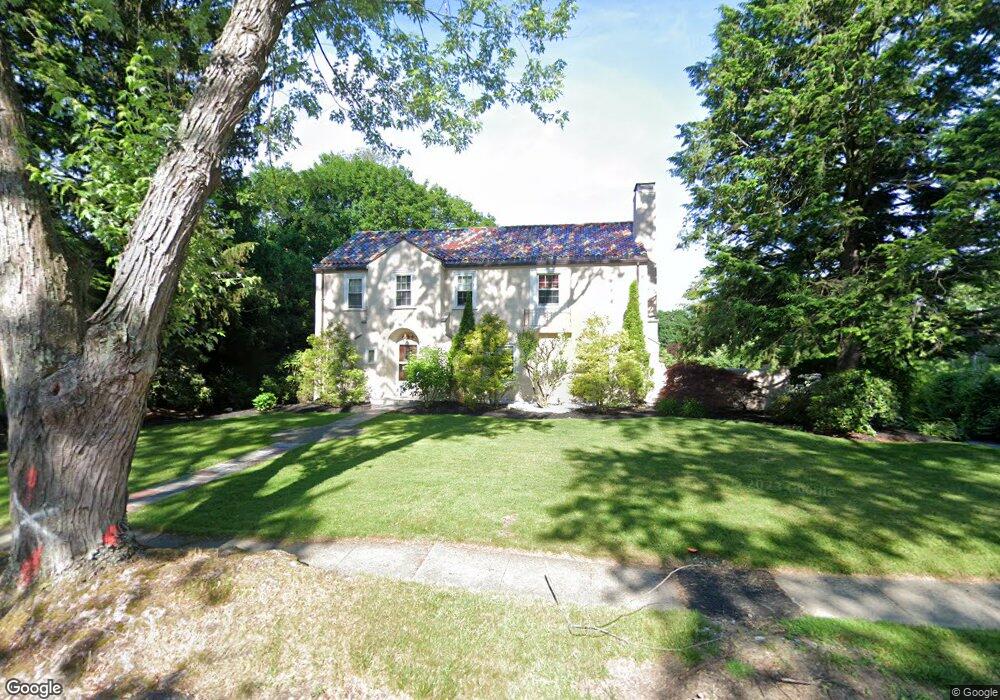
131 Newton Ave N Worcester, MA 01609
Salisbury Street NeighborhoodEstimated Value: $598,601 - $821,000
4
Beds
3
Baths
2,332
Sq Ft
$292/Sq Ft
Est. Value
About This Home
This home is located at 131 Newton Ave N, Worcester, MA 01609 and is currently estimated at $681,400, approximately $292 per square foot. 131 Newton Ave N is a home located in Worcester County with nearby schools including Chandler Magnet, Jacob Hiatt Magnet School, and Flagg Street School.
Ownership History
Date
Name
Owned For
Owner Type
Purchase Details
Closed on
Aug 14, 1998
Sold by
Dorfman Phyllis
Bought by
Freije Richard M and Freije Margaret N
Current Estimated Value
Create a Home Valuation Report for This Property
The Home Valuation Report is an in-depth analysis detailing your home's value as well as a comparison with similar homes in the area
Home Values in the Area
Average Home Value in this Area
Purchase History
| Date | Buyer | Sale Price | Title Company |
|---|---|---|---|
| Freije Richard M | $226,000 | -- |
Source: Public Records
Mortgage History
| Date | Status | Borrower | Loan Amount |
|---|---|---|---|
| Open | Freije Richard M | $250,000 | |
| Closed | Freije Richard M | $30,000 | |
| Closed | Freije Richard M | $90,000 | |
| Closed | Freije Richard M | $255,000 |
Source: Public Records
Tax History
| Year | Tax Paid | Tax Assessment Tax Assessment Total Assessment is a certain percentage of the fair market value that is determined by local assessors to be the total taxable value of land and additions on the property. | Land | Improvement |
|---|---|---|---|---|
| 2025 | $6,919 | $524,600 | $124,000 | $400,600 |
| 2024 | $6,753 | $491,100 | $124,000 | $367,100 |
| 2023 | $6,496 | $453,000 | $106,800 | $346,200 |
| 2022 | $6,025 | $396,100 | $85,400 | $310,700 |
| 2021 | $5,916 | $363,400 | $68,300 | $295,100 |
| 2020 | $5,891 | $346,500 | $68,100 | $278,400 |
| 2019 | $5,996 | $333,100 | $65,900 | $267,200 |
| 2018 | $5,919 | $313,000 | $65,900 | $247,100 |
| 2017 | $5,689 | $296,000 | $65,900 | $230,100 |
| 2016 | $5,866 | $284,600 | $55,100 | $229,500 |
| 2015 | $5,712 | $284,600 | $55,100 | $229,500 |
| 2014 | $5,489 | $280,900 | $55,100 | $225,800 |
Source: Public Records
Map
Nearby Homes
- 133 Newton Ave N
- 129 Newton Ave N
- 25 Ellis Dr
- 125 Newton Ave N
- 137 Newton Ave N
- 19 Ellis Dr
- 130A Newton Ave N
- 130 Newton Ave N
- 130 Newton Ave N
- 128 Newton Ave N
- 123 Newton Ave N
- 132 Newton Ave N
- 126 Newton Ave N
- 134 Newton Ave N
- 17 Ellis Dr
- 139 Newton Ave N
- 121 Newton Ave N
- 121 Newton Ave N
- 37 Terrace Dr
- 20 Ellis Dr
Your Personal Tour Guide
Ask me questions while you tour the home.