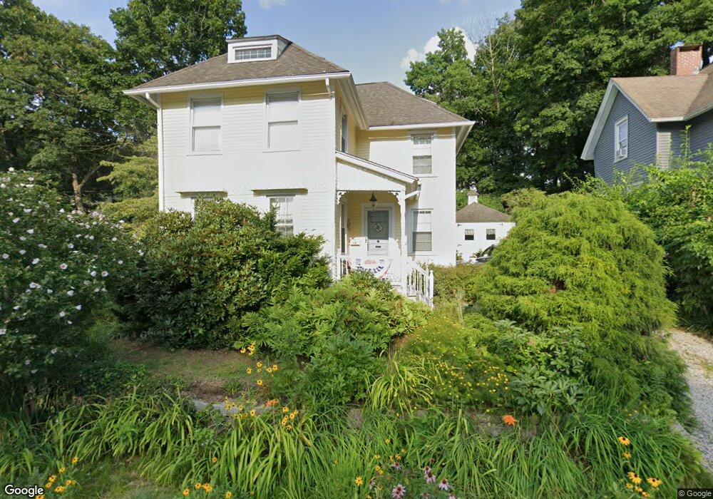
131 Platt Ave Norwich, CT 06360
Central Norwich NeighborhoodEstimated Value: $263,000 - $306,000
3
Beds
2
Baths
1,522
Sq Ft
$185/Sq Ft
Est. Value
About This Home
This home is located at 131 Platt Ave, Norwich, CT 06360 and is currently estimated at $280,898, approximately $184 per square foot. 131 Platt Ave is a home located in New London County with nearby schools including Moriarty Magnet Elementary School, Kelly STEAM Magnet Middle School, and Integrated Day Charter School.
Ownership History
Date
Name
Owned For
Owner Type
Purchase Details
Closed on
Sep 27, 2005
Sold by
Murray Joseph and Murray Patricia
Bought by
Grecki Bernadette
Current Estimated Value
Home Financials for this Owner
Home Financials are based on the most recent Mortgage that was taken out on this home.
Original Mortgage
$208,050
Interest Rate
5.92%
Purchase Details
Closed on
May 29, 2002
Sold by
Hubbard Joshua Walter
Bought by
Murray Joseph and Murray Patricia M
Purchase Details
Closed on
Jun 9, 2000
Sold by
Amburn Virginia R
Bought by
Hibbard Joshua W
Create a Home Valuation Report for This Property
The Home Valuation Report is an in-depth analysis detailing your home's value as well as a comparison with similar homes in the area
Home Values in the Area
Average Home Value in this Area
Purchase History
| Date | Buyer | Sale Price | Title Company |
|---|---|---|---|
| Grecki Bernadette | $219,000 | -- | |
| Grecki Bernadette | $219,000 | -- | |
| Murray Joseph | $124,500 | -- | |
| Murray Joseph | $124,500 | -- | |
| Hibbard Joshua W | $96,000 | -- | |
| Hibbard Joshua W | $96,000 | -- |
Source: Public Records
Mortgage History
| Date | Status | Borrower | Loan Amount |
|---|---|---|---|
| Open | Hibbard Joshua W | $211,000 | |
| Closed | Hibbard Joshua W | $208,050 |
Source: Public Records
Tax History Compared to Growth
Tax History
| Year | Tax Paid | Tax Assessment Tax Assessment Total Assessment is a certain percentage of the fair market value that is determined by local assessors to be the total taxable value of land and additions on the property. | Land | Improvement |
|---|---|---|---|---|
| 2025 | $5,735 | $141,700 | $27,800 | $113,900 |
| 2024 | $5,413 | $141,700 | $27,800 | $113,900 |
| 2023 | $4,344 | $89,300 | $19,700 | $69,600 |
| 2022 | $4,329 | $89,300 | $19,700 | $69,600 |
| 2021 | $4,344 | $89,300 | $19,700 | $69,600 |
| 2020 | $4,328 | $89,300 | $19,700 | $69,600 |
| 2019 | $4,286 | $89,300 | $19,700 | $69,600 |
| 2018 | $4,186 | $86,500 | $23,200 | $63,300 |
| 2017 | $4,216 | $86,500 | $23,200 | $63,300 |
| 2016 | $4,244 | $86,500 | $23,200 | $63,300 |
| 2015 | $4,157 | $86,500 | $23,200 | $63,300 |
| 2014 | $3,973 | $86,500 | $23,200 | $63,300 |
Source: Public Records
Map
Nearby Homes
- 127 Platt Ave
- 130 Platt Ave
- 209 Rockwell St
- 132 Platt Ave
- 201 Rockwell St
- 215 Rockwell St
- 219 Rockwell St
- 124 Platt Ave
- 195 Rockwell St
- 115 Platt Ave
- 189 Rockwell St
- 120 Platt Ave
- 227 Rockwell St
- 15 Rose Garden Ln
- 126 Orchard St
- 187 Rockwell St
- 124 Orchard St
- 112 Orchard St
- 13 Rose Garden Ln
- 110 Orchard St