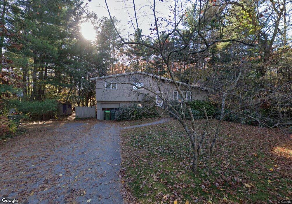
131 Pratts Mill Rd Sudbury, MA 01776
Estimated Value: $822,613 - $895,000
3
Beds
3
Baths
1,200
Sq Ft
$719/Sq Ft
Est. Value
About This Home
This home is located at 131 Pratts Mill Rd, Sudbury, MA 01776 and is currently estimated at $862,903, approximately $719 per square foot. 131 Pratts Mill Rd is a home located in Middlesex County with nearby schools including Peter Noyes Elementary School, Ephraim Curtis Middle School, and Lincoln-Sudbury Regional High School.
Ownership History
Date
Name
Owned For
Owner Type
Purchase Details
Closed on
May 21, 2014
Sold by
Drumm Debra L and Schwartz Deborah M
Bought by
Drumm Debra L
Current Estimated Value
Home Financials for this Owner
Home Financials are based on the most recent Mortgage that was taken out on this home.
Original Mortgage
$300,000
Outstanding Balance
$227,970
Interest Rate
4.33%
Mortgage Type
New Conventional
Estimated Equity
$634,933
Create a Home Valuation Report for This Property
The Home Valuation Report is an in-depth analysis detailing your home's value as well as a comparison with similar homes in the area
Home Values in the Area
Average Home Value in this Area
Purchase History
| Date | Buyer | Sale Price | Title Company |
|---|---|---|---|
| Drumm Debra L | -- | -- | |
| Drumm Debra L | -- | -- | |
| Drumm Debra L | -- | -- |
Source: Public Records
Mortgage History
| Date | Status | Borrower | Loan Amount |
|---|---|---|---|
| Open | Drumm Debra L | $300,000 | |
| Closed | Drumm Debra L | $300,000 | |
| Previous Owner | Drumm Debra L | $305,000 | |
| Previous Owner | Drumm Debra L | $299,900 |
Source: Public Records
Tax History Compared to Growth
Tax History
| Year | Tax Paid | Tax Assessment Tax Assessment Total Assessment is a certain percentage of the fair market value that is determined by local assessors to be the total taxable value of land and additions on the property. | Land | Improvement |
|---|---|---|---|---|
| 2025 | $10,731 | $733,000 | $424,900 | $308,100 |
| 2024 | $10,375 | $710,100 | $412,500 | $297,600 |
| 2023 | $10,211 | $647,500 | $374,900 | $272,600 |
| 2022 | $9,563 | $529,800 | $344,100 | $185,700 |
| 2021 | $9,261 | $491,800 | $344,100 | $147,700 |
| 2020 | $9,074 | $491,800 | $344,100 | $147,700 |
| 2019 | $8,808 | $491,800 | $344,100 | $147,700 |
| 2018 | $8,443 | $470,900 | $348,100 | $122,800 |
| 2017 | $7,985 | $450,100 | $336,100 | $114,000 |
| 2016 | $7,757 | $435,800 | $323,300 | $112,500 |
| 2015 | $7,248 | $411,800 | $308,100 | $103,700 |
| 2014 | $7,178 | $398,100 | $297,300 | $100,800 |
Source: Public Records
Map
Nearby Homes
- 14 Tanbark Rd
- 7 Saddle Ridge Rd
- 21 Summer St
- 30 Rolling Ln
- 36 Old Forge Ln
- 47 Fairbank Rd
- 25 Bridle Path
- 89 Bridle Path
- 24 Goodnow Rd
- 4 Elderberry Cir
- 143 Peakham Rd
- 12 Hickory Rd
- 270 Old Lancaster Rd
- 12 Camperdown Ln
- 54 Stone Rd
- 0 Robbins Rd
- 54 Phillips Rd
- 0 Boston Post Rd
- 7 Adams Rd
- 24 Woodland Rd
- 132 Pratts Mill Rd
- 137 Pratts Mill Rd
- 20 Willow Rd
- 138 Pratts Mill Rd
- 124 Pratts Mill Rd
- 14 Willow Rd
- 26 Willow Rd
- 11 West St
- 120 Pratts Mill Rd
- 143 Pratts Mill Rd
- 32 Willow Rd
- 114 Pratts Mill Rd
- 12 West St
- 15 West St
- 19 Willow Rd
- 149 Pratts Mill Rd
- 25 Willow Rd
- 15 Willow Rd
- 150 Pratts Mill Rd
- 38 Willow Rd