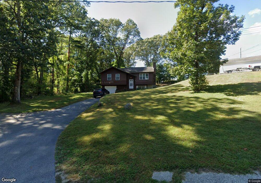
131 Route 12 Preston, CT 06365
Estimated Value: $284,000 - $329,000
3
Beds
1
Bath
976
Sq Ft
$313/Sq Ft
Est. Value
About This Home
This home is located at 131 Route 12, Preston, CT 06365 and is currently estimated at $305,053, approximately $312 per square foot. 131 Route 12 is a home located in New London County with nearby schools including Integrated Day Charter School and St. Bernard School.
Ownership History
Date
Name
Owned For
Owner Type
Purchase Details
Closed on
Aug 16, 2022
Sold by
Koziol Albert J and Koziol Ann
Bought by
Koziol Albert J and Koziol Ann
Current Estimated Value
Purchase Details
Closed on
Aug 13, 2013
Sold by
Koziol Albert J
Bought by
Koziol Albert J and Koziol Ann
Purchase Details
Closed on
Sep 21, 1979
Bought by
Koziol Albert J and Koziol Ann
Create a Home Valuation Report for This Property
The Home Valuation Report is an in-depth analysis detailing your home's value as well as a comparison with similar homes in the area
Home Values in the Area
Average Home Value in this Area
Purchase History
| Date | Buyer | Sale Price | Title Company |
|---|---|---|---|
| Koziol Albert J | -- | None Available | |
| Koziol Albert J | -- | -- | |
| Koziol Albert J | -- | -- |
Source: Public Records
Mortgage History
| Date | Status | Borrower | Loan Amount |
|---|---|---|---|
| Previous Owner | Koziol Albert J | $100,000 | |
| Previous Owner | Koziol Albert J | $20,000 | |
| Previous Owner | Koziol Albert J | $90,000 |
Source: Public Records
Tax History Compared to Growth
Tax History
| Year | Tax Paid | Tax Assessment Tax Assessment Total Assessment is a certain percentage of the fair market value that is determined by local assessors to be the total taxable value of land and additions on the property. | Land | Improvement |
|---|---|---|---|---|
| 2025 | $4,180 | $166,460 | $49,560 | $116,900 |
| 2024 | $3,890 | $166,460 | $49,560 | $116,900 |
| 2023 | $3,820 | $166,460 | $49,560 | $116,900 |
| 2022 | $3,081 | $110,500 | $40,900 | $69,600 |
| 2021 | $2,977 | $110,500 | $40,900 | $69,600 |
| 2020 | $2,972 | $110,500 | $40,900 | $69,600 |
| 2019 | $2,921 | $110,500 | $40,900 | $69,600 |
| 2018 | $2,876 | $110,500 | $40,900 | $69,600 |
| 2017 | $2,537 | $105,700 | $42,200 | $63,500 |
| 2016 | $2,510 | $105,700 | $42,200 | $63,500 |
| 2015 | $2,431 | $105,700 | $42,200 | $63,500 |
| 2014 | $2,446 | $105,700 | $42,200 | $63,500 |
Source: Public Records
Map
Nearby Homes
- 3 Holdsworth Rd
- 15 Drawbridge Rd
- 5 Bittersweet Dr
- 11 Willow Ln
- 178 Route 2a
- 7 Barn Rd
- 16 Marlene Dr
- 5 Arrowhead Dr
- 6 Arrowhead Dr
- 65 Dydo Dr
- 59 Harris Fuller Rd
- 104 Route 2a
- 6 Route 117
- 87 Fort Shantok Rd
- 60 Fort Shantok Rd
- 34 Ridgewood Dr
- 0 Clarks Falls Unit 24089817
- 2057 Norwich New London Turnpike
- 552 Laurel Hill Rd
- 547 Old Laurel Hill Rd