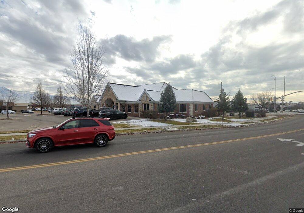
131 S 700 E Unit 102 American Fork, UT 84003
--
Bed
--
Bath
5,927
Sq Ft
0.58
Acres
About This Home
This home is located at 131 S 700 E Unit 102, American Fork, UT 84003. 131 S 700 E Unit 102 is a home located in Utah County with nearby schools including Barratt Elementary School, American Fork Junior High School, and American Fork High School.
Ownership History
Date
Name
Owned For
Owner Type
Purchase Details
Closed on
Mar 26, 2015
Sold by
All American Investments Vii Llc
Bought by
Nelson Ford Investments Llc
Home Financials for this Owner
Home Financials are based on the most recent Mortgage that was taken out on this home.
Original Mortgage
$900,000
Outstanding Balance
$690,562
Interest Rate
3.65%
Mortgage Type
Credit Line Revolving
Purchase Details
Closed on
Jul 29, 2008
Sold by
Legacy Properties & Investments Llc
Bought by
All American Investments Vii Llc
Create a Home Valuation Report for This Property
The Home Valuation Report is an in-depth analysis detailing your home's value as well as a comparison with similar homes in the area
Home Values in the Area
Average Home Value in this Area
Purchase History
| Date | Buyer | Sale Price | Title Company |
|---|---|---|---|
| Nelson Ford Investments Llc | -- | Backman Title Services Ltd | |
| All American Investments Vii Llc | -- | Backman |
Source: Public Records
Mortgage History
| Date | Status | Borrower | Loan Amount |
|---|---|---|---|
| Open | Nelson Ford Investments Llc | $900,000 |
Source: Public Records
Tax History Compared to Growth
Tax History
| Year | Tax Paid | Tax Assessment Tax Assessment Total Assessment is a certain percentage of the fair market value that is determined by local assessors to be the total taxable value of land and additions on the property. | Land | Improvement |
|---|---|---|---|---|
| 2025 | $16,606 | $1,860,300 | $379,400 | $1,480,900 |
| 2024 | $16,606 | $1,845,100 | $0 | $0 |
| 2023 | $15,775 | $1,858,300 | $0 | $0 |
| 2022 | $14,092 | $1,638,200 | $347,300 | $1,290,900 |
| 2021 | $13,149 | $1,313,200 | $310,900 | $1,002,300 |
| 2020 | $13,977 | $1,353,800 | $310,900 | $1,042,900 |
| 2019 | $13,298 | $1,332,200 | $287,800 | $1,044,400 |
| 2018 | $11,176 | $1,070,500 | $261,600 | $808,900 |
| 2017 | $11,258 | $1,058,200 | $0 | $0 |
| 2016 | $11,982 | $1,046,400 | $0 | $0 |
| 2015 | $10,838 | $898,200 | $0 | $0 |
| 2014 | $10,877 | $889,200 | $0 | $0 |
Source: Public Records
Map
Nearby Homes
- 131 S 700 E
- 131 S 700 E Unit 101
- 119 S Pacific Dr
- 686 E 110 S Unit 104
- 686 E 110 S Unit 103
- 686 E 110 S Unit 102
- 686 E 110 S Unit 203
- 735 E Pacific Dr Unit 1
- 656 E 110 S
- 656 E 110 S Unit N3
- 658 E 110 S Unit N3
- 658 E 110 S
- 654 E 110 S Unit N5
- 654 E 110 S
- 662 E 110 S Unit N2
- 652 E 110 S Unit N6
- 664 E 110 S Unit N1
- 664 E 110 S
- 644 E 110 S
- 644 E 110 S Unit M-3