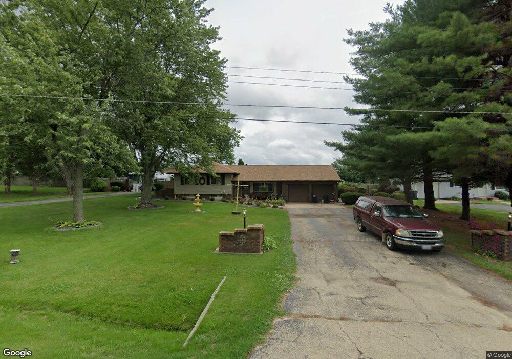
131 Sheffield Rd Groveland, IL 61535
Estimated Value: $225,000 - $268,000
3
Beds
2
Baths
2,008
Sq Ft
$121/Sq Ft
Est. Value
About This Home
This home is located at 131 Sheffield Rd, Groveland, IL 61535 and is currently estimated at $243,228, approximately $121 per square foot. 131 Sheffield Rd is a home located in Tazewell County with nearby schools including Morton High School, Blessed Sacrament School, and Bethel Lutheran School.
Ownership History
Date
Name
Owned For
Owner Type
Purchase Details
Closed on
Dec 27, 2021
Sold by
Dickson Scott A
Bought by
Dickson Scott A and Dickson Pamela Jean
Current Estimated Value
Home Financials for this Owner
Home Financials are based on the most recent Mortgage that was taken out on this home.
Original Mortgage
$138,600
Outstanding Balance
$127,476
Interest Rate
3.11%
Mortgage Type
New Conventional
Estimated Equity
$115,752
Purchase Details
Closed on
Sep 22, 2005
Sold by
Dickson Coleen A
Bought by
Dickson Scott A
Home Financials for this Owner
Home Financials are based on the most recent Mortgage that was taken out on this home.
Original Mortgage
$17,000
Interest Rate
6.04%
Mortgage Type
New Conventional
Create a Home Valuation Report for This Property
The Home Valuation Report is an in-depth analysis detailing your home's value as well as a comparison with similar homes in the area
Home Values in the Area
Average Home Value in this Area
Purchase History
| Date | Buyer | Sale Price | Title Company |
|---|---|---|---|
| Dickson Scott A | -- | New Title Company Name | |
| Dickson Scott A | -- | -- |
Source: Public Records
Mortgage History
| Date | Status | Borrower | Loan Amount |
|---|---|---|---|
| Open | Dickson Scott A | $138,600 | |
| Previous Owner | Dickson Scott A | $17,000 | |
| Previous Owner | Dickson Scott A | $136,000 |
Source: Public Records
Tax History Compared to Growth
Tax History
| Year | Tax Paid | Tax Assessment Tax Assessment Total Assessment is a certain percentage of the fair market value that is determined by local assessors to be the total taxable value of land and additions on the property. | Land | Improvement |
|---|---|---|---|---|
| 2024 | $3,625 | $62,240 | $4,760 | $57,480 |
| 2023 | $3,625 | $57,140 | $4,370 | $52,770 |
| 2022 | $3,489 | $52,850 | $4,040 | $48,810 |
| 2021 | $3,334 | $50,810 | $3,880 | $46,930 |
| 2020 | $3,243 | $50,810 | $3,880 | $46,930 |
| 2019 | $3,237 | $50,810 | $3,880 | $46,930 |
| 2018 | $3,177 | $50,810 | $3,880 | $46,930 |
| 2017 | $3,095 | $49,230 | $3,760 | $45,470 |
| 2016 | $3,061 | $49,230 | $3,760 | $45,470 |
| 2015 | $2,957 | $0 | $0 | $0 |
| 2013 | $2,929 | $49,230 | $3,760 | $45,470 |
Source: Public Records
Map
Nearby Homes
- 101 Apache Way
- 105 Apache Way
- 417 Apache Way
- 105 Sheffield Rd
- 19478 Springfield Rd
- 109 Apache Way
- 19314 Springfield Rd
- 123 Apache Way
- 305 Apache Way
- 210 Apache Way
- 4851 Sheridan Rd
- 305 Conaghan Dr
- 015 Harris Rd
- Lot 4 Harris Rd
- 0 Pinecrest Dr
- 301 Briarbrook Dr
- Lot 1 Briarbrook Dr
- Lot 2 Briarbrook Dr
- 110 Susan Ct
- 118 Susan Ct
- 123 Sheffield Rd Unit 125
- 119 Sheffield Rd
- 139 Sheffield Rd
- 108 Cherokee Dr
- 104 Cherokee Dr
- 124 Sheffield Rd
- 132 Sheffield Rd
- 124 W Sheffield
- 112 Cherokee Dr
- 136 Sheffield Rd
- 120 Sheffield Rd
- 143 Sheffield Rd
- 100 Cherokee Dr
- 117 Sheffield Rd
- 116 Cherokee Dr
- 144 Sheffield Rd
- 19383 Springfield Rd
- 116 Sheffield Rd
- 36 Cherokee Dr
- 115 Sheffield Rd