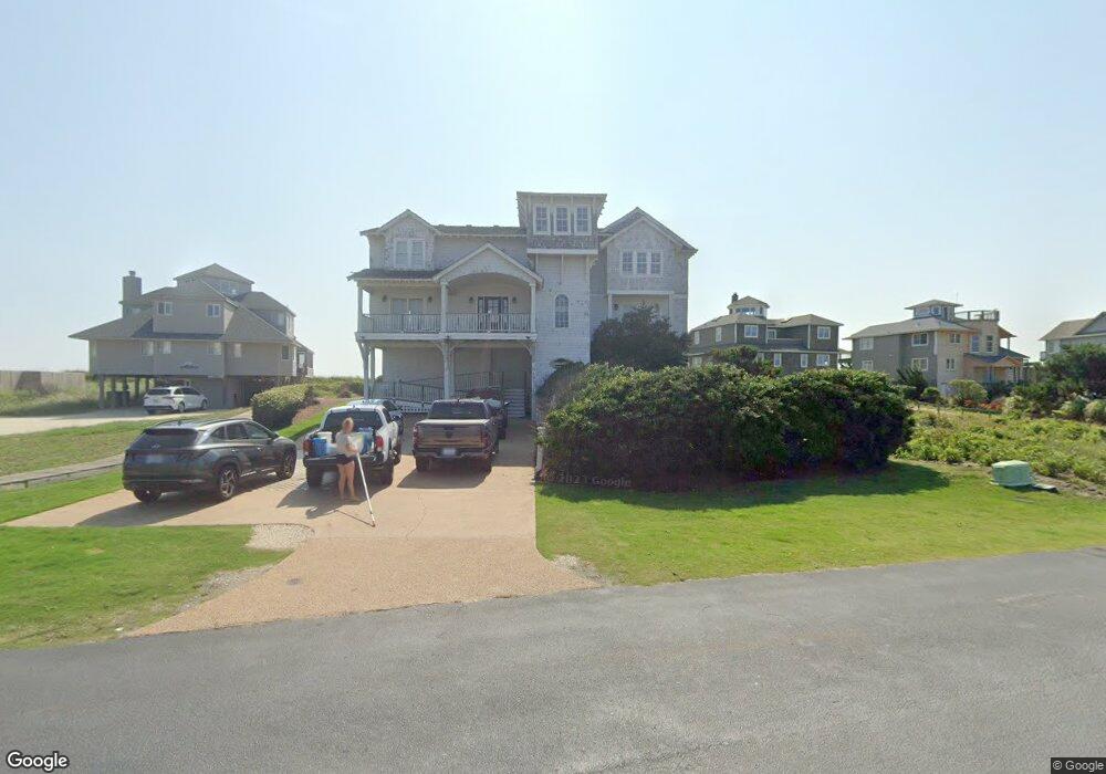
131 Spindrift Ln Kitty Hawk, NC 27949
Estimated Value: $3,175,000 - $3,955,702
7
Beds
9
Baths
6,744
Sq Ft
$531/Sq Ft
Est. Value
About This Home
This home is located at 131 Spindrift Ln, Kitty Hawk, NC 27949 and is currently estimated at $3,583,176, approximately $531 per square foot. 131 Spindrift Ln is a home located in Dare County with nearby schools including Kitty Hawk Elementary School, First Flight Middle School, and First Flight High School.
Ownership History
Date
Name
Owned For
Owner Type
Purchase Details
Closed on
Sep 8, 2022
Sold by
Kirby Pamela Lynn H and Kirby Gregory F
Bought by
Kirby Pamela Lynn H
Current Estimated Value
Purchase Details
Closed on
Nov 18, 2013
Sold by
Kirk A Russell and Kirk Pamela G
Bought by
Kirk A Russell and Kirk Pamela G
Purchase Details
Closed on
Nov 30, 2010
Sold by
Doudera Andrea D and Fulcher James P
Bought by
Kirk A Russell
Create a Home Valuation Report for This Property
The Home Valuation Report is an in-depth analysis detailing your home's value as well as a comparison with similar homes in the area
Home Values in the Area
Average Home Value in this Area
Purchase History
| Date | Buyer | Sale Price | Title Company |
|---|---|---|---|
| Kirby Pamela Lynn H | -- | -- | |
| Kirk A Russell | -- | None Available | |
| Kirk A Russell | $854,500 | None Available |
Source: Public Records
Tax History
| Year | Tax Paid | Tax Assessment Tax Assessment Total Assessment is a certain percentage of the fair market value that is determined by local assessors to be the total taxable value of land and additions on the property. | Land | Improvement |
|---|---|---|---|---|
| 2025 | $22,523 | $4,127,600 | $1,725,000 | $2,402,600 |
| 2024 | $13,105 | $2,397,800 | $825,000 | $1,572,800 |
| 2023 | $25,471 | $2,460,712 | $825,000 | $1,635,712 |
| 2022 | $25,471 | $2,460,712 | $825,000 | $1,635,712 |
| 2021 | $25,471 | $2,460,712 | $825,000 | $1,635,712 |
| 2020 | $24,890 | $2,460,712 | $825,000 | $1,635,712 |
| 2019 | $23,553 | $1,975,200 | $799,800 | $1,175,400 |
| 2018 | $23,553 | $1,975,200 | $799,800 | $1,175,400 |
| 2017 | $23,248 | $1,975,200 | $799,800 | $1,175,400 |
| 2016 | $22,435 | $1,975,200 | $799,800 | $1,175,400 |
| 2014 | $12,982 | $1,970,000 | $799,800 | $1,170,200 |
Source: Public Records
Map
Nearby Homes
- 118 Spindrift Ln Unit Lot 8
- 131 N Snow Geese Dr Unit Lot 24
- 123 Spyglass Rd Unit Lot 18
- 136 N Snow Geese Dr Unit Lot 19
- 152 Whistling Swan Dr Unit Lot 10
- 163 Buffell Head Rd Unit 14
- 110 Sailfish Ct Unit 33
- 111 Nor' Banks Dr Unit Lot 6
- 102 Widgeon Dr Unit Lot 201
- 108 Ships Watch Dr Unit Lot 4
- 1367 Duck Rd Unit Lot 21
- 116 Mainsail Ct Unit Lot 8
- 1280 Duck Rd Unit Lot 49
- 102 Ships Watch Dr
- 132 Ships Watch Dr Unit Lot 16
- 1278 Duck Rd Unit 51
- 122 Ships Watch Dr Unit Lot 11
- 120 Mainsail Ct Unit Lot 10
- 1274 Duck Rd Unit Lot 53
- 134 S Snow Geese Dr
- 131 S Snow Geese Dr
- 130 S Snow Geese Dr
- 131 S Snow Geese Dunes Unit 20
- 131 S Snow Geese Dunes
- 130 S Snow Geese Dunes
- 129 S Snow Geese Dunes
- 135 N Snow Geese Dunes
- 128 S Snow Geese Dr Unit 16
- 128 S Snow Geese Dunes
- 132 S Snow Geese Dunes
- 139 N Snow Geese Dr
- 112 Spindrift Ln
- 133 S Snow Geese Dunes Unit 19
- 133 S Snow Geese Dunes
- 127 S Snow Geese Dunes
- 133 N Snow Geese Dunes
- 137 N Snow Geese Dunes Unit 20
- 137 N Snow Geese Dunes
- 139 N Snow Geese Dunes
Your Personal Tour Guide
Ask me questions while you tour the home.