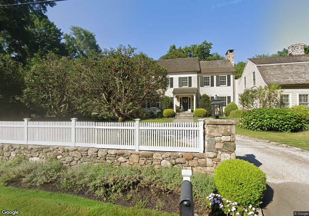
131 Sturges Hwy Westport, CT 06880
Staples NeighborhoodEstimated Value: $3,219,988 - $4,765,000
5
Beds
7
Baths
6,915
Sq Ft
$589/Sq Ft
Est. Value
About This Home
This home is located at 131 Sturges Hwy, Westport, CT 06880 and is currently estimated at $4,073,247, approximately $589 per square foot. 131 Sturges Hwy is a home located in Fairfield County with nearby schools including Long Lots School, Bedford Middle School, and Staples High School.
Ownership History
Date
Name
Owned For
Owner Type
Purchase Details
Closed on
Apr 18, 2011
Sold by
Tuthill Fin
Bought by
Shiel Matthew J and Shiel Courtney A
Current Estimated Value
Home Financials for this Owner
Home Financials are based on the most recent Mortgage that was taken out on this home.
Original Mortgage
$1,417,500
Outstanding Balance
$910,590
Interest Rate
3.38%
Estimated Equity
$3,162,657
Purchase Details
Closed on
Nov 12, 2004
Sold by
Edelman Carole
Bought by
Sturges Build Llc
Create a Home Valuation Report for This Property
The Home Valuation Report is an in-depth analysis detailing your home's value as well as a comparison with similar homes in the area
Home Values in the Area
Average Home Value in this Area
Purchase History
| Date | Buyer | Sale Price | Title Company |
|---|---|---|---|
| Shiel Matthew J | $2,025,000 | -- | |
| Shiel Matthew J | $2,025,000 | -- | |
| Sturges Build Llc | $600,000 | -- | |
| Sturges Build Llc | $600,000 | -- |
Source: Public Records
Mortgage History
| Date | Status | Borrower | Loan Amount |
|---|---|---|---|
| Open | Sturges Build Llc | $1,417,500 | |
| Closed | Sturges Build Llc | $1,417,500 | |
| Previous Owner | Sturges Build Llc | $1,000,000 |
Source: Public Records
Tax History Compared to Growth
Tax History
| Year | Tax Paid | Tax Assessment Tax Assessment Total Assessment is a certain percentage of the fair market value that is determined by local assessors to be the total taxable value of land and additions on the property. | Land | Improvement |
|---|---|---|---|---|
| 2025 | $26,002 | $1,378,700 | $433,000 | $945,700 |
| 2024 | $25,671 | $1,378,700 | $433,000 | $945,700 |
| 2023 | $25,299 | $1,378,700 | $433,000 | $945,700 |
| 2022 | $24,913 | $1,378,700 | $433,000 | $945,700 |
| 2021 | $61,143 | $1,378,700 | $433,000 | $945,700 |
| 2020 | $25,652 | $1,535,100 | $440,500 | $1,094,600 |
| 2019 | $26,290 | $1,559,300 | $440,500 | $1,118,800 |
| 2018 | $26,290 | $1,559,300 | $440,500 | $1,118,800 |
| 2017 | $26,290 | $1,559,300 | $440,500 | $1,118,800 |
| 2016 | $26,290 | $1,559,300 | $440,500 | $1,118,800 |
| 2015 | $31,160 | $1,722,500 | $408,700 | $1,313,800 |
| 2014 | $29,597 | $1,649,800 | $408,700 | $1,241,100 |
Source: Public Records
Map
Nearby Homes
- 111 Sturges Hwy
- 1084 Sturges Hwy
- 24 Tupelo Rd
- 2190 Sturges Hwy
- 6 Fox Run Ln
- 21 Queens Grant Dr
- 6 Nutcracker Ln
- 6 Bayberry Common
- 21 Sturges Commons
- 212 Fence Row Dr
- 56 Charcoal Hill Rd
- 88 Merry Meet Cir
- 26 Cob Dr
- 2015 Redding Rd
- 5 Willow Walk
- 101 Brambley Hedge Cir
- 17 Clover Ln
- 9 Greenbrier Rd
- 24 Warnock Dr
- 10 Debra Ln
- 129 Sturges Hwy
- 1488 Sturges Hwy
- 35 Wellington Dr
- 32 Fleming Ln
- 196 Cross Hwy
- 95 Wellington Dr
- 200 Cross Hwy
- 25 Fleming Ln
- 20 Daniel Ct
- 192 Cross Hwy
- 80 Fleming Ln
- 183 Cross Hwy
- 80 Wellington Dr
- 190 Cross Hwy Unit Front apt.
- 1488 Sturges Hwy
- 22 Daniel Ct
- 185 Cross Hwy
- 17 Boxwood Ln
- 123 Sturges Hwy
- 13 Boxwood Ln