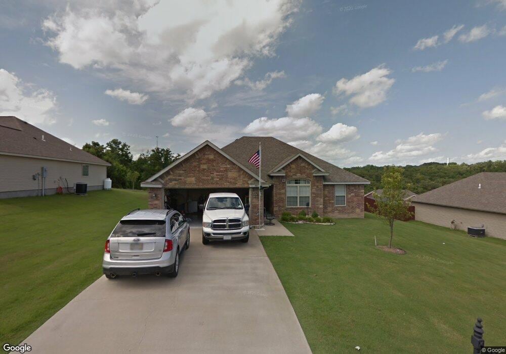
131 Thunder Ridge Estates Dr Branson, MO 65616
Estimated Value: $286,000 - $358,000
3
Beds
2
Baths
1,400
Sq Ft
$223/Sq Ft
Est. Value
About This Home
This home is located at 131 Thunder Ridge Estates Dr, Branson, MO 65616 and is currently estimated at $312,406, approximately $223 per square foot. 131 Thunder Ridge Estates Dr is a home located in Taney County with nearby schools including Buchanan Intermediate School, Buchanan Elementary School, and Branson Junior High School.
Ownership History
Date
Name
Owned For
Owner Type
Purchase Details
Closed on
May 6, 2025
Sold by
Blodgett Dawn L
Bought by
Dijulio Stanley Shane and Dijulio Melody Marie
Current Estimated Value
Home Financials for this Owner
Home Financials are based on the most recent Mortgage that was taken out on this home.
Original Mortgage
$151,000
Outstanding Balance
$150,465
Interest Rate
6.65%
Mortgage Type
New Conventional
Estimated Equity
$161,941
Purchase Details
Closed on
Dec 2, 2008
Sold by
Destiny Development & Investment Llc
Bought by
Hulstar Properties Llc
Create a Home Valuation Report for This Property
The Home Valuation Report is an in-depth analysis detailing your home's value as well as a comparison with similar homes in the area
Purchase History
We collect this data history from publicly available records. To have your information removed, we recommend requesting removal directly through your county’s website.
| Date | Buyer | Sale Price | Title Company |
|---|---|---|---|
| Dijulio Stanley Shane | -- | None Listed On Document | |
| Hulstar Properties Llc | -- | -- |
Source: Public Records
Mortgage History
We collect this data history from publicly available records. To have your information removed, we recommend requesting removal directly through your county’s website.
| Date | Status | Borrower | Loan Amount |
|---|---|---|---|
| Open | Dijulio Stanley Shane | $151,000 |
Source: Public Records
Tax History
| Year | Tax Paid | Tax Assessment Tax Assessment Total Assessment is a certain percentage of the fair market value that is determined by local assessors to be the total taxable value of land and additions on the property. | Land | Improvement |
|---|---|---|---|---|
| 2025 | $1,335 | $25,440 | -- | -- |
| 2023 | $1,508 | $29,060 | -- | -- |
| 2022 | $1,465 | $29,060 | $0 | $0 |
| 2021 | $1,458 | $29,060 | $0 | $0 |
| 2019 | $1,342 | $26,080 | $0 | $0 |
| 2018 | $1,344 | $26,080 | $0 | $0 |
| 2017 | $1,214 | $23,800 | $0 | $0 |
| 2016 | $1,124 | $22,070 | $0 | $0 |
| 2015 | $1,114 | $22,070 | $0 | $0 |
| 2014 | $1,023 | $21,180 | $0 | $0 |
Source: Public Records
Map
Nearby Homes
- 175 Sunrise Villa Dr
- 121 Jacks
- 180 Sunrise Villa Dr
- 000 Rinehart Rd
- 1420 Bee Creek Rd
- 200 Hickory Ridge Ct
- 648 Sunrise Dr
- Lot 3 Cannon Ball Loop
- Lot 42 Cannon Ball Loop
- Lot 46 Cannon Ball Loop
- Lot 40 Cannon Ball Loop
- 000 North St
- 000 Beeler Rd
- Tbd Pinehurst Ct
- 314 Easy St
- 964 Beeler Rd
- 115 Gettysburg Ave
- 000 Pinehurst Dr
- 140 Pinehurst Dr
- Lot 29 Pinehurst Dr
- 55 Thunder Ridge Estates Dr
- 53 Thunder Ridge Estates Dr
- 31 Thunder Ridge Estates Dr
- 41 Thunder Ridge Estates Dr
- 121 Thunder Ridge Estates Dr
- 130 Thunder Ridge Estates Dr
- 54 Thunder Ridge Estates Dr
- 42 Thunder Ridge Estates Dr
- 56 Thunder Ridge Estates Dr
- Ph I Thunder Ridge Estates Dr
- 0 Thunder Ridge Estates Dr
- 35 Rainfall Cir
- 230 Thunder Ridge Estates Dr
- 141 Thunder Ridge Estates Dr
- Ph II Thunder Ridge Ct
- 49 Thunder Ridge Ct
- 47 Thunder Ridge Ct
- 51 Thunder Ridge Ct
- 0 Thunder Ridge Ct
- 142 Thunder Ridge Ct
Your Personal Tour Guide
Ask me questions while you tour the home.