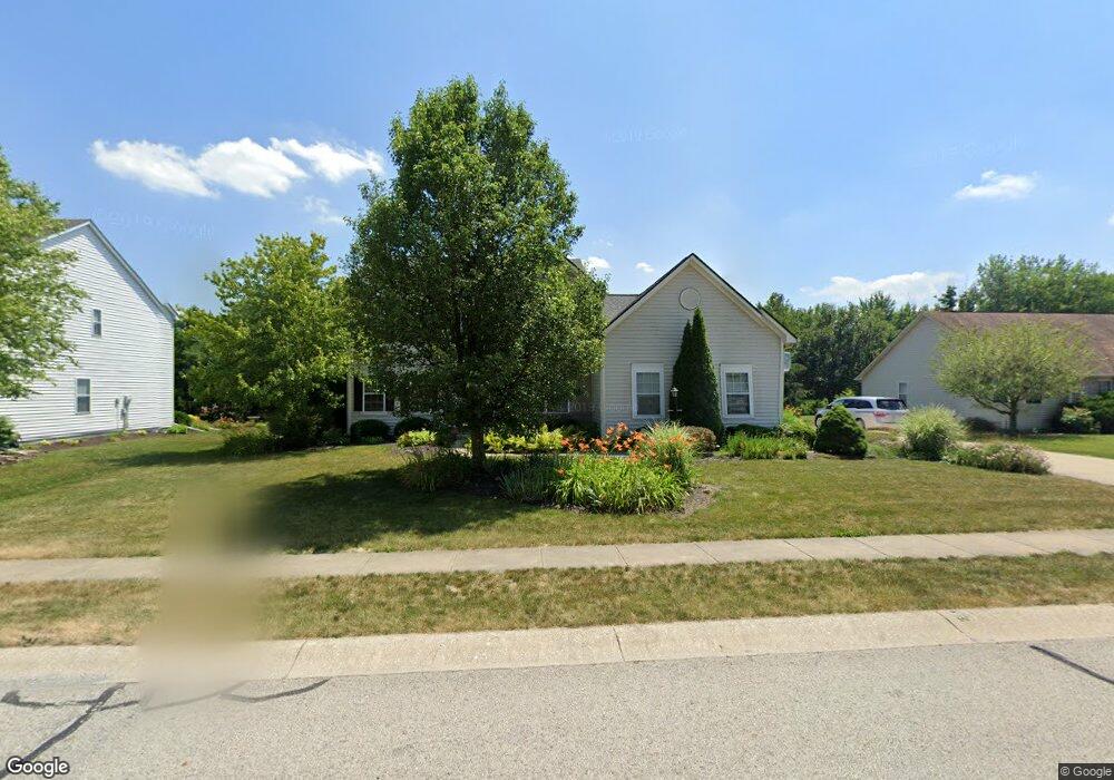
131 W Columbine Ln Westfield, IN 46074
Estimated Value: $464,000 - $516,000
4
Beds
3
Baths
2,785
Sq Ft
$179/Sq Ft
Est. Value
About This Home
This home is located at 131 W Columbine Ln, Westfield, IN 46074 and is currently estimated at $497,782, approximately $178 per square foot. 131 W Columbine Ln is a home located in Hamilton County with nearby schools including Shamrock Springs Elementary School, Westfield Intermediate School, and Westfield Middle School.
Ownership History
Date
Name
Owned For
Owner Type
Purchase Details
Closed on
Sep 17, 2013
Sold by
Russell Gail R
Bought by
Hemmerling Jason F and Hemmerling Elizabeth A
Current Estimated Value
Home Financials for this Owner
Home Financials are based on the most recent Mortgage that was taken out on this home.
Original Mortgage
$231,725
Outstanding Balance
$174,415
Interest Rate
4.62%
Mortgage Type
FHA
Estimated Equity
$323,368
Purchase Details
Closed on
Jan 27, 2006
Sold by
Edwards John D and Edwards Claire M
Bought by
Ressel Gail R
Home Financials for this Owner
Home Financials are based on the most recent Mortgage that was taken out on this home.
Original Mortgage
$180,781
Interest Rate
6.37%
Mortgage Type
Fannie Mae Freddie Mac
Create a Home Valuation Report for This Property
The Home Valuation Report is an in-depth analysis detailing your home's value as well as a comparison with similar homes in the area
Home Values in the Area
Average Home Value in this Area
Purchase History
| Date | Buyer | Sale Price | Title Company |
|---|---|---|---|
| Hemmerling Jason F | -- | None Available | |
| Ressel Gail R | -- | Lawyers Title |
Source: Public Records
Mortgage History
| Date | Status | Borrower | Loan Amount |
|---|---|---|---|
| Open | Hemmerling Jason F | $231,725 | |
| Previous Owner | Ressel Gail R | $180,781 |
Source: Public Records
Tax History Compared to Growth
Tax History
| Year | Tax Paid | Tax Assessment Tax Assessment Total Assessment is a certain percentage of the fair market value that is determined by local assessors to be the total taxable value of land and additions on the property. | Land | Improvement |
|---|---|---|---|---|
| 2024 | $4,502 | $406,800 | $66,000 | $340,800 |
| 2023 | $4,567 | $396,400 | $66,000 | $330,400 |
| 2022 | $4,211 | $357,500 | $66,000 | $291,500 |
| 2021 | $3,785 | $313,200 | $66,000 | $247,200 |
| 2020 | $3,603 | $295,600 | $66,000 | $229,600 |
| 2019 | $3,433 | $281,800 | $52,200 | $229,600 |
| 2018 | $3,282 | $269,500 | $52,200 | $217,300 |
| 2017 | $2,992 | $264,700 | $52,200 | $212,500 |
| 2016 | $2,842 | $251,500 | $52,200 | $199,300 |
| 2014 | $2,571 | $230,100 | $52,200 | $177,900 |
| 2013 | $2,571 | $224,900 | $52,200 | $172,700 |
Source: Public Records
Map
Nearby Homes
- 15409 Heath Cir
- 15429 Cornflower Ct
- 225 W Tansey Crossing
- 32 E Greyhound Pass
- 315 Mcintosh Ln
- 221 Kerry Ct
- 15657 Hush Hickory Bend
- 809 Stockbridge Dr
- 564 Zephyr Way
- 15564 Bethesda Cir
- 15826 Buxton Dr
- 15706 Maybell Ln
- 693 Mcnamara Ct
- 2175 Ryder Place
- 14843 Bixby Dr
- 14936 Annabel Ct
- 15865 W Rail Dr
- 62 Bennett Rd
- 84 Bennett Rd
- 245 Coatsville Dr
- 123 W Columbine Ln
- 124 W Greyhound Pass
- 201 W Columbine Ln
- 115 W Columbine Ln
- 138 W Columbine Ln
- 122 W Columbine Ln
- 202 W Columbine Ln
- 132 W Greyhound Pass
- 116 W Greyhound Pass
- 140 W Greyhound Pass
- 114 W Columbine Ln
- 209 W Columbine Ln
- 15207 Derby Ct
- 210 W Columbine Ln
- 148 W Greyhound Pass
- 110 W Greyhound Pass
- 133 W Greyhound Pass
- 106 W Columbine Ln
- 15211 Derby Ct