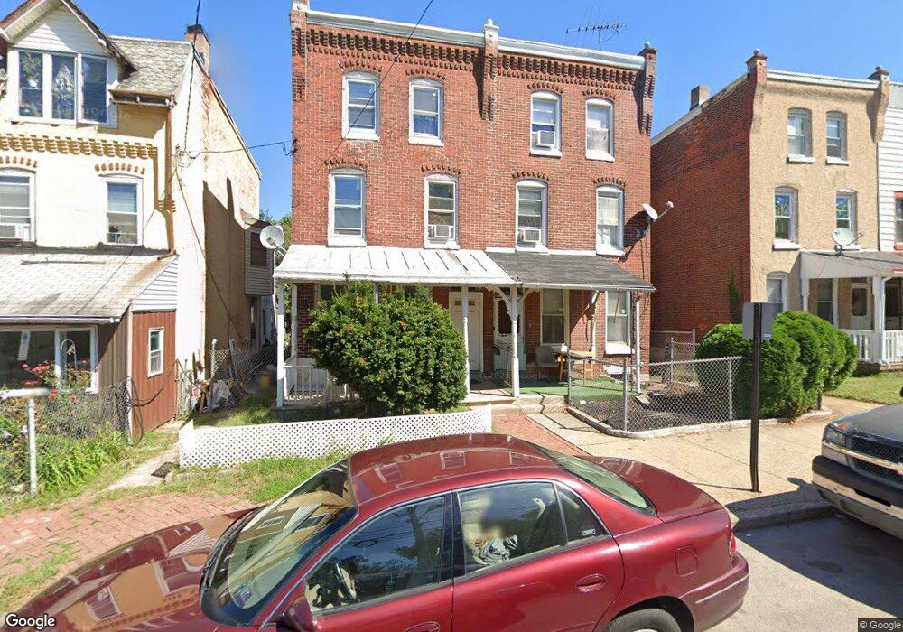
131 W Elm St Norristown, PA 19401
Estimated Value: $118,000 - $257,000
4
Beds
1
Bath
1,692
Sq Ft
$102/Sq Ft
Est. Value
About This Home
This home is located at 131 W Elm St, Norristown, PA 19401 and is currently estimated at $173,285, approximately $102 per square foot. 131 W Elm St is a home located in Montgomery County with nearby schools including Charles Blockson Middle School, Whitehall Elementary School, and East Norriton Middle School.
Ownership History
Date
Name
Owned For
Owner Type
Purchase Details
Closed on
Nov 14, 2005
Sold by
Mcdonald Lorice
Bought by
Thai Huu and Thai Mythuong
Current Estimated Value
Home Financials for this Owner
Home Financials are based on the most recent Mortgage that was taken out on this home.
Original Mortgage
$62,100
Outstanding Balance
$34,067
Interest Rate
6.06%
Estimated Equity
$139,218
Purchase Details
Closed on
Dec 8, 2003
Sold by
Mcdonald Lorice
Bought by
Commerce Bank Pa Na
Home Financials for this Owner
Home Financials are based on the most recent Mortgage that was taken out on this home.
Original Mortgage
$48,350
Interest Rate
5.96%
Purchase Details
Closed on
Nov 8, 2001
Sold by
Findlater Maria and Mcdonald Lorice
Bought by
Mcdonald Lorice
Create a Home Valuation Report for This Property
The Home Valuation Report is an in-depth analysis detailing your home's value as well as a comparison with similar homes in the area
Home Values in the Area
Average Home Value in this Area
Purchase History
| Date | Buyer | Sale Price | Title Company |
|---|---|---|---|
| Thai Huu | $69,000 | -- | |
| Commerce Bank Pa Na | -- | -- | |
| Mcdonald Lorice | -- | -- |
Source: Public Records
Mortgage History
| Date | Status | Borrower | Loan Amount |
|---|---|---|---|
| Open | Thai Huu | $62,100 | |
| Previous Owner | Commerce Bank Pa Na | $48,350 |
Source: Public Records
Tax History Compared to Growth
Tax History
| Year | Tax Paid | Tax Assessment Tax Assessment Total Assessment is a certain percentage of the fair market value that is determined by local assessors to be the total taxable value of land and additions on the property. | Land | Improvement |
|---|---|---|---|---|
| 2025 | $1,834 | $29,870 | $21,430 | $8,440 |
| 2024 | $1,834 | $29,870 | $21,430 | $8,440 |
| 2023 | $1,818 | $29,870 | $21,430 | $8,440 |
| 2022 | $1,778 | $29,870 | $21,430 | $8,440 |
| 2021 | $1,769 | $29,870 | $21,430 | $8,440 |
| 2020 | $1,688 | $29,870 | $21,430 | $8,440 |
| 2019 | $1,657 | $29,870 | $21,430 | $8,440 |
| 2018 | $1,103 | $29,870 | $21,430 | $8,440 |
| 2017 | $1,522 | $29,870 | $21,430 | $8,440 |
| 2016 | $1,509 | $29,870 | $21,430 | $8,440 |
| 2015 | $1,446 | $29,870 | $21,430 | $8,440 |
| 2014 | $1,446 | $29,870 | $21,430 | $8,440 |
Source: Public Records
Map
Nearby Homes
- 231 W Spruce St
- 1031 Swede St
- 332 James St
- 1225 Swede St
- 32 E Elm St
- 16 W Spruce St
- 52 W Basin St
- 1035 Willow St
- 711 Swede St
- 804 George St
- 42 Jacoby St
- 1055 Willow St
- 1009 Dekalb St
- 809 George St
- 1844 Arbor Place Dr Unit 45S
- 1836 Arbor Place Dr Unit 41W
- 1852 Arbor Place Dr Unit 49S
- 1000 Dekalb St Unit 6
- 632 Chain St
- 0 Astor St