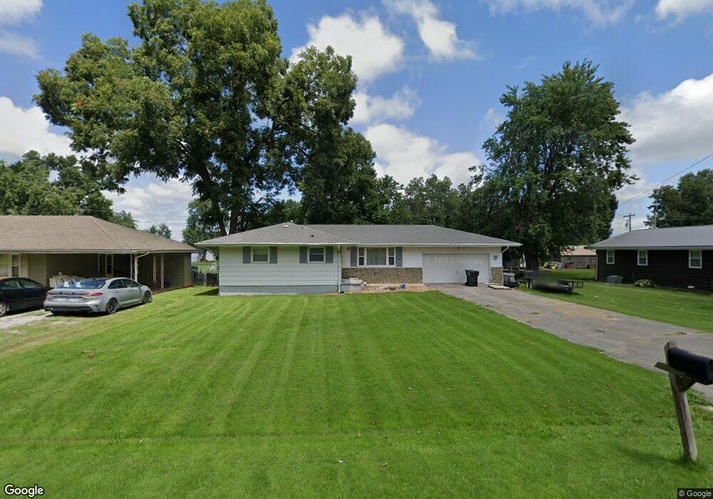
131 W Roosevelt Ave Shawneetown, IL 62984
Estimated Value: $104,445 - $172,000
--
Bed
--
Bath
--
Sq Ft
0.34
Acres
About This Home
This home is located at 131 W Roosevelt Ave, Shawneetown, IL 62984 and is currently estimated at $129,361. 131 W Roosevelt Ave is a home located in Gallatin County with nearby schools including Gallatin Elementary School, Gallatin Junior High School, and Gallatin High School.
Ownership History
Date
Name
Owned For
Owner Type
Purchase Details
Closed on
Apr 4, 2025
Sold by
Hazel Eric D
Bought by
Oldham Gracie
Current Estimated Value
Home Financials for this Owner
Home Financials are based on the most recent Mortgage that was taken out on this home.
Original Mortgage
$77,400
Outstanding Balance
$76,422
Interest Rate
0.63%
Mortgage Type
Construction
Estimated Equity
$52,939
Purchase Details
Closed on
Oct 1, 2012
Bought by
Eric Hazel D and Payne Nicki L
Purchase Details
Closed on
May 9, 2006
Bought by
Hazel Eric D and Payne Nicki L
Create a Home Valuation Report for This Property
The Home Valuation Report is an in-depth analysis detailing your home's value as well as a comparison with similar homes in the area
Home Values in the Area
Average Home Value in this Area
Purchase History
| Date | Buyer | Sale Price | Title Company |
|---|---|---|---|
| Oldham Gracie | $86,000 | Kotner Title | |
| Eric Hazel D | $65,000 | -- | |
| Hazel Eric D | $65,000 | -- |
Source: Public Records
Mortgage History
| Date | Status | Borrower | Loan Amount |
|---|---|---|---|
| Open | Oldham Gracie | $77,400 |
Source: Public Records
Tax History Compared to Growth
Tax History
| Year | Tax Paid | Tax Assessment Tax Assessment Total Assessment is a certain percentage of the fair market value that is determined by local assessors to be the total taxable value of land and additions on the property. | Land | Improvement |
|---|---|---|---|---|
| 2024 | $2,799 | $28,401 | $3,576 | $24,825 |
| 2023 | $2,436 | $28,401 | $3,576 | $24,825 |
| 2022 | $2,418 | $27,049 | $3,406 | $23,643 |
| 2021 | $2,363 | $26,518 | $3,339 | $23,179 |
| 2020 | $2,297 | $26,786 | $3,373 | $23,413 |
| 2019 | $2,324 | $26,786 | $3,373 | $23,413 |
| 2018 | $2,405 | $25,930 | $3,265 | $22,665 |
| 2017 | $2,281 | $24,009 | $3,023 | $20,986 |
| 2015 | $1,640 | $22,200 | $2,795 | $19,405 |
| 2014 | $1,640 | $22,200 | $2,795 | $19,405 |
| 2013 | $1,378 | $22,200 | $2,795 | $19,405 |
| 2012 | -- | $20,845 | $2,624 | $18,221 |
Source: Public Records
Map
Nearby Homes
- 129 E Wilson Ave
- 174 E Wilson Ave
- 273 W McClernand Ave
- 143 E Posey Ave
- TBD N Lincoln Blvd
- 149 Lincoln Blvd
- 133 W Shawnee Ave
- 141 W Shawnee Ave
- 000 Shawnee Hill Rd
- 8860 Shawnee Hill Rd
- 000 Shawneetown New Haven Rd
- 10116 State Route 56 W
- 103 N Baltimore St
- 890 Bald Hill Rd W Unit tract 3
- 3485 Coyle Ln
- 0 Bald Hill Rd
- 889 Bald Hill Rd W Unit Tract 1
- 2174 Highway 1
- 321 N Calhoun St
- 000 N Shawnee Hills Rd
- 139 W Roosevelt Ave
- 125 W Roosevelt Ave
- 120 W Denton St
- 149 W Roosevelt Ave
- 136 W Denton St
- 110 W Denton St
- 126 W Roosevelt Ave
- 159 W Roosevelt Ave
- 114 W Roosevelt Ave
- 895 N Lincoln Blvd
- 154 W Denton St
- 140 W Roosevelt Ave
- 795 N Lincoln Blvd
- 111 W Wilson Ave
- 179 W Roosevelt Ave
- 143 W Denton St
- 164 W Denton St
- 820 N Lincoln Blvd
- 890 N Lincoln Blvd
- 174 W Denton St