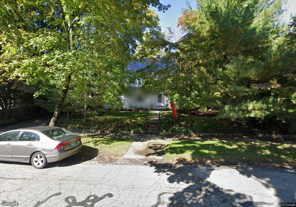
131 Windermere Rd Auburndale, MA 02466
Auburndale NeighborhoodEstimated Value: $1,787,000 - $1,994,000
4
Beds
3
Baths
2,276
Sq Ft
$830/Sq Ft
Est. Value
About This Home
This home is located at 131 Windermere Rd, Auburndale, MA 02466 and is currently estimated at $1,887,982, approximately $829 per square foot. 131 Windermere Rd is a home located in Middlesex County with nearby schools including Williams Elementary School, Charles E Brown Middle School, and Newton South High School.
Ownership History
Date
Name
Owned For
Owner Type
Purchase Details
Closed on
Jul 31, 2009
Sold by
Pratt Alice D
Bought by
Ockene Kimberly D and Milsten Andrew M
Current Estimated Value
Create a Home Valuation Report for This Property
The Home Valuation Report is an in-depth analysis detailing your home's value as well as a comparison with similar homes in the area
Home Values in the Area
Average Home Value in this Area
Purchase History
| Date | Buyer | Sale Price | Title Company |
|---|---|---|---|
| Ockene Kimberly D | $757,000 | -- |
Source: Public Records
Tax History Compared to Growth
Tax History
| Year | Tax Paid | Tax Assessment Tax Assessment Total Assessment is a certain percentage of the fair market value that is determined by local assessors to be the total taxable value of land and additions on the property. | Land | Improvement |
|---|---|---|---|---|
| 2025 | $14,410 | $1,470,400 | $973,800 | $496,600 |
| 2024 | $13,933 | $1,427,600 | $945,400 | $482,200 |
| 2023 | $12,687 | $1,246,300 | $726,700 | $519,600 |
| 2022 | $12,140 | $1,154,000 | $672,900 | $481,100 |
| 2021 | $4,014 | $1,088,700 | $634,800 | $453,900 |
| 2020 | $3,670 | $1,088,700 | $634,800 | $453,900 |
| 2019 | $11,046 | $1,057,000 | $616,300 | $440,700 |
| 2018 | $3,322 | $983,000 | $559,600 | $423,400 |
| 2017 | $10,313 | $927,400 | $527,900 | $399,500 |
| 2016 | $9,863 | $866,700 | $493,400 | $373,300 |
| 2015 | $9,404 | $810,000 | $461,100 | $348,900 |
Source: Public Records
Map
Nearby Homes
- 283 Woodland Rd
- 1754 Washington St
- 1639 Washington St
- 17 Gilbert St
- 51 Bourne St
- 1640 Commonwealth Ave
- 13 Weir St
- 224 Auburn St Unit 224
- 224 Auburn St Unit A
- 226 Auburn St Unit 226
- 0 Duncan Rd Unit 72925240
- 17 Lasell St
- 62-64 Rowe St Unit B
- 17 Crescent St
- 10 Ruane Rd
- 10 Crescent St Unit 1
- 10 Crescent St Unit 2
- 283 Melrose St
- 27 Oakwood Rd
- 40 Sewall St
- 125 Windermere Rd
- 125 Windermere Rd Unit 125
- 266 Woodland Rd
- 256 Woodland Rd
- 119 Windermere Rd
- 140 Windermere Rd
- 126 Windermere Rd
- 118 Windermere Rd
- 115 Windermere Rd
- 44 Cheswick Rd
- 244 Woodland Rd
- 290 Woodland Rd
- 114 Windermere Rd
- 18 Bonmar Cir
- 105 Windermere Rd
- 30 Cheswick Rd
- 30 Cheswick Rd Unit SF
- 296 Woodland Rd
- 1816 Commonwealth Ave
- 1816 Commonwealth Ave Unit 22