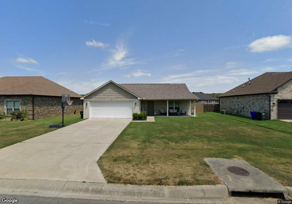
1310 Andrews Dr Conway, AR 72032
East Conway NeighborhoodEstimated Value: $268,469 - $287,000
--
Bed
2
Baths
1,695
Sq Ft
$163/Sq Ft
Est. Value
About This Home
This home is located at 1310 Andrews Dr, Conway, AR 72032 and is currently estimated at $276,367, approximately $163 per square foot. 1310 Andrews Dr is a home located in Faulkner County with nearby schools including Theodore Jones Elementary School, Conway Junior High School, and Conway High School.
Ownership History
Date
Name
Owned For
Owner Type
Purchase Details
Closed on
Jun 16, 2017
Sold by
Brock Rick and Brock Shelly D
Bought by
Mcfalls Colette Marie
Current Estimated Value
Home Financials for this Owner
Home Financials are based on the most recent Mortgage that was taken out on this home.
Original Mortgage
$6,000
Outstanding Balance
$1,231
Interest Rate
4.02%
Mortgage Type
FHA
Estimated Equity
$275,136
Purchase Details
Closed on
Jan 30, 2017
Sold by
Tri Con Builder Inc
Bought by
Brock Rick and Brock Shelly D
Home Financials for this Owner
Home Financials are based on the most recent Mortgage that was taken out on this home.
Original Mortgage
$153,000
Interest Rate
4.16%
Mortgage Type
Construction
Create a Home Valuation Report for This Property
The Home Valuation Report is an in-depth analysis detailing your home's value as well as a comparison with similar homes in the area
Home Values in the Area
Average Home Value in this Area
Purchase History
| Date | Buyer | Sale Price | Title Company |
|---|---|---|---|
| Mcfalls Colette Marie | $179,500 | Faulkner County Title Compan | |
| Brock Rick | $31,500 | Lenders Title Company |
Source: Public Records
Mortgage History
| Date | Status | Borrower | Loan Amount |
|---|---|---|---|
| Open | Mcfalls Colette Marie | $6,000 | |
| Previous Owner | Brock Rick | $153,000 |
Source: Public Records
Tax History Compared to Growth
Tax History
| Year | Tax Paid | Tax Assessment Tax Assessment Total Assessment is a certain percentage of the fair market value that is determined by local assessors to be the total taxable value of land and additions on the property. | Land | Improvement |
|---|---|---|---|---|
| 2025 | $2,071 | $52,860 | $7,000 | $45,860 |
| 2024 | $1,976 | $52,860 | $7,000 | $45,860 |
| 2023 | $1,882 | $39,320 | $7,000 | $32,320 |
| 2022 | $1,425 | $39,320 | $7,000 | $32,320 |
| 2021 | $1,343 | $39,320 | $7,000 | $32,320 |
| 2020 | $1,261 | $32,340 | $7,000 | $25,340 |
| 2019 | $1,261 | $32,340 | $7,000 | $25,340 |
| 2018 | $1,286 | $32,340 | $7,000 | $25,340 |
| 2017 | $177 | $3,500 | $3,500 | $0 |
| 2016 | $177 | $3,500 | $3,500 | $0 |
| 2015 | $177 | $3,500 | $3,500 | $0 |
| 2014 | $177 | $3,500 | $3,500 | $0 |
Source: Public Records
Map
Nearby Homes
- 00 Victory Ln
- 1220 Bulldog Dr
- 2020 Mary Alice Dr
- 2080 Mary Alice Dr
- 0 Blake Ln
- 0 Victory Ln
- 2225 Eldridge Ln
- 1605 Duke St
- 2240 Eldridge Ln
- 1200 Mae Ln
- 1810 Angeline Dr
- 1365 Woodside Dr
- 2485 E Oak St
- 2510 E Oak St
- 2515 E Oak St
- 00 Museum Rd
- 1012 Woodside Dr
- 2800 Plateau Dr
- 6 Cedar Hill Rd
- 60 Sandpiper Ct
- 1300 Andrews Dr
- 1315 Bird Song Dr
- 1330 Andrews Dr
- 1240 Andrews Dr
- 1305 Bird Song Dr
- 1325 Bird Song Dr
- 1335 Bird Song Dr
- 1245 Bird Song Dr
- 1335 Andrews Dr
- 1340 Andrews Dr
- 1230 Andrews Dr
- 1235 Bird Song Dr
- 1345 Bird Song Dr
- 1645 Trison Ln
- 0 Andrews Dr Unit 16007961
- 0 Andrews Dr Unit 16007968
- 0 Andrews Dr Unit 16018339
- 0 Andrews Dr Unit 16018335
- 0 Andrews Dr Unit 16030431
- 0 Andrews Dr Unit 16030424