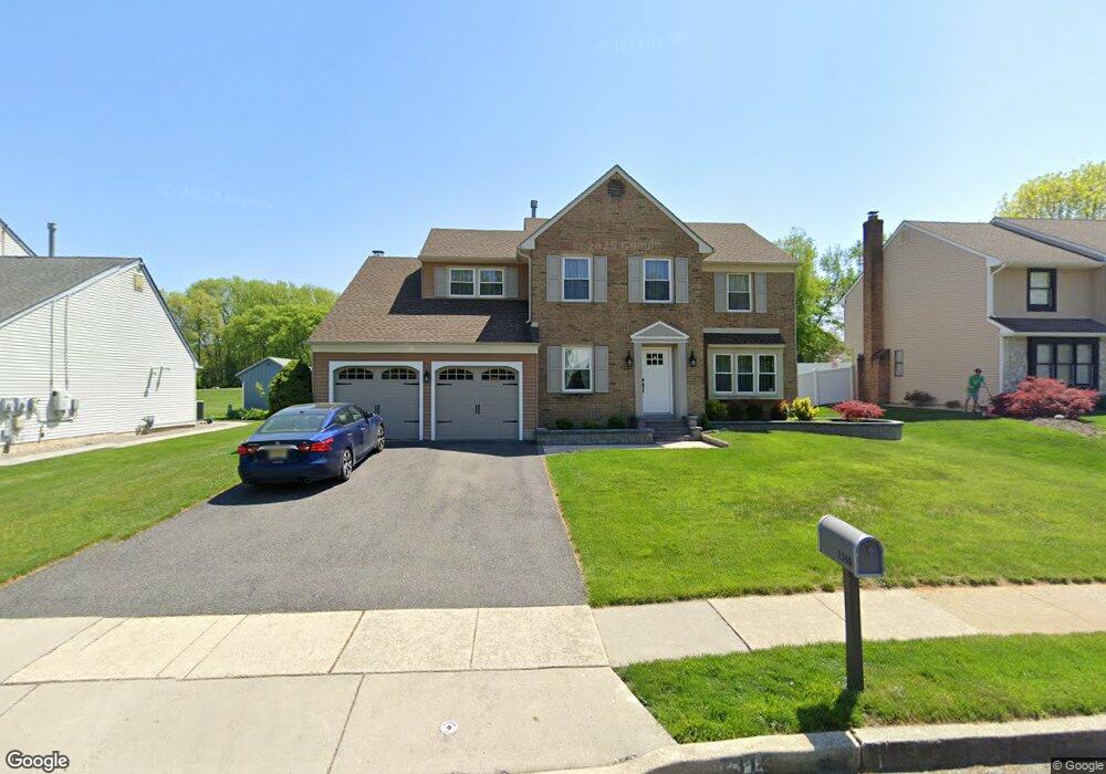
1310 Barnesdale Rd West Deptford, NJ 08096
West Deptford Township NeighborhoodEstimated Value: $527,087 - $560,000
--
Bed
--
Bath
2,302
Sq Ft
$236/Sq Ft
Est. Value
About This Home
This home is located at 1310 Barnesdale Rd, West Deptford, NJ 08096 and is currently estimated at $543,772, approximately $236 per square foot. 1310 Barnesdale Rd is a home located in Gloucester County with nearby schools including Green-Fields Elementary School, Oakview Elementary School, and Red Bank Elementary School.
Ownership History
Date
Name
Owned For
Owner Type
Purchase Details
Closed on
Jan 31, 2007
Sold by
Beutel James
Bought by
Daniel Wood
Current Estimated Value
Home Financials for this Owner
Home Financials are based on the most recent Mortgage that was taken out on this home.
Original Mortgage
$300,000
Outstanding Balance
$179,687
Interest Rate
6.16%
Mortgage Type
Purchase Money Mortgage
Estimated Equity
$364,085
Create a Home Valuation Report for This Property
The Home Valuation Report is an in-depth analysis detailing your home's value as well as a comparison with similar homes in the area
Home Values in the Area
Average Home Value in this Area
Purchase History
| Date | Buyer | Sale Price | Title Company |
|---|---|---|---|
| Daniel Wood | $375,000 | -- |
Source: Public Records
Mortgage History
| Date | Status | Borrower | Loan Amount |
|---|---|---|---|
| Open | Daniel Wood | $300,000 |
Source: Public Records
Tax History Compared to Growth
Tax History
| Year | Tax Paid | Tax Assessment Tax Assessment Total Assessment is a certain percentage of the fair market value that is determined by local assessors to be the total taxable value of land and additions on the property. | Land | Improvement |
|---|---|---|---|---|
| 2025 | $10,060 | $288,100 | $68,100 | $220,000 |
| 2024 | $9,931 | $288,100 | $68,100 | $220,000 |
| 2023 | $9,931 | $288,100 | $68,100 | $220,000 |
| 2022 | $9,885 | $288,100 | $68,100 | $220,000 |
| 2021 | $9,850 | $288,100 | $68,100 | $220,000 |
| 2020 | $9,827 | $288,100 | $68,100 | $220,000 |
| 2019 | $9,553 | $288,100 | $68,100 | $220,000 |
| 2018 | $9,294 | $288,100 | $68,100 | $220,000 |
| 2017 | $9,078 | $288,100 | $68,100 | $220,000 |
| 2016 | $8,825 | $288,100 | $68,100 | $220,000 |
| 2015 | $8,407 | $288,100 | $68,100 | $220,000 |
| 2014 | $7,989 | $288,100 | $68,100 | $220,000 |
Source: Public Records
Map
Nearby Homes
- 1311 Barnesdale Rd
- 4 Saint Emilion Ct
- 1102 Barnesdale Rd
- 1810 Fernwood Dr
- 1220 Royal Ln
- 740 Carter Hill Dr
- 87 Woodway Dr Unit 87
- 863 Doncaster Dr
- 558 Prince St
- 640 Worcester Dr
- 344 S Girard St
- 438 S Columbia St
- 64 Tilden Rd
- 609 Salem Ave
- 12 Highbridge Ln Unit I2
- 125 Lionheart Ln Unit C125
- 608 Salem Ave
- 1012 Moore Rd Unit 6
- 340 High St
- 1091 Buckingham Dr Unit 45
- 1308 Barnesdale Rd
- 1312 Barnesdale Rd
- 1306 Barnesdale Rd
- 1314 Barnesdale Rd
- 1 Latour Ct
- 1316 Barnesdale Rd
- 1304 Barnesdale Rd
- 2 Lafite Ct
- 1301 Barnesdale Rd
- 3 Latour Ct
- 474 Westwood Dr
- 2 Latour Ct
- 1318 Barnesdale Rd
- 470 Westwood Dr
- 478 Westwood Dr
- 4 Lafite Ct
- 466 Westwood Dr
- 1302 Barnesdale Rd
- 4 Latour Ct
- 482 Westwood Dr