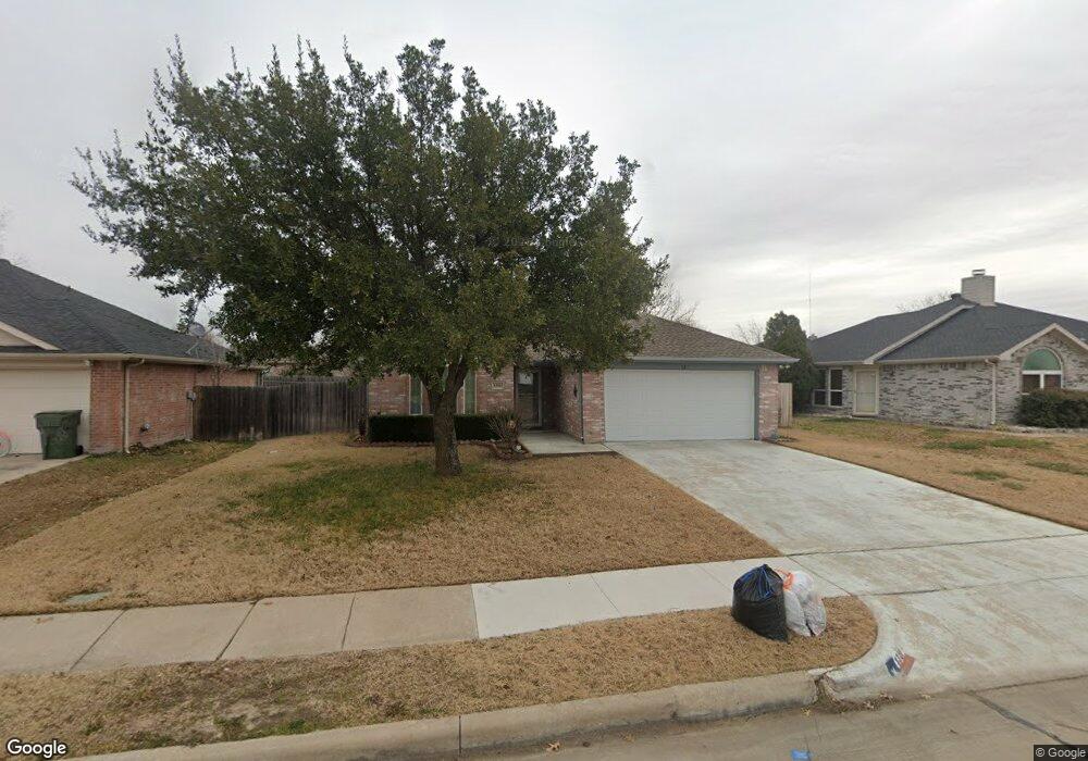
1310 Embercrest Dr Midlothian, TX 76065
Estimated Value: $298,007 - $308,000
3
Beds
2
Baths
1,370
Sq Ft
$221/Sq Ft
Est. Value
About This Home
This home is located at 1310 Embercrest Dr, Midlothian, TX 76065 and is currently estimated at $303,004, approximately $221 per square foot. 1310 Embercrest Dr is a home located in Ellis County with nearby schools including J A Vitovsky Elementary School and Walnut Grove Middle School.
Ownership History
Date
Name
Owned For
Owner Type
Purchase Details
Closed on
Feb 18, 2018
Sold by
Cantu Sonja and Cantu Delfino
Bought by
Euerle Andrew W and Euerle Jennifer K
Current Estimated Value
Home Financials for this Owner
Home Financials are based on the most recent Mortgage that was taken out on this home.
Original Mortgage
$155,000
Outstanding Balance
$131,435
Interest Rate
4.04%
Mortgage Type
New Conventional
Estimated Equity
$171,569
Purchase Details
Closed on
Oct 20, 2014
Sold by
Wilson Rachel L and Mcgowan Michael
Bought by
Cantu Sonja and Cantu Delfino
Home Financials for this Owner
Home Financials are based on the most recent Mortgage that was taken out on this home.
Original Mortgage
$124,699
Interest Rate
4.25%
Mortgage Type
FHA
Create a Home Valuation Report for This Property
The Home Valuation Report is an in-depth analysis detailing your home's value as well as a comparison with similar homes in the area
Home Values in the Area
Average Home Value in this Area
Purchase History
| Date | Buyer | Sale Price | Title Company |
|---|---|---|---|
| Euerle Andrew W | -- | Old Republic Title | |
| Cantu Sonja | -- | None Available |
Source: Public Records
Mortgage History
| Date | Status | Borrower | Loan Amount |
|---|---|---|---|
| Open | Euerle Andrew W | $155,000 | |
| Previous Owner | Cantu Sonja | $124,699 |
Source: Public Records
Tax History Compared to Growth
Tax History
| Year | Tax Paid | Tax Assessment Tax Assessment Total Assessment is a certain percentage of the fair market value that is determined by local assessors to be the total taxable value of land and additions on the property. | Land | Improvement |
|---|---|---|---|---|
| 2025 | $3,380 | $248,520 | $80,000 | $168,520 |
| 2024 | $3,380 | $252,386 | $80,000 | $172,386 |
| 2023 | $3,380 | $230,650 | $0 | $0 |
| 2022 | $4,698 | $209,682 | $0 | $0 |
| 2021 | $4,511 | $190,620 | $35,000 | $155,620 |
| 2020 | $4,632 | $184,150 | $35,000 | $149,150 |
| 2019 | $4,646 | $177,410 | $0 | $0 |
| 2018 | $3,604 | $168,330 | $25,000 | $143,330 |
| 2017 | $3,944 | $148,150 | $25,000 | $123,150 |
| 2016 | $3,537 | $132,870 | $20,000 | $112,870 |
| 2015 | $2,569 | $120,320 | $20,000 | $100,320 |
| 2014 | $2,569 | $112,530 | $0 | $0 |
Source: Public Records
Map
Nearby Homes
- 1309 Rye Glen Dr
- 1410 Rye Glen Dr
- 1105 Crooked Creek Ct
- TBD 1 acre Overlook Dr
- 912 Crockett St
- 807 Crockett St
- 0 U S Highway 67
- 1401 Yucca St
- 714 Green Acres Ln
- 1511 Hillside Dr
- 312 Overlook Dr
- 620 N 6th St
- 796 N 7th St
- TBD 8 acres N 9th St
- 1421 N 9th St
- 0 W Avenue A
- 414 N 5th St
- 412 N 5th St
- 1834 Rough Ridge Trail
- 000 N 6th St
- 1314 Embercrest Dr
- 1306 Embercrest Dr
- 1318 Embercrest Dr
- 1302 Embercrest Dr
- 1313 Rye Glen Dr
- 1305 Rye Glen Dr
- 1317 Rye Glen Dr
- 1305 Embercrest Dr
- 1402 Embercrest Dr
- 1226 Embercrest Dr
- 1317 Embercrest Dr
- 1301 Embercrest Dr
- 1401 Rye Glen Dr
- 1217 Rye Glen Dr
- 1321 Embercrest Dr
- 1406 Embercrest Dr
- 1222 Embercrest Dr
- 1225 Embercrest Dr
- 1405 Rye Glen Dr
- 1314 Beacon Hill Dr