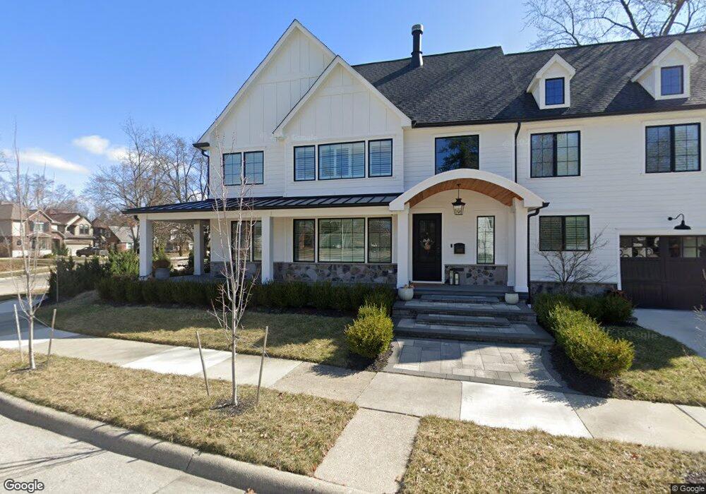
1310 Forestdale Rd Royal Oak, MI 48067
Estimated Value: $364,000 - $968,924
4
Beds
4
Baths
3,436
Sq Ft
$231/Sq Ft
Est. Value
About This Home
This home is located at 1310 Forestdale Rd, Royal Oak, MI 48067 and is currently estimated at $792,731, approximately $230 per square foot. 1310 Forestdale Rd is a home located in Oakland County with nearby schools including Northwood Elementary School, Royal Oak Middle School, and Royal Oak High School.
Ownership History
Date
Name
Owned For
Owner Type
Purchase Details
Closed on
Apr 30, 2018
Sold by
Vulpe Patricia L
Bought by
Spahiu Bledjon and Bulka Helena
Current Estimated Value
Home Financials for this Owner
Home Financials are based on the most recent Mortgage that was taken out on this home.
Original Mortgage
$225,000
Outstanding Balance
$133,513
Interest Rate
4.45%
Mortgage Type
New Conventional
Estimated Equity
$659,218
Purchase Details
Closed on
Nov 29, 2010
Sold by
Vulpe Patricia L
Bought by
Vulpe Patricia L and Bulka Helena
Purchase Details
Closed on
Oct 30, 1995
Sold by
Marrone Steven F
Bought by
Thieme Wendy R
Home Financials for this Owner
Home Financials are based on the most recent Mortgage that was taken out on this home.
Original Mortgage
$131,400
Interest Rate
7.44%
Create a Home Valuation Report for This Property
The Home Valuation Report is an in-depth analysis detailing your home's value as well as a comparison with similar homes in the area
Home Values in the Area
Average Home Value in this Area
Purchase History
| Date | Buyer | Sale Price | Title Company |
|---|---|---|---|
| Spahiu Bledjon | $225,000 | None Available | |
| Vulpe Patricia L | -- | None Available | |
| Thieme Wendy R | -- | -- |
Source: Public Records
Mortgage History
| Date | Status | Borrower | Loan Amount |
|---|---|---|---|
| Open | Spahiu Bledjon | $225,000 | |
| Previous Owner | Thieme Wendy R | $131,400 |
Source: Public Records
Tax History Compared to Growth
Tax History
| Year | Tax Paid | Tax Assessment Tax Assessment Total Assessment is a certain percentage of the fair market value that is determined by local assessors to be the total taxable value of land and additions on the property. | Land | Improvement |
|---|---|---|---|---|
| 2024 | $13,224 | $435,090 | $0 | $0 |
| 2022 | $21,178 | $391,060 | $0 | $0 |
| 2020 | $11,939 | $149,440 | $0 | $0 |
| 2018 | $21,178 | $97,890 | $0 | $0 |
| 2017 | $3,501 | $97,890 | $0 | $0 |
| 2015 | -- | $87,820 | $0 | $0 |
| 2014 | -- | $82,950 | $0 | $0 |
| 2011 | -- | $84,250 | $0 | $0 |
Source: Public Records
Map
Nearby Homes
- 1319 Woodsboro Dr
- 1103 Fernwood Rd
- 1022 Maplegrove Ave
- 1402 Catalpa Dr
- 1721 Forestdale Ct
- 934 Lockwood Rd
- 820 Oakridge Ave
- 1507 Roseland Ave
- 817 Fernwood Rd
- 821 Forestdale Rd
- 800 Lockwood Rd
- 1630 W 12 Mile Rd
- 1631 Roseland Ave
- 811 Maxwell Ave
- 719 W 12 Mile Rd
- 1718 W 12 Mile Rd
- 606 Catalpa Dr
- 2015 Alicia Ln
- 1808 W 12 Mile Rd
- 1028 Edgewood Dr
- 1227 Greenleaf Dr
- 1223 Greenleaf Dr
- 1226 Cloverdale Dr
- 1232 Cloverdale Dr
- 1305 Greenleaf Dr
- 1217 Greenleaf Dr
- 1240 Cloverdale Dr
- 1222 Cloverdale Dr
- 1213 Greenleaf Dr
- 1304 Greenleaf Dr
- 1226 Greenleaf Dr
- 1311 Greenleaf Dr
- 1306 Mayfield Dr
- 1216 Cloverdale Dr
- 1227 Cloverdale Dr
- 1207 Greenleaf Dr
- 1235 Cloverdale Dr
- 1316 Greenleaf Dr
- 1222 Greenleaf Dr
- 1212 Cloverdale Dr