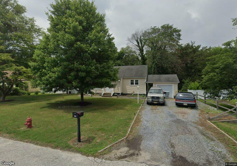
1310 Oak Ln Vineland, NJ 08360
Estimated Value: $220,064 - $310,000
--
Bed
--
Bath
1,240
Sq Ft
$226/Sq Ft
Est. Value
About This Home
This home is located at 1310 Oak Ln, Vineland, NJ 08360 and is currently estimated at $280,766, approximately $226 per square foot. 1310 Oak Ln is a home located in Cumberland County with nearby schools including Marie D. Durand Elementary School, T.W. Wallace Middle School, and Vineland Senior High School.
Ownership History
Date
Name
Owned For
Owner Type
Purchase Details
Closed on
Oct 17, 1996
Sold by
Kline Dianne T and Banks Joann
Bought by
Weaver Robert W and Dooley Kenneth C
Current Estimated Value
Home Financials for this Owner
Home Financials are based on the most recent Mortgage that was taken out on this home.
Original Mortgage
$85,378
Outstanding Balance
$7,930
Interest Rate
8.22%
Mortgage Type
FHA
Estimated Equity
$272,836
Purchase Details
Closed on
Mar 31, 1994
Sold by
Crisafulli Mark
Bought by
Kline Diane and Mclaughlin William Mc
Home Financials for this Owner
Home Financials are based on the most recent Mortgage that was taken out on this home.
Original Mortgage
$42,000
Interest Rate
7.45%
Create a Home Valuation Report for This Property
The Home Valuation Report is an in-depth analysis detailing your home's value as well as a comparison with similar homes in the area
Home Values in the Area
Average Home Value in this Area
Purchase History
| Date | Buyer | Sale Price | Title Company |
|---|---|---|---|
| Weaver Robert W | $85,000 | -- | |
| Kline Diane | $87,000 | -- |
Source: Public Records
Mortgage History
| Date | Status | Borrower | Loan Amount |
|---|---|---|---|
| Open | Weaver Robert W | $85,378 | |
| Previous Owner | Kline Diane | $42,000 |
Source: Public Records
Tax History Compared to Growth
Tax History
| Year | Tax Paid | Tax Assessment Tax Assessment Total Assessment is a certain percentage of the fair market value that is determined by local assessors to be the total taxable value of land and additions on the property. | Land | Improvement |
|---|---|---|---|---|
| 2025 | $4,986 | $156,600 | $26,700 | $129,900 |
| 2024 | $4,986 | $156,600 | $26,700 | $129,900 |
| 2023 | $4,953 | $156,600 | $26,700 | $129,900 |
| 2022 | $4,806 | $156,600 | $26,700 | $129,900 |
| 2021 | $4,370 | $156,600 | $26,700 | $129,900 |
| 2020 | $4,584 | $156,600 | $26,700 | $129,900 |
| 2019 | $4,521 | $156,600 | $26,700 | $129,900 |
| 2018 | $4,402 | $156,600 | $26,700 | $129,900 |
| 2017 | $4,181 | $156,600 | $26,700 | $129,900 |
| 2016 | $4,034 | $156,600 | $26,700 | $129,900 |
| 2015 | $3,885 | $156,600 | $26,700 | $129,900 |
| 2014 | $3,674 | $156,600 | $26,700 | $129,900 |
Source: Public Records
Map
Nearby Homes
- 663 Wayne Ave
- 1489 N Delsea Dr
- 1252 W Oak Rd
- 1811 N Delsea Dr Unit 4
- 550 Northwest Ave
- 1887 N Delsea Dr Unit 39
- 1887 N Delsea Dr Unit 135 HOLLY HOCK DR.
- 1887 N Delsea Dr Unit 19
- 1429 W Oak Rd
- 1500 Venus Dr
- 108 W Park Ave
- 2246 N West Ave
- 1469 N Mill Rd
- 1267 Northeast Blvd
- 1298 W Cornell St
- 829 W Garden Rd
- 330 W Peach St
- 1976 N East Ave Unit 32
- 1976 N East Ave Unit 249
- 1976 N East Ave Unit 233