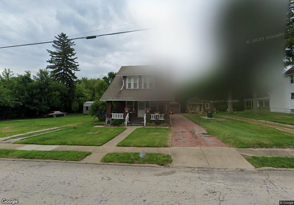
1310 S Mahoning Ave Alliance, OH 44601
Estimated Value: $48,000 - $74,000
3
Beds
1
Bath
1,144
Sq Ft
$56/Sq Ft
Est. Value
About This Home
This home is located at 1310 S Mahoning Ave, Alliance, OH 44601 and is currently estimated at $64,315, approximately $56 per square foot. 1310 S Mahoning Ave is a home located in Mahoning County with nearby schools including Alliance Elementary School at Rockhill, Alliance Intermediate School at Northside, and Alliance Middle School.
Ownership History
Date
Name
Owned For
Owner Type
Purchase Details
Closed on
Feb 3, 2010
Sold by
Warner Edna G and Schreckengost Ruth E
Bought by
Ritchie Shannon M
Current Estimated Value
Home Financials for this Owner
Home Financials are based on the most recent Mortgage that was taken out on this home.
Original Mortgage
$29,456
Interest Rate
4.5%
Mortgage Type
FHA
Purchase Details
Closed on
Feb 19, 1981
Bought by
Schreckengost Ruth E
Create a Home Valuation Report for This Property
The Home Valuation Report is an in-depth analysis detailing your home's value as well as a comparison with similar homes in the area
Home Values in the Area
Average Home Value in this Area
Purchase History
| Date | Buyer | Sale Price | Title Company |
|---|---|---|---|
| Ritchie Shannon M | $30,000 | Attorney | |
| Schreckengost Ruth E | -- | -- |
Source: Public Records
Mortgage History
| Date | Status | Borrower | Loan Amount |
|---|---|---|---|
| Closed | Ritchie Shannon M | $29,456 |
Source: Public Records
Tax History Compared to Growth
Tax History
| Year | Tax Paid | Tax Assessment Tax Assessment Total Assessment is a certain percentage of the fair market value that is determined by local assessors to be the total taxable value of land and additions on the property. | Land | Improvement |
|---|---|---|---|---|
| 2024 | $548 | $13,020 | $620 | $12,400 |
| 2023 | $564 | $12,740 | $620 | $12,120 |
| 2022 | $505 | $10,520 | $480 | $10,040 |
| 2021 | $506 | $10,520 | $480 | $10,040 |
| 2020 | $528 | $10,520 | $480 | $10,040 |
| 2019 | $462 | $8,920 | $480 | $8,440 |
| 2018 | $477 | $8,920 | $480 | $8,440 |
| 2017 | $495 | $8,920 | $480 | $8,440 |
| 2016 | $516 | $9,670 | $480 | $9,190 |
| 2015 | $507 | $9,670 | $480 | $9,190 |
| 2014 | $526 | $9,670 | $480 | $9,190 |
| 2013 | $520 | $9,670 | $480 | $9,190 |
Source: Public Records
Map
Nearby Homes
- 1233 Woodland Ave
- 815 Grace St
- 729 Waugh St
- 831 Wade Ave
- 814 Milner St
- 1044 S Liberty Ave
- 551 South St
- 1005 S Freedom Ave
- 1846 S Freedom Ave
- 1437 S Linden Ave
- 390 E College St
- 2218 S Freedom Ave
- 452 E Summit St
- 442 S Liberty Ave
- 2376 S Seneca Ave
- 317 E State St
- 167 11th St
- 853 Fairway Dr
- 1475 Chatauqua Ct
- 548 E High St
- 1318 S Mahoning Ave
- 1326 S Mahoning Ave
- 1342 S Mahoning Ave
- 1291 S Mahoning Ave
- 1358 S Mahoning Ave
- 1374 S Mahoning Ave
- 1293 S Mahoning Ave
- 1281 S Mahoning Ave
- 1212 S Mahoning Ave
- 1237 S Mahoning Ave
- 14571 Mahoning Ave NE
- 1236 Willow Ave
- 1206 S Mahoning Ave
- 1226 Willow Ave
- 1204 S Mahoning Ave
- 1205 S Mahoning Ave
- 1239 Willow Ave
- 1415 South St
- 1229 Willow Ave
- 1403 South St